塔吉克斯坦地质灾害滑坡点数据集
收藏国家青藏高原科学数据中心2025-07-14 更新2025-07-26 收录
下载链接:
https://data.tpdc.ac.cn/zh-hans/data/05a4a613-9252-4beb-b320-eadda4381b5d
下载链接
链接失效反馈官方服务:
资源简介:
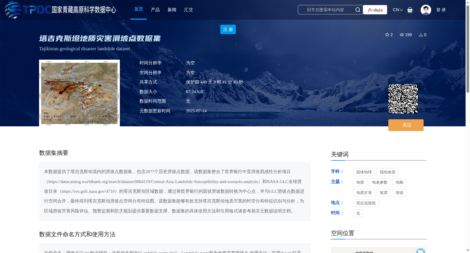
本数据提供了塔吉克斯坦境内的滑坡点数据集,包含2877个历史滑坡点数据。该数据集整合了世界银行中亚滑坡易感性分析项目(https://datacatalog.worldbank.org/search/dataset/0064119/Central-Asia-Landslide-Susceptibility-and-scenario-analysis)和NASA GLC全球滑坡目录(https://svs.gsfc.nasa.gov/4710)的塔吉克斯坦区域数据,通过将世界银行的面状滑坡数据转换为中心点,并与GLC滑坡点数据进行空间合并,最终得到塔吉克斯坦滑坡点空间分布特征图。该数据集能够有效支持塔吉克斯坦地质灾害的时空分布特征识别与分析,为区域滑坡灾害风险评估、预警监测和防灾规划提供重要数据支撑。数据集的具体使用方法和引用格式请参考相关元数据说明文档。
This dataset provides landslide point data for Tajikistan, encompassing 2877 historical landslide records. It integrates regional landslide data of Tajikistan from two sources: the World Bank Central Asia Landslide Susceptibility and Scenario Analysis project (https://datacatalog.worldbank.org/search/dataset/0064119/Central-Asia-Landslide-Susceptibility-and-scenario-analysis) and the NASA GLC Global Landslide Catalog (https://svs.gsfc.nasa.gov/4710). Specifically, the areal landslide data from the World Bank was converted into centroid points, which were then spatially merged with the landslide point data from the GLC catalog, ultimately generating the spatial distribution map of landslide points in Tajikistan. This dataset effectively supports the identification and analysis of spatiotemporal distribution characteristics of geological hazards in Tajikistan, providing critical data support for regional landslide disaster risk assessment, early warning and monitoring, and disaster prevention planning. Please refer to the relevant metadata documentation for specific usage methods and citation formats of this dataset.
提供机构:
程传美,郭浩,伍永秋,贾佳
创建时间:
2025-07-10
搜集汇总
数据集介绍
背景与挑战
背景概述
该数据集整合了世界银行和NASA的滑坡数据,包含塔吉克斯坦2877个历史滑坡点,以shp格式存储,适用于地质灾害时空分布分析和风险评估。
以上内容由遇见数据集搜集并总结生成


