青藏高原及其周边地区潜在冰湖分布
收藏国家青藏高原科学数据中心2022-08-30 更新2024-04-21 收录
下载链接:
https://data.tpdc.ac.cn/zh-hans/data/df42c38d-4907-417c-b05d-1ef6e45639e1
下载链接
链接失效反馈官方服务:
资源简介:
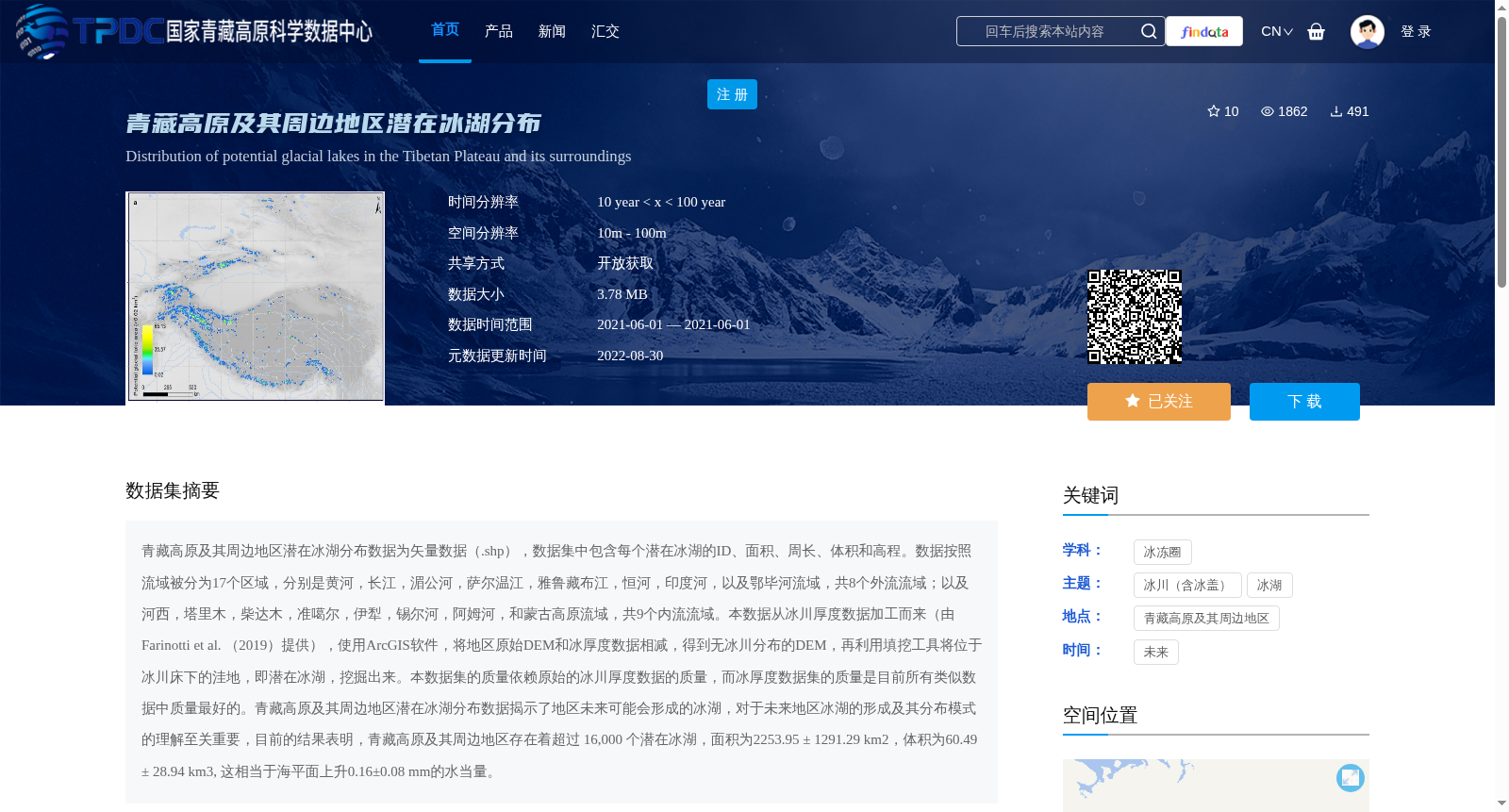
青藏高原及其周边地区潜在冰湖分布数据为矢量数据(.shp),数据集中包含每个潜在冰湖的ID、面积、周长、体积和高程。数据按照流域被分为17个区域,分别是黄河,长江,湄公河,萨尔温江,雅鲁藏布江,恒河,印度河,以及鄂毕河流域,共8个外流流域;以及河西,塔里木,柴达木,准噶尔,伊犁,锡尔河,阿姆河,和蒙古高原流域,共9个内流流域。本数据从冰川厚度数据加工而来(由Farinotti et al. (2019)提供),使用ArcGIS软件,将地区原始DEM和冰厚度数据相减,得到无冰川分布的DEM,再利用填挖工具将位于冰川床下的洼地,即潜在冰湖,挖掘出来。本数据集的质量依赖原始的冰川厚度数据的质量,而冰厚度数据集的质量是目前所有类似数据中质量最好的。青藏高原及其周边地区潜在冰湖分布数据揭示了地区未来可能会形成的冰湖,对于未来地区冰湖的形成及其分布模式的理解至关重要,目前的结果表明,青藏高原及其周边地区存在着超过 16,000 个潜在冰湖,面积为2253.95 ± 1291.29 km2,体积为60.49 ± 28.94 km3, 这相当于海平面上升0.16±0.08 mm的水当量。
The potential glacial lake distribution dataset over the Tibetan Plateau and its surrounding areas is provided as vector data in the .shp format, which contains the ID, area, perimeter, volume and elevation of each individual potential glacial lake.
The dataset is partitioned into 17 regional subsets based on river basins: 8 exorheic basins, namely the Yellow River, Yangtze River, Mekong River, Salween River, Yarlung Zangbo River, Ganges River, Indus River and Ob River basins; and 9 endorheic basins, including the Hexi, Tarim, Qaidam, Junggar, Ili, Syr Darya, Amu Darya and Mongolian Plateau basins.
This dataset was processed from glacial thickness data provided by Farinotti et al. (2019). Using ArcGIS software, the original regional digital elevation model (DEM) and glacial thickness data were subtracted to obtain the bedrock DEM without glacial influence. Subsequently, the depression extraction tool was utilized to extract the depressions under the former glacial beds, which are defined as potential glacial lakes.
The quality of this dataset depends on the quality of the original glacial thickness data, which is currently the best among all comparable datasets of the same type.
This dataset reveals the locations of potential glacial lakes that may form in the study region in the future, which is critical for advancing the understanding of future glacial lake formation and their distribution patterns. Current results show that there are over 16,000 potential glacial lakes across the Tibetan Plateau and its surrounding areas, with a total area of 2253.95 ± 1291.29 km², a total volume of 60.49 ± 28.94 km³, equivalent to a sea level rise of 0.16 ± 0.08 mm in water equivalent.
提供机构:
张太刚,王伟财,姚檀栋,高坛光,安宝晟
创建时间:
2021-05-19
搜集汇总
数据集介绍
背景与挑战
背景概述
该数据集为青藏高原及其周边地区的潜在冰湖分布数据,包含超过16,000个潜在冰湖的面积、体积等信息,按照17个流域分区。数据基于冰川厚度数据加工,对未来冰湖形成研究具有重要价值。
以上内容由遇见数据集搜集并总结生成


