2019年典型长城无人机倾斜摄影数据集
收藏地球大数据科学工程2024-03-04 收录
下载链接:
https://data.casearth.cn/sdo/detail/6538af05819aec0f261b732d
下载链接
链接失效反馈官方服务:
资源简介:
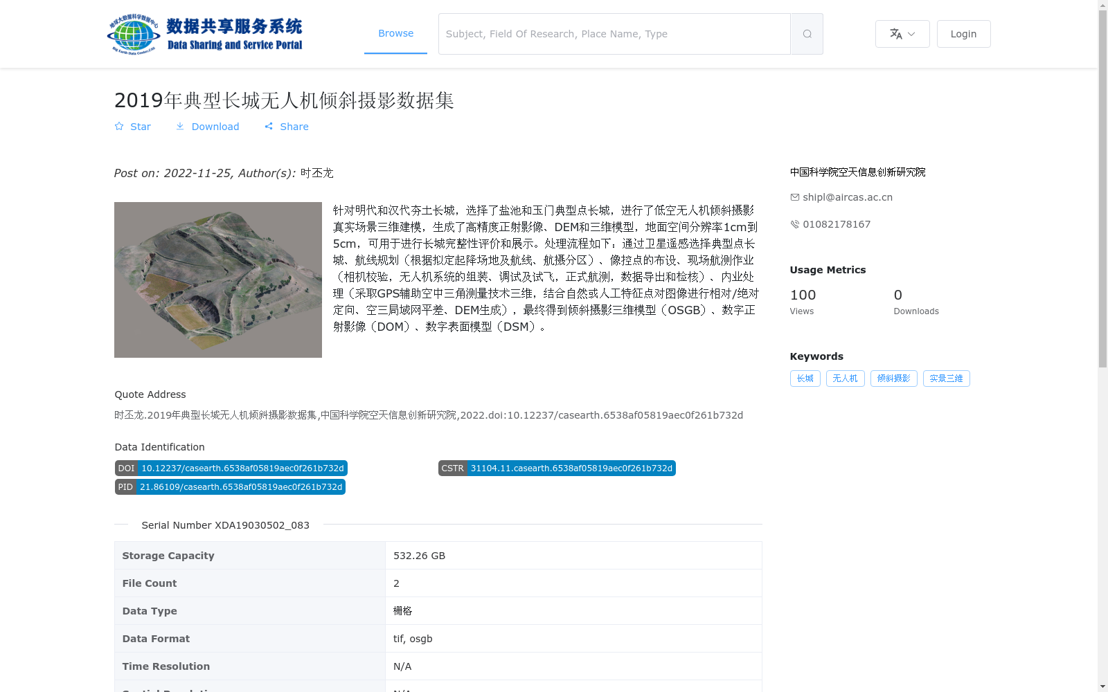
针对明代和汉代夯土长城,选择了盐池和玉门典型点长城,进行了低空无人机倾斜摄影真实场景三维建模,生成了高精度正射影像、DEM和三维模型,地面空间分辨率1cm到5cm,可用于进行长城完整性评价和展示。处理流程如下:通过卫星遥感选择典型点长城、航线规划(根据拟定起降场地及航线、航摄分区)、像控点的布设、现场航测作业(相机校验,无人机系统的组装、调试及试飞,正式航测,数据导出和检核)、内业处理(采取GPS辅助空中三角测量技术三维,结合自然或人工特征点对图像进行相对/绝对定向、空三局域网平差、DEM生成),最终得到倾斜摄影三维模型(OSGB)、数字正射影像(DOM)、数字表面模型(DSM)。
For the rammed earth Great Wall of the Ming and Han Dynasties, typical sections of the Great Wall in Yanchi and Yumen were selected. Low-altitude UAV oblique photography real-scene 3D modeling was conducted, generating high-precision orthophotos, DEMs and 3D models with a ground spatial resolution ranging from 1 cm to 5 cm, which can be used for Great Wall integrity evaluation and display. The processing workflow is as follows: select typical Great Wall sections via satellite remote sensing, flight path planning (based on proposed take-off and landing sites, flight routes and aerial photography zones), layout of ground control points (GCPs), field aerial survey operations (including camera calibration, assembly, debugging and test flight of the UAV system, formal aerial survey, data export and inspection), and indoor processing (adopting GPS-aided aerial triangulation technology for 3D processing, performing relative/absolute orientation on images combined with natural or artificial feature points, aerial triangulation network adjustment, and DEM generation). Finally, oblique photography 3D models (OSGB), Digital Orthophoto Maps (DOM) and Digital Surface Models (DSM) are obtained.
提供机构:
中国科学院空天信息创新研究院
搜集汇总
数据集介绍
背景与挑战
背景概述
该数据集是2019年针对明代和汉代夯土长城在盐池和玉门典型点进行的无人机倾斜摄影项目,生成了高精度正射影像、数字高程模型和三维模型,地面空间分辨率达1-5厘米,适用于长城完整性评价和三维展示。数据集包含栅格格式文件,存储容量为532.26 GB,覆盖中国区域,专注于无人机倾斜摄影技术在文化遗产保护中的应用。
以上内容由遇见数据集搜集并总结生成


