2015年中国1km鸟类物种分布热点图
收藏地球大数据科学工程2024-04-26 收录
下载链接:
https://data.casearth.cn/sdo/detail/636e17ed819aec5df66b5244
下载链接
链接失效反馈官方服务:
资源简介:
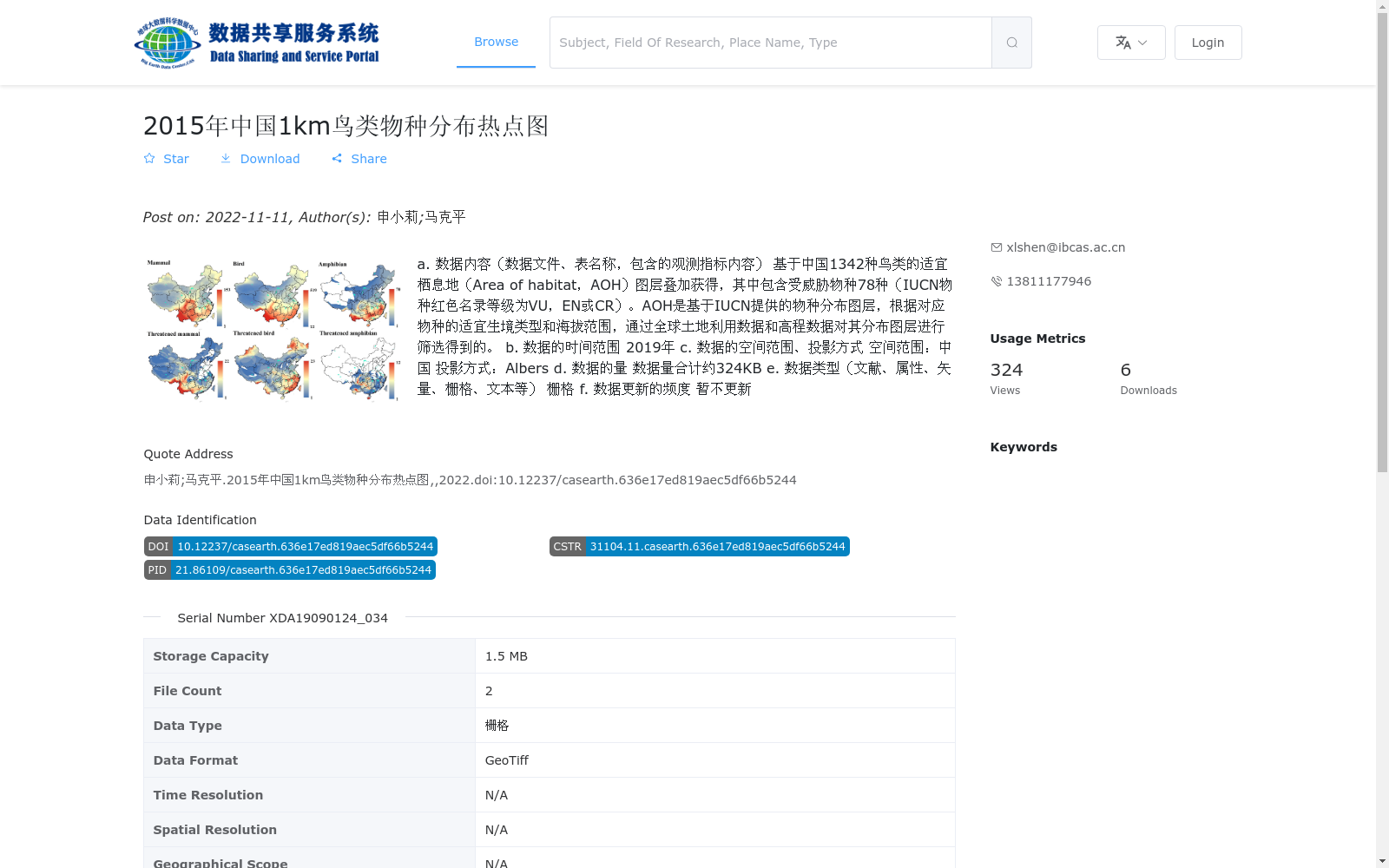
a. 数据内容(数据文件、表名称,包含的观测指标内容)
基于中国1342种鸟类的适宜栖息地(Area of habitat,AOH)图层叠加获得,其中包含受威胁物种78种(IUCN物种红色名录等级为VU,EN或CR)。AOH是基于IUCN提供的物种分布图层,根据对应物种的适宜生境类型和海拔范围,通过全球土地利用数据和高程数据对其分布图层进行筛选得到的。
b. 数据的时间范围
2019年
c. 数据的空间范围、投影方式
空间范围:中国
投影方式:Albers
d. 数据的量
数据量合计约324KB
e. 数据类型(文献、属性、矢量、栅格、文本等)
栅格
f. 数据更新的频度
暂不更新
a. Data Content (data files, table names, included observation indicators):
This dataset is generated by overlaying Habitat Suitability (Area of Habitat, AOH) layers for 1342 bird species in China, and contains 78 threatened species classified as VU, EN or CR per the IUCN Red List of Threatened Species. AOH layers were derived by filtering the species distribution layers provided by IUCN, based on the suitable habitat types and elevation ranges of each target species, combined with global land use and elevation datasets.
b. Temporal Scope:
2019
c. Spatial Scope and Projection Method:
Spatial scope: China; Projection method: Albers
d. Data Volume:
Approximately 324 KB in total
e. Data Type (examples: literature, attribute, vector, raster, text, etc.):
Raster
f. Update Frequency:
No scheduled updates for the time being
搜集汇总
数据集介绍
背景与挑战
背景概述
该数据集是一个2015年中国1公里空间分辨率的鸟类物种分布热点图,基于1342种鸟类的适宜栖息地图层叠加生成,特别包含78种受威胁物种信息。数据以栅格格式(GeoTiff)提供,覆盖中国全境,采用Albers投影,数据量约324KB,适用于鸟类多样性分析和保护策略制定。
以上内容由遇见数据集搜集并总结生成


