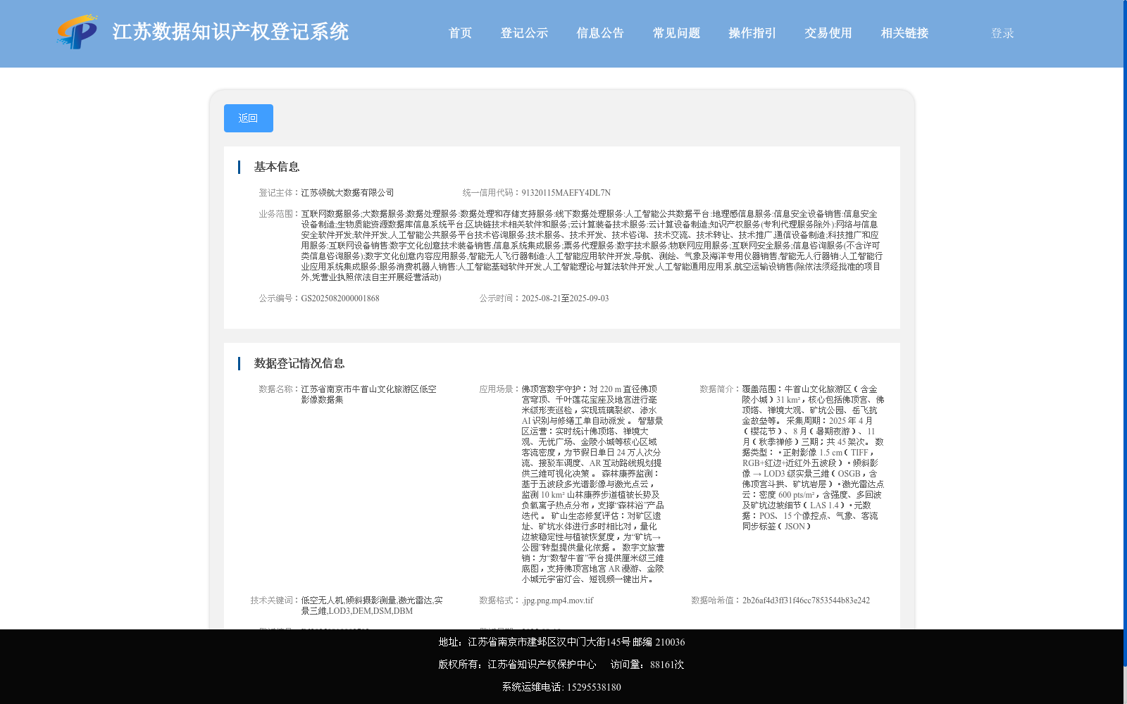
江苏省南京市牛首山文化旅游区低空影像数据集
收藏江苏数据知识产权登记系统2025-08-20 更新2025-09-06 收录
下载链接:
https://dataip.jsipp.cn/#/changeDetialCertical?pType=登记&cType=登记&id=ffadd55dd0ddee3f9bbcc0d9ae52acf3
下载链接
链接失效反馈官方服务:
资源简介:
覆盖范围:牛首山文化旅游区(含金陵小城)31 km²,核心包括佛顶宫、佛顶塔、禅境大观、矿坑公园、岳飞抗金故垒等。
采集周期:2025 年 4 月(樱花节)、8 月(暑期夜游)、11 月(秋季禅修)三期;共 45 架次。
数据类型:
• 正射影像 1.5 cm(TIFF,RGB+红边+近红外五波段)
• 倾斜影像 → LOD3 级实景三维(OSGB,含佛顶宫斗拱、矿坑岩层)
• 激光雷达点云:密度 600 pts/m²,含强度、多回波及矿坑边坡细节(LAS 1.4)
• 元数据:POS、15 个像控点、气象、客流同步标签(JSON)
Coverage: 31 km² of Niushoushan Cultural and Tourism Zone (including Jinling Ancient Town), with core areas covering Foding Palace, Foding Pagoda, Zen Realm Grand View, Mine Park, Yue Fei's Ancient Anti-Jin Fortifications, etc.
Data Collection Period: Three phases in April 2025 (Cherry Blossom Festival), August 2025 (Summer Night Tour) and November 2025 (Autumn Zen Retreat), with a total of 45 sorties.
Data Types:
• Orthophotos with 1.5 cm ground sampling distance (GSD), stored in TIFF format, with 5 bands including RGB, red edge and near-infrared
• Oblique imagery → LOD3 (Level of Detail 3) real-scene 3D models (OSGB format), including Dougong (bracket sets) of Foding Palace and rock strata of the mine pit
• LiDAR point clouds: with a density of 600 pts/m², containing intensity information, multiple echoes and details of mine pit slopes (LAS 1.4 format)
• Metadata: POS (Position and Orientation System) data, 15 ground control points (GCPs), meteorological data and synchronized passenger flow tags, in JSON format
提供机构:
江苏领航大数据有限公司
搜集汇总
数据集介绍
背景与挑战
背景概述
该数据集聚焦于江苏省南京市牛首山文化旅游区的低空影像数据,主要用于文化旅游区的空间信息采集和分析。其关键特点是提供高分辨率低空视角的影像,支持地理信息系统应用和旅游规划研究。
以上内容由遇见数据集搜集并总结生成


