阿姆河流域Kerki以上月径流模拟数据(1980-2016)
收藏国家青藏高原科学数据中心2023-05-11 更新2024-03-01 收录
下载链接:
https://data.tpdc.ac.cn/zh-hans/data/c4466ef8-7dee-425d-b516-5bc5136a5e80
下载链接
链接失效反馈官方服务:
资源简介:
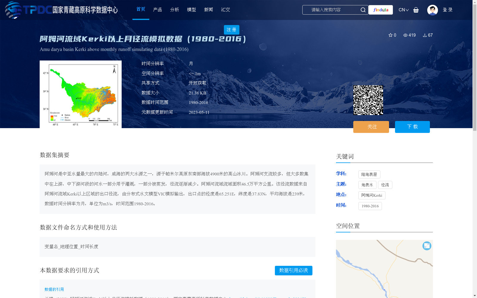
阿姆河是中亚水量最大的内陆河,咸海的两大水源之一,源于帕米尔高原东南部海拔4900米的高山冰川。阿姆河支流较多,但大多数集中在上游,中下游河段的河水一部分用于灌溉,一部分被蒸发,径流逐渐减少。阿姆河流域流域面积46.5万平方公里。该径流数据来自阿姆河流域Kerki以上区域的出口径流,由分布式水文模型VIC模拟输出,出口点的经度是65.251E,纬度是37.83N,平均海拔是239米,数据时间分辨率为月,单位为m3/s,时间范围1980-2016。
The Amu Darya is the largest inland river by water volume in Central Asia and one of the two primary water sources for the Aral Sea. It originates from alpine glaciers at an elevation of 4900 meters in the southeastern Pamir Plateau. The Amu Darya has numerous tributaries, most of which are concentrated in its upper reaches. In its middle and lower reaches, part of the river water is used for irrigation and part evaporates, resulting in a gradual reduction in runoff. The drainage basin of the Amu Darya covers an area of 465,000 square kilometers. This runoff dataset is sourced from the outlet runoff of the region upstream of Kerki in the Amu Darya basin, simulated and output by the distributed hydrological model VIC. The outlet point has coordinates of 65.251°E longitude and 37.83°N latitude, with an average elevation of 239 meters. The data has a monthly temporal resolution, with the unit of m³/s, and covers the time period from 1980 to 2016.
提供机构:
兰措
创建时间:
2023-05-04
搜集汇总
数据集介绍
背景与挑战
背景概述
该数据集提供了阿姆河流域Kerki以上区域1980年至2016年的月径流模拟数据,由分布式水文模型VIC生成,时间分辨率为月,单位为m3/s。数据覆盖出口点(经度65.251E,纬度37.83N),主要用于研究该区域的地表水径流变化,支持水文分析和环境监测。
以上内容由遇见数据集搜集并总结生成


