2021-2100年中国1km多情景逐月潜在蒸散发数据集
收藏国家地球系统科学数据中心2023-07-07 更新2024-04-21 收录
下载链接:
https://www.geodata.cn/data/datadetails.html?dataguid=80853383227414&docId=4678
下载链接
链接失效反馈官方服务:
资源简介:
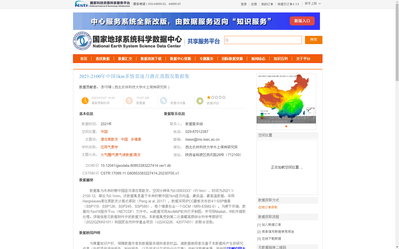
数据集为未来时期中国逐月潜在蒸散发,空间分辨率为0.0083333°(约1km),时间为2021.1-2100.12,单位为0.1mm。该数据集是基于未来时期中国1km逐月均温、最低温、最高温数据,采用Hargreaves潜在蒸散发计算式得到(Peng at al. 2017)。数据采用IPCC最新发布的4个SSP情景(SSP119、SSP126、SSP245、SSP585),每个情景包含一个GCM(MRI-ESM2-0)。为便于存储,数据均为int16型存于nc(NETCDF)文件中。nc数据可用ArcMAP软件打开制图,并可用Matlab、R软件提取处理。详细信息见数据附件中的数据文档。本数据集受到第二次青藏高原综合科学考察研究(2022QZKK0101)和国家自然科学基金项目(U2243226、42077451)的联合资助。
This dataset contains monthly potential evapotranspiration over China during the future period, with a spatial resolution of 0.0083333° (approximately 1 km), temporal coverage from January 2021 to December 2100, and a unit of 0.1 mm. It is derived using the Hargreaves potential evapotranspiration calculation equation (Peng et al., 2017) based on monthly mean, minimum and maximum air temperature data at 1 km resolution over China for the future period. The dataset employs four latest SSP scenarios released by the IPCC: SSP119, SSP126, SSP245 and SSP585, with each scenario paired with one GCM (MRI-ESM2-0). For ease of storage, all data are stored as int16 format in NETCDF (nc) files. The nc-formatted data can be opened and used for mapping with ArcGIS ArcMap, and can be extracted and processed with Matlab and R software. Detailed information is available in the data documentation attached to the dataset. This dataset was jointly funded by the Second Tibetan Plateau Scientific Expedition and Research (STEP) Program (2022QZKK0101) and the National Natural Science Foundation of China (Grants U2243226 and 42077451).
提供机构:
西北农林科技大学水土保持研究所
创建时间:
2023-07-05
搜集汇总
数据集介绍
背景与挑战
背景概述
该数据集提供了2021年至2100年中国逐月潜在蒸散发数据,空间分辨率约为1公里,覆盖未来80年,适用于长期气候模拟研究。数据基于Hargreaves公式计算,采用IPCC的四个SSP情景(SSP119、SSP126、SSP245、SSP585)和一个全球气候模型(MRI-ESM2-0),支持多情景分析,有助于评估气候变化对水文和生态过程的影响。数据以NETCDF格式存储,便于使用ArcMAP、Matlab或R等工具进行制图和处理。
以上内容由遇见数据集搜集并总结生成


