青藏高原1-km分辨率人类活动强度数据集(2000-2020)
收藏国家青藏高原科学数据中心2023-09-26 更新2024-03-01 收录
下载链接:
https://data.tpdc.ac.cn/zh-hans/data/c1f865e9-8673-4b40-b612-ac0012ce0aed
下载链接
链接失效反馈官方服务:
资源简介:
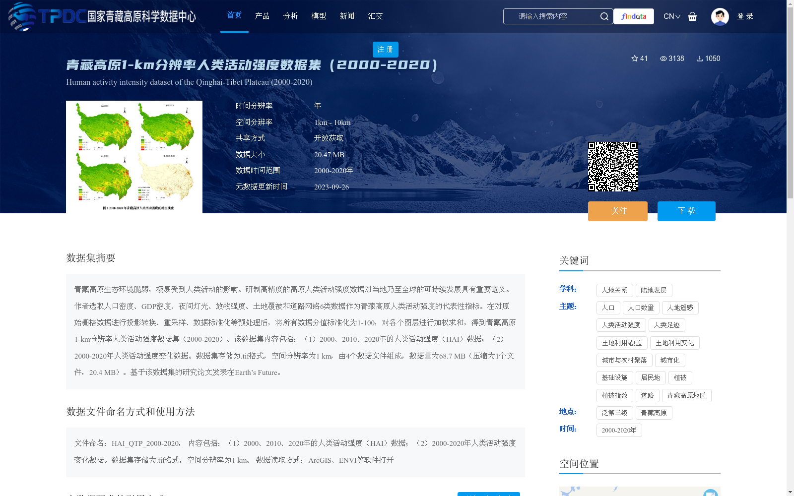
青藏高原生态环境脆弱,极易受到人类活动的影响。研制高精度的高原人类活动强度数据对当地乃至全球的可持续发展具有重要意义。作者选取人口密度、GDP密度、夜间灯光、放牧强度、土地覆被和道路网络6类数据作为青藏高原人类活动强度的代表性指标。在对原始栅格数据进行投影转换、重采样、数据标准化等预处理后,将所有数据分值标准化为1-100,对各个图层进行加权求和,得到青藏高原1-km分辨率人类活动强度数据集(2000-2020)。该数据集内容包括:(1)2000、2010、2020年的人类活动强度(HAI)数据;(2)2000-2020年人类活动强度变化数据。数据集存储为.tif格式,空间分辨率为1 km,由4个数据文件组成,数据量为68.7 MB(压缩为1个文件,20.4 MB)。基于该数据集的研究论文发表在Earth’s Future。
The Qinghai-Tibet Plateau has a fragile ecological environment and is highly susceptible to human activities. Developing high-precision human activity intensity datasets for the plateau is of great significance for the sustainable development of the local region and even the entire globe. The authors selected six types of data as representative indicators for quantifying human activity intensity on the Qinghai-Tibet Plateau: population density, GDP density, nighttime light imagery, grazing intensity, land cover, and road networks. After preprocessing the original raster data including projection transformation, resampling, and data normalization, the scores of all six indicator layers were normalized to the range of 1–100, and a weighted summation was performed across all layers to generate the 1-km resolution Human Activity Intensity (HAI) dataset of the Qinghai-Tibet Plateau for the period 2000–2020. This dataset includes two components: (1) Human Activity Intensity (HAI) data for the years 2000, 2010, and 2020; (2) Human Activity Intensity change data for the period 2000–2020. The dataset is stored in .tif format with a spatial resolution of 1 km, consisting of 4 individual data files with a total size of 68.7 MB (compressed into a single file of 20.4 MB). A research paper based on this dataset has been published in *Earth’s Future*.
提供机构:
刘海猛
创建时间:
2023-09-26
搜集汇总
数据集介绍
背景与挑战
背景概述
该数据集提供了青藏高原2000-2020年1公里分辨率的人类活动强度数据,基于人口密度、GDP密度、夜间灯光等6类指标综合计算生成,内容包括2000、2010、2020年的强度数据及变化数据。数据集以.tif格式存储,数据量20.47 MB,适用于ArcGIS等软件分析,旨在支持青藏高原生态环境和可持续发展研究。
以上内容由遇见数据集搜集并总结生成


