
GEOFON Seismic Network
收藏DataCite Commons2025-12-18 更新2024-07-13 收录
下载链接:
http://geofon.gfz.de/doi/network/GE
下载链接
链接失效反馈官方服务:
资源简介:
GEOFON (GEOFOrschungsNetz) is the global seismological broad-band network operated by the German GeoForschungsZentrum (GFZ). The GEOFON seismic network came into being in 1993 as one of the three pillars of the GEOFON program dedicated to Ernst von Rebeur-Paschwitz, proposer of a global earthquake monitoring system, who recorded the first teleseismic seismogram in Potsdam in 1889. The program and its seismic network were created to provide high quality broad-band data for scientific use and foster common standards in the seismological community. The network has evolved towards real-time data acquisition and distribution while keeping the high quality broad-band data in focus. Today the network plays a leading role in global real-time seismology providing valuable data for almost all fundamental and applied global/regional seismological research projects at GFZ and the wider seismological community.
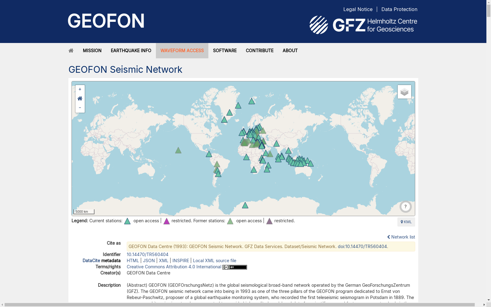
The GEOFON network is operated jointly with more than 50 international partners and in 2014 consists of about 80 active stations on all continents, but concentrated in Europe and the Mediterranean region as well as in the Indian Ocean. Station operation is mostly performed by local partners with GFZ guidance and logistic support, allowing the global network to be well-advanced technically while still extremely cost-effective. All stations are equipped with broad-band sensors (generally STS-2) that allow resolution of the complete seismic spectrum from small high-frequency local earthquakes to the largest global earthquakes.
Data from all stations are freely redistributed in real-time for earthquake monitoring and tsunami warning centers immediately after acquisition at the GEOFON data centre via wired or satellite links. Archived data is also available. GEOFON is part of the Modular Earth Science Infrastructure (MESI) housed at GFZ.
GEOFON(GEOFOrschungsNetz)是德国地球科学研究中心(GeoForschungsZentrum,简称GFZ)运营的全球宽频带地震观测网络。GEOFON地震网络始建于1993年,是为纪念全球地震监测系统的提出者恩斯特·冯·罗伊博尔-帕施维茨(Ernst von Rebeur-Paschwitz)而设立的GEOFON计划三大支柱之一,后者于1889年在波茨坦记录了全球首个远震地震图。该计划及其地震网络的创立初衷,是为科研工作提供高质量宽频带地震数据,并推动地震学界通用标准的建立。该网络逐步发展为具备实时数据采集与分发能力,同时始终将高质量宽频带数据作为核心要务。如今,该网络在全球实时地震学领域发挥着引领作用,为GFZ及全球更广范围地震学界的几乎所有基础与应用类全球/区域地震学研究项目提供宝贵数据。
GEOFON网络与50余家国际合作伙伴联合运营,2014年时在全球各大洲拥有约80个活跃观测台站,台站主要集中分布于欧洲、地中海区域以及印度洋海域。台站运维工作大多由当地合作伙伴在GFZ的技术指导与后勤支持下完成,这使得该全球网络既能在技术上保持领先水平,又能维持极高的成本效益。所有台站均配备宽频带传感器(通常为STS-2型),可完整解析从微小高频局部地震至特大型全球地震的全部地震频谱。
所有台站的数据在GEOFON数据中心通过有线或卫星链路完成采集后,即可实时免费分发给地震监测与海啸预警中心。存档数据亦可获取。GEOFON隶属于设于GFZ的模块化地球科学基础设施(Modular Earth Science Infrastructure,简称MESI)。
提供机构:
GFZ Data Services
创建时间:
2014-01-24
搜集汇总
数据集介绍
背景与挑战
背景概述
GEOFON地震网络是由德国地球科学研究中心(GFZ)运营的全球性宽频带地震数据集,始于1993年,旨在为科学研究提供高质量实时数据。该网络覆盖全球,拥有约80个活跃台站(主要集中在欧洲和地中海地区),配备宽频带传感器,能解析完整地震频谱,并支持地震监测和海啸预警应用。数据以开放获取方式分发,每天产生超过440MB的数据量,体现了国际合作与成本效益的特点。
以上内容由遇见数据集搜集并总结生成



