青藏高原30米空间分辨率TPCover30土地覆被产品(2000-2020)
收藏国家青藏高原科学数据中心2023-12-15 更新2024-03-07 收录
下载链接:
https://data.tpdc.ac.cn/zh-hans/data/9183f748-2a55-4e1b-b6cc-0ee01d83d765
下载链接
链接失效反馈官方服务:
资源简介:
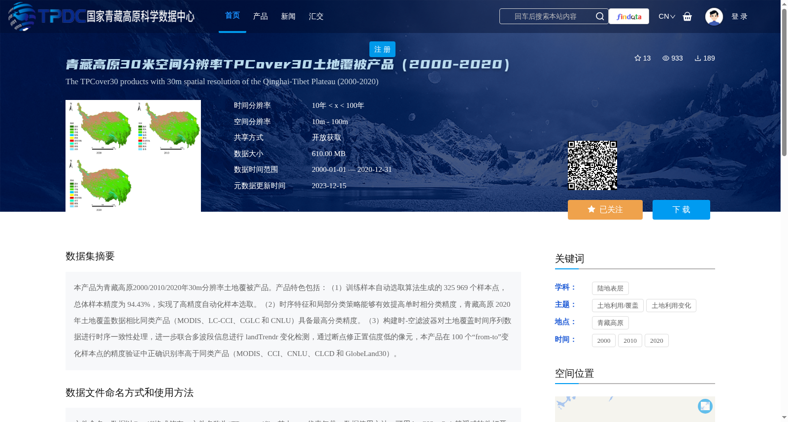
本产品为青藏高原2000/2010/2020年30m分辨率土地覆被产品。产品特色包括:(1)训练样本自动选取算法生成的 325 969 个样本点,总体样本精度为 94.43%,实现了高精度自动化样本选取。(2)时序特征和局部分类策略能够有效提高单时相分类精度,青藏高原 2020 年土地覆盖数据相比同类产品(MODIS、LC-CCI、CGLC 和 CNLU)具备最高分类精度。(3)构建时-空滤波器对土地覆盖时间序列数据进行时序一致性处理,进一步联合多波段信息进行 landTrendr 变化检测,通过断点修正置信度低的像元,本产品在 100 个“from-to”变化样本点的精度验证中正确识别率高于同类产品(MODIS、CCI、CNLU、CLCD 和 GlobeLand30)。
This product is a 30m-resolution land cover product for the Qinghai-Tibet Plateau covering the years 2000, 2010 and 2020. Its key features are as follows:
(1) A total of 325,969 sample points were generated by the automatic training sample selection algorithm, with an overall sample accuracy of 94.43%, achieving high-precision automated sample selection.
(2) Temporal features and local classification strategies can effectively improve single-temporal classification accuracy. The 2020 land cover data of the Qinghai-Tibet Plateau boasts the highest classification accuracy compared with similar products (MODIS, LC-CCI, CGLC and CNLU).
(3) A spatio-temporal filter was constructed to perform temporal consistency processing on land cover time series data, and then combined with multi-band information to conduct landTrendr-based change detection. Low-confidence pixels were corrected via detected breakpoints. In the accuracy verification using 100 "from-to" change sample points, this product achieved a higher correct recognition rate than similar products (MODIS, CCI, CNLU, CLCD and GlobeLand30).
提供机构:
刘焱序,张锐
创建时间:
2023-12-14
搜集汇总
数据集介绍
背景与挑战
背景概述
该数据集是青藏高原2000、2010、2020年三个时点的30米空间分辨率土地覆被产品,采用高精度自动样本选取和时序特征分类策略,确保数据精度优于同类产品。数据以Geotiff格式提供,开放获取,适用于遥感分析,覆盖青藏高原区域,时间范围跨20年。
以上内容由遇见数据集搜集并总结生成


