东南亚18个关键节点区域逐年的地表土地覆盖数据(2001-2016)
收藏地球大数据科学工程2024-03-04 收录
下载链接:
https://data.casearth.cn/sdo/detail/5feae825819aec33049b7c11
下载链接
链接失效反馈官方服务:
资源简介:
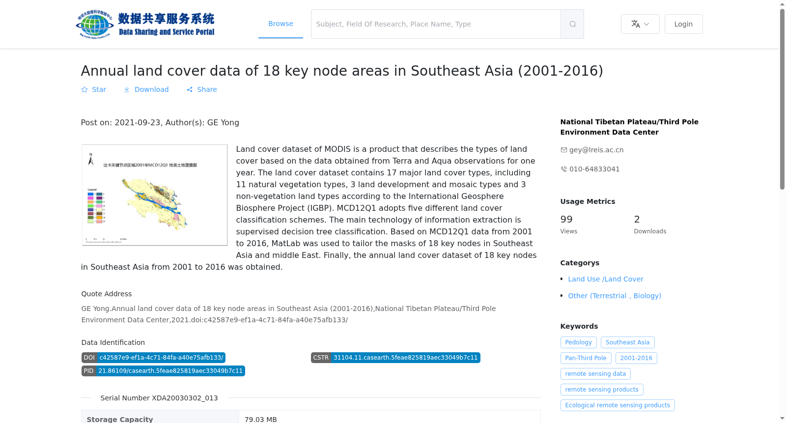
MODIS三级数据土地覆盖类型产品(Land Cover data)是基于Terra和Aqua卫星的年度观测数据提取而来的。根据国际地圈生物圈计划(IGBP)定义的土地覆盖类型,该数据产品集中包含了17个主要土地覆盖类型,其中包括11个自然植被类型,3个土地开发和镶嵌的地类和3个非草木土地类型。MODIS Terra/Aqua三级土地覆盖年度全球500米产品MCD12Q1采用了五种不同的土地覆盖分类方案,而信息提取主要技术则是监督决策树分类。以主要覆盖东南亚和中东的18个关键节点为研究区域,基于2001至2016年的MCD12Q1数据,利用MatLab对数据进行研究区的掩模裁剪,最终得到了东南亚18个关键节点区域2001-2016逐年的地表土地覆盖数据。
MODIS Level 3 Land Cover product (Land Cover data) is derived from annual observational datasets collected by the Terra and Aqua satellites. According to the land cover classification system defined by the International Geosphere-Biosphere Programme (IGBP), this data product includes 17 major land cover categories, comprising 11 natural vegetation types, 3 developed and mosaic land classes, and 3 non-vegetated land types. The MODIS Terra/Aqua Level 3 annual global 500-meter land cover product MCD12Q1 adopts five distinct land cover classification schemes, with supervised decision tree classification as the primary technical approach for information extraction. Taking 18 key nodes primarily covering Southeast Asia and the Middle East as the study area, and based on the MCD12Q1 dataset from 2001 to 2016, we performed mask cropping on the dataset for the study area using MATLAB, and finally obtained annual land surface cover data for the 18 key node regions in Southeast Asia spanning the period 2001 to 2016.
提供机构:
国家青藏高原科学数据中心
搜集汇总
数据集介绍
背景与挑战
背景概述
该数据集提供了东南亚18个关键节点区域2001-2016年逐年的地表土地覆盖信息,基于MODIS卫星数据,采用IGBP分类体系,包含17种土地覆盖类型,适用于生态和土地覆盖变化研究。
以上内容由遇见数据集搜集并总结生成


