长江源区径流及土壤水分变化(2003-2018)
收藏国家青藏高原科学数据中心2024-10-16 更新2024-11-02 收录
下载链接:
https://data.tpdc.ac.cn/zh-hans/data/b324d4d5-16f3-4db1-b0eb-1b25c7a4c857
下载链接
链接失效反馈官方服务:
资源简介:
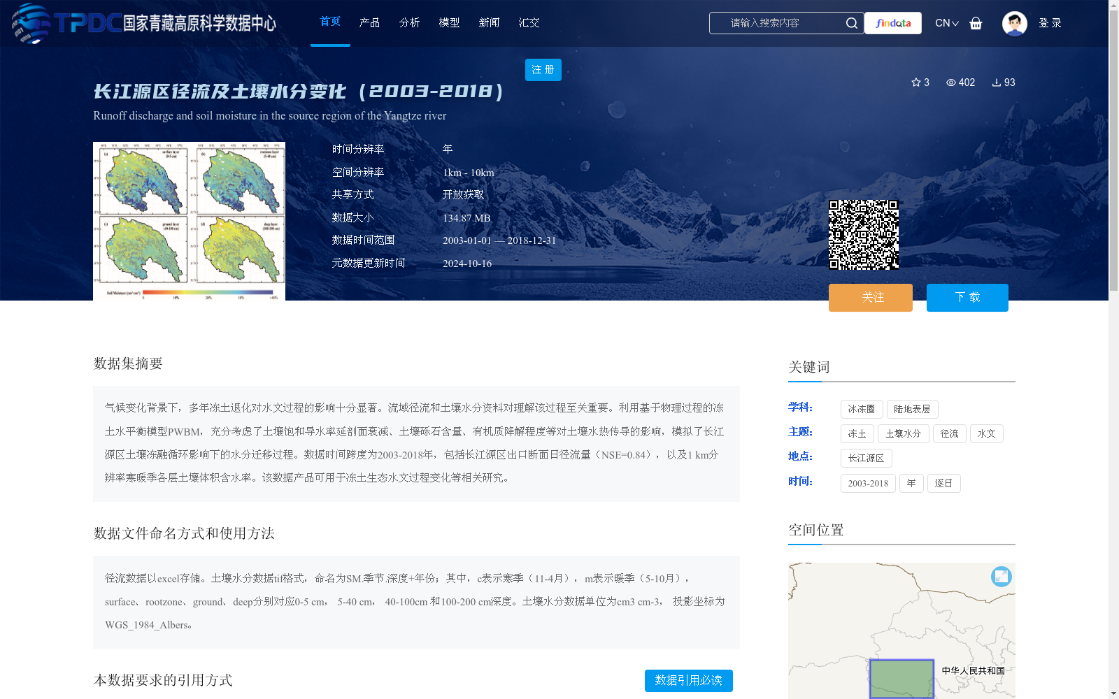
气候变化背景下,多年冻土退化对水文过程的影响十分显著。流域径流和土壤水分资料对理解该过程至关重要。利用基于物理过程的冻土水平衡模型PWBM,充分考虑了土壤饱和导水率延剖面衰减、土壤砾石含量、有机质降解程度等对土壤水热传导的影响,模拟了长江源区土壤冻融循环影响下的水分迁移过程。数据时间跨度为2003-2018年,包括长江源区出口断面日径流量(NSE=0.84),以及1 km分辨率寒暖季各层土壤体积含水率。该数据产品可用于冻土生态水文过程变化等相关研究。
Against the backdrop of climate change, permafrost degradation exerts a substantial impact on hydrological processes. Data on watershed runoff and soil moisture are critical for understanding this process. This study employed the physics-based permafrost water balance model PWBM, which fully accounts for the effects of factors including vertical profile attenuation of soil saturated hydraulic conductivity, soil gravel content, and the degree of organic matter degradation on soil water-heat conduction, to simulate the water migration process driven by soil freeze-thaw cycles in the source region of the Yangtze River. The dataset spans the period from 2003 to 2018, including daily runoff at the outlet section of the Yangtze River source region (NSE=0.84), as well as soil volumetric water content at each soil layer in both cold and warm seasons with a 1 km spatial resolution. This data product can be used for relevant research such as studies on changes in permafrost ecohydrological processes.
提供机构:
蒋蕙如
创建时间:
2024-10-15
搜集汇总
数据集介绍
背景与挑战
背景概述
该数据集聚焦于长江源区2003年至2018年的径流和土壤水分变化,基于冻土水平衡模型PWBM模拟生成,考虑了土壤特性对水文过程的影响。数据包括出口断面日径流量(模拟精度NSE=0.84)和1km分辨率的寒暖季多层土壤含水率,适用于冻土生态水文变化研究,时间分辨率为年,空间分辨率为1km-10km,以开放获取方式共享。
以上内容由遇见数据集搜集并总结生成


