滇池流域1:100万矢量边界数据集(2013年)
收藏国家地球系统科学数据中心2022-05-07 更新2024-03-04 收录
下载链接:
https://www.geodata.cn/data/datadetails.html?dataguid=126996218789699&docId=9339
下载链接
链接失效反馈官方服务:
资源简介:
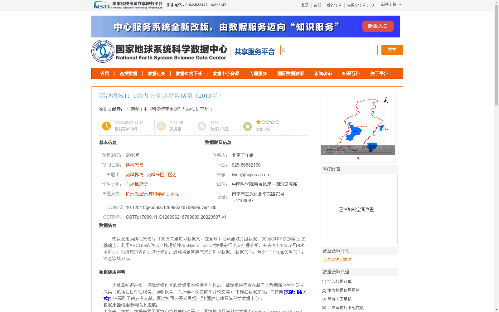
该数据集为滇池流域1:100万矢量边界数据集,在全球1-12级流域分级数据、30m分辨率DEM数据的基础上,利用ARCGIS软件水文处理插件ArcHydro Tools对数据进行水文处理分析,并参考1:100万河网水系数据,对流域边界数据进行修正,最终得到滇池流域的边界数据。
数据文件,包含了1个shp矢量文件:滇池流域.shp。
This dataset is a 1:1,000,000 scale vector boundary dataset for the Dianchi Lake Basin. Based on global 1–12 level basin hierarchical data and 30m resolution DEM data, hydrological processing and analysis was conducted using ArcHydro Tools, a hydrological processing plugin for ArcGIS software. The basin boundary data was then revised with reference to the 1:1,000,000 scale river network and water system data, ultimately yielding the boundary data of the Dianchi Lake Basin. The data package includes one shapefile vector file: Dianchi Lake Basin.shp.
提供机构:
中国科学院南京地理与湖泊研究所
创建时间:
2022-05-07
搜集汇总
数据集介绍
背景与挑战
背景概述
该数据集是2013年滇池流域的1:100万矢量边界数据,基于全球流域分级和30m分辨率DEM数据,通过ARCGIS软件的水文处理工具分析并参考河网水系数据修正生成,包含一个shp文件。数据集质量优良,适用于自然地理学和流域区划研究,支持滇池流域的科学分析和规划应用。
以上内容由遇见数据集搜集并总结生成


