2015年中国滨海30m分辨率养殖池空间分布动态数据集
收藏国家地球系统科学数据中心2022-02-25 更新2024-03-04 收录
下载链接:
https://www.geodata.cn/data/datadetails.html?dataguid=65417431063622&docId=10264
下载链接
链接失效反馈官方服务:
资源简介:
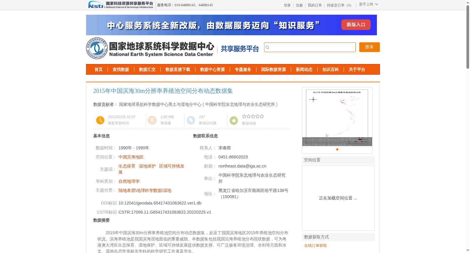
2015年中国滨海30m分辨率养殖池空间分布动态数据集,反应了我国滨海地区2015年养殖池空间分布状况。滨海养殖池是我国滨海湿地面临的重要威胁。本数据集包括我国沿海养殖池分布现状数据,可为粤港澳大湾区生态保育、湿地保护、区域可持续发展提供数据支撑。可广泛服务环境治理、水利等方面和水文、湿地生态学等相关学科的科学研究工作者及学生。
2015 30m-resolution Spatial Distribution Dynamic Dataset of Aquaculture Ponds in Coastal China. This dataset reflects the spatial distribution of aquaculture ponds in China's coastal areas in 2015. Coastal aquaculture ponds pose a significant threat to China's coastal wetlands. This dataset provides current distribution data of aquaculture ponds in China's coastal regions, offering data support for ecological conservation, wetland protection, and regional sustainable development in the Guangdong-Hong Kong-Macao Greater Bay Area (GBA). It can be widely applied to scientific researchers and students in relevant disciplines such as environmental governance, water conservancy, hydrology, and wetland ecology.
提供机构:
中国科学院东北地理与农业生态研究所
创建时间:
2022-02-25
搜集汇总
数据集介绍
背景与挑战
背景概述
该数据集反映了2015年中国滨海地区养殖池的空间分布状况,采用30米分辨率的Landsat遥感影像作为主要数据源,通过面向对象的遥感图像分类方法提取信息,数据质量优良。数据集可为生态保育、湿地保护和区域可持续发展研究提供数据支撑,适用于环境治理、水利等领域的科研工作。
以上内容由遇见数据集搜集并总结生成


