近三十年我国西南山地Landsat森林林线产品
收藏地球大数据科学工程2024-03-04 收录
下载链接:
https://data.casearth.cn/sdo/detail/6538a60b819aec0f26153cb5
下载链接
链接失效反馈官方服务:
资源简介:
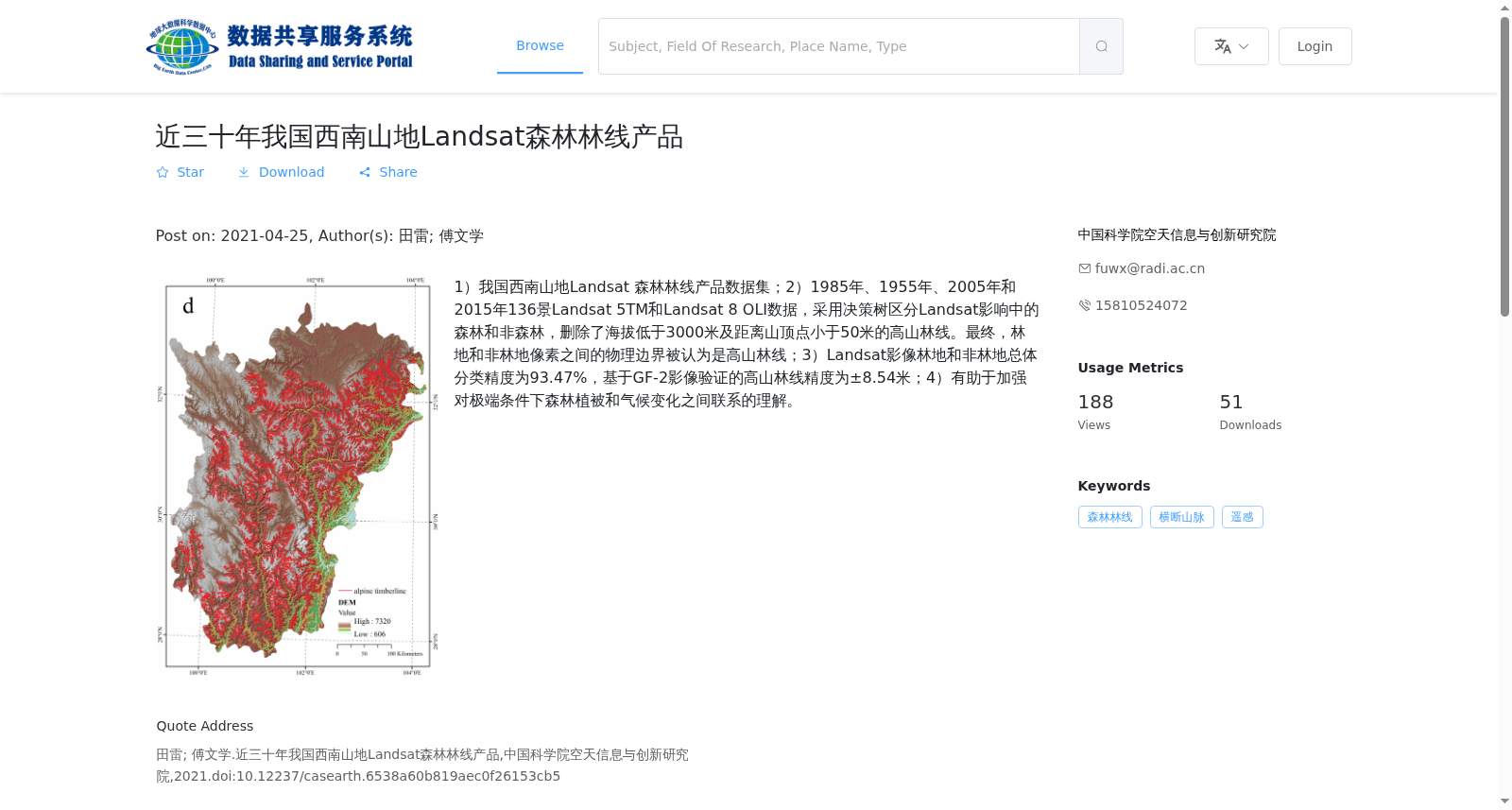
1)我国西南山地Landsat 森林林线产品数据集;2)1985年、1955年、2005年和2015年136景Landsat 5TM和Landsat 8 OLI数据,采用决策树区分Landsat影响中的森林和非森林,删除了海拔低于3000米及距离山顶点小于50米的高山林线。最终,林地和非林地像素之间的物理边界被认为是高山林线;3)Landsat影像林地和非林地总体分类精度为93.47%,基于GF-2影像验证的高山林线精度为±8.54米;4)有助于加强对极端条件下森林植被和气候变化之间联系的理解。
1) Landsat Forest Treeline Product Dataset in Mountainous Areas of Southwest China; 2) This dataset includes 136 scenes of Landsat 5 TM and Landsat 8 OLI data acquired in 1985, 1955, 2005 and 2015. A decision tree was adopted to distinguish forest and non-forest pixels in the Landsat imagery, and alpine treeline pixels with an elevation lower than 3000 meters or within 50 meters from the summit were excluded. Finally, the physical boundary between forest and non-forest pixels was defined as the alpine treeline; 3) The overall classification accuracy of forest and non-forest pixels from Landsat imagery is 93.47%, and the validation accuracy of the alpine treeline based on GF-2 imagery is ±8.54 meters; 4) This dataset helps enhance the understanding of the linkages between forest vegetation and climate change under extreme conditions.
提供机构:
中国科学院空天信息与创新研究院
搜集汇总
数据集介绍
背景与挑战
背景概述
该数据集提供了1985年至2015年间我国西南山地的高山林线产品,基于Landsat影像通过决策树分类生成,覆盖四个时间点(每5年一次),空间分辨率为30米。数据集采用严格筛选条件(海拔>3000米,距离山顶点>50米),林地分类精度达93.47%,林线位置精度为±8.54米,有助于研究森林植被与气候变化的关系。
以上内容由遇见数据集搜集并总结生成


