东北地区10m分辨率主要作物分布数据集(2017-2019年)
收藏国家地球系统科学数据中心2022-09-19 更新2024-03-04 收录
下载链接:
https://www.geodata.cn/data/datadetails.html?dataguid=133604947698117&docId=7172
下载链接
链接失效反馈官方服务:
资源简介:
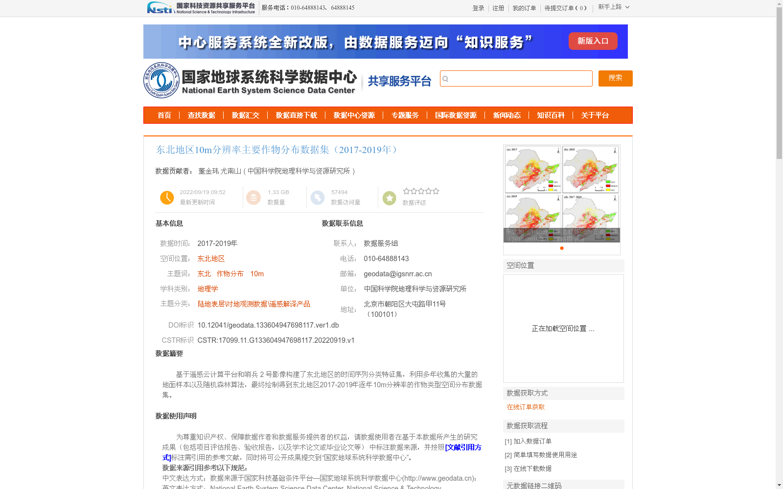
基于遥感云计算平台和哨兵 2 号影像构建了东北地区的时间序列分类特征集,利用多年收集的大量的地面样本以及随机森林算法,最终绘制得到东北地区2017-2019年逐年10m分辨率的作物类型空间分布数据集。
Based on remote sensing cloud computing platforms and Sentinel-2 imagery, a time-series classification feature set for Northeast China was developed. Using a large number of ground samples collected over multiple years and the Random Forest algorithm, the annual 10-meter resolution spatial distribution datasets of crop types for Northeast China from 2017 to 2019 were finally mapped.
提供机构:
中国科学院地理科学与资源研究所
创建时间:
2022-09-19
搜集汇总
数据集介绍
背景与挑战
背景概述
该数据集是东北地区2017-2019年逐年10米分辨率的主要作物空间分布数据,基于Google Earth Engine云计算平台和Sentinel-2遥感影像,采用“分层分区全时序”策略和随机森林算法生成。数据集经过精度验证,总体精度在81%至87%之间,并与市级统计数据有较高相关性,适用于农业监测和地理研究。
以上内容由遇见数据集搜集并总结生成


