中国1km分辨率月相对湿度数据集(2000年)
收藏国家地球系统科学数据中心2018-09-27 更新2024-03-04 收录
下载链接:
https://www.geodata.cn/data/datadetails.html?dataguid=52115570964319&docId=19161
下载链接
链接失效反馈官方服务:
资源简介:
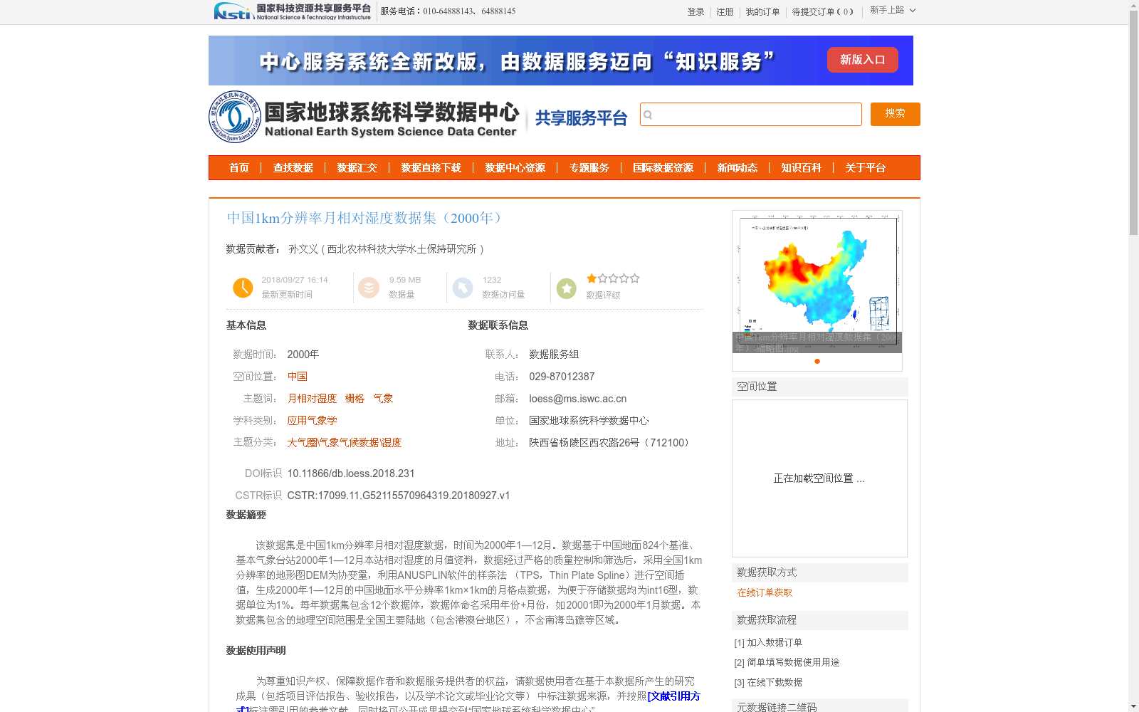
该数据集是中国1km分辨率月相对湿度数据,时间为2000年1—12月。数据基于中国地面824个基准、基本气象台站2000年1—12月本站相对湿度的月值资料,数据经过严格的质量控制和筛选后,采用全国1km分辨率的地形图DEM为协变量,利用ANUSPLIN软件的样条法 (TPS,Thin Plate Spline)进行空间插值,生成2000年1—12月的中国地面水平分辨率1km×1km的月格点数据,为便于存储数据均为int16型,数据单位为1%。每年数据集包含12个数据体,数据体命名采用年份+月份,如20001即为2000年1月数据。本数据集包含的地理空间范围是全国主要陆地(包含港澳台地区),不含南海岛礁等区域。
This dataset is monthly relative humidity data of China at 1 km resolution, covering January to December 2000. It is developed based on monthly in-situ relative humidity data from 824 national reference and basic meteorological stations across China during the same period. After strict quality control and screening, the thin plate spline (TPS) method in the ANUSPLIN software was used for spatial interpolation, taking the 1 km resolution topographic DEM of China as a covariate, to generate monthly grid point data of China's land surface at 1 km × 1 km resolution for January to December 2000. For convenient storage, all data are stored in int16 format, with the unit of 1%. Each annual dataset contains 12 data files, which are named by combining the year and the month; for example, 20001 corresponds to the data for January 2000. The geographic scope of this dataset covers the main terrestrial areas of China (including Hong Kong, Macao and Taiwan regions), excluding regions such as the South China Sea islands and reefs.
提供机构:
西北农林科技大学水土保持研究所
创建时间:
2018-09-27
搜集汇总
数据集介绍
背景与挑战
背景概述
该数据集是中国2000年1-12月的1km分辨率月相对湿度格点数据,基于824个气象台站观测资料通过ANUSPLIN软件插值生成,覆盖全国主要陆地区域(含港澳台),数据格式为int16型,单位为1%。数据集适用于气象学、气候研究等领域,使用时需遵守相关引用规范。
以上内容由遇见数据集搜集并总结生成


