成渝地区双城经济圈县域尺度城镇化监测与评估10年间隔数据集(2010年-2020年)
收藏国家地球系统科学数据中心2024-08-27 更新2024-08-31 收录
下载链接:
https://www.geodata.cn/data/datadetails.html?dataguid=4010532&docId=2794
下载链接
链接失效反馈官方服务:
资源简介:
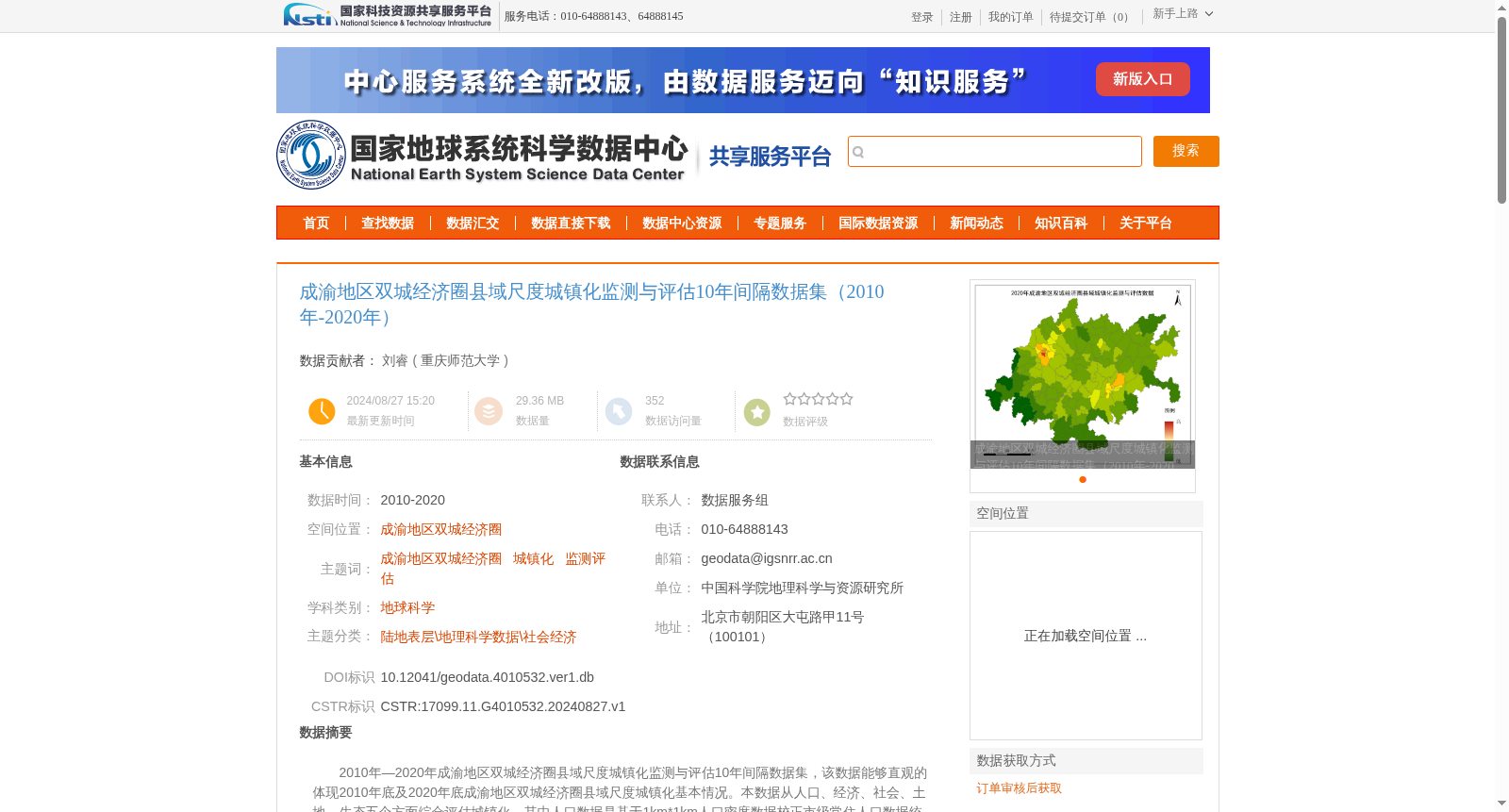
2010年—2020年成渝地区双城经济圈县域尺度城镇化监测与评估10年间隔数据集,该数据能够直观的体现2010年底及2020年底成渝地区双城经济圈县域尺度城镇化基本情况。本数据从人口、经济、社会、土地、生态五个方面综合评估城镇化,其中人口数据是基于1km*1km人口密度数据校正市级常住人口数据统计得到县级常住人口数据;经济数据则主要通过500m*500m夜间灯光数据校正市级GDP统计得到县级GDP值;社会数据是基于POI数据统计得出;土地数据是通过提取30m*30m的土地利用数据中的县域建设用地以及县域总面积之比得出;生态数据是通过提取30m*30m的土地利用数据中的县域森林、灌木、草地、水体、湿地面积以及县域总面积之比以及县域NDVI相加归一化得出。
10-year interval dataset of urbanization monitoring and assessment at the county scale in the Chengdu-Chongqing Twin-City Economic Circle from 2010 to 2020. This dataset can intuitively reflect the basic urbanization situation at the county scale in the Chengdu-Chongqing Twin-City Economic Circle by the end of 2010 and 2020. This dataset comprehensively evaluates urbanization from five dimensions: population, economy, society, land, and ecology. Specifically, the population data is derived by correcting municipal permanent population statistics using 1km×1km population density data to obtain county-level permanent population figures; the economic data is mainly obtained by correcting municipal GDP statistics using 500m×500m nighttime light data to derive county-level GDP values; the social data is calculated based on POI data; the land data is calculated by extracting the ratio of county-level construction land to the total county area from 30m×30m land use data; the ecological data is obtained by normalizing the sum of two components: the ratio of county-level forest, shrub, grassland, water body and wetland area to the total county area extracted from 30m×30m land use data, and the county-level NDVI.
提供机构:
重庆师范大学
创建时间:
2024-08-27
搜集汇总
数据集介绍
背景与挑战
背景概述
该数据集为成渝地区双城经济圈2010-2020年县域尺度的城镇化监测与评估数据,涵盖人口、经济、社会、土地和生态五个维度,通过多源数据校正和统计方法生成,数据质量可靠,适用于城镇化研究。
以上内容由遇见数据集搜集并总结生成


