QTP-NDVI30: 青藏高原高时空分辨率(30m-8d)NDVI时间序列数据集(2000-2020)
收藏国家青藏高原科学数据中心2022-07-30 更新2024-03-01 收录
下载链接:
https://data.tpdc.ac.cn/zh-hans/data/80ee374d-b956-4c51-9572-ee4f6017e0d7
下载链接
链接失效反馈官方服务:
资源简介:
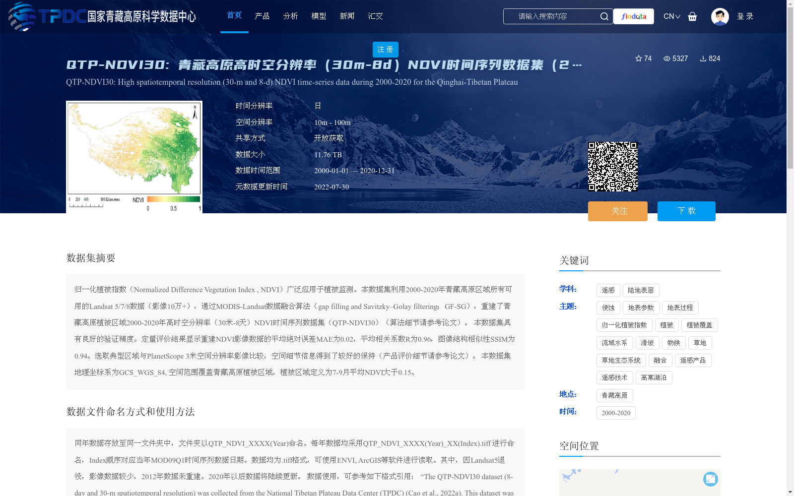
归一化植被指数(Normalized Difference Vegetation Index , NDVI)广泛应用于植被监测。本数据集利用2000-2020年青藏高原区域所有可用的Landsat 5/7/8数据(影像10万+),通过MODIS-Landsat数据融合算法(gap filling and Savitzky–Golay filtering;GF-SG),重建了青藏高原植被区域2000-2020年高时空分辨率(30米-8天)NDVI时间序列数据集(QTP-NDVI30)(算法细节请参考论文)。
本数据集具有良好的验证精度。定量评价结果显示重建NDVI影像数据的平均绝对误差MAE为0.02,平均相关系数R为0.96,图像结构相似性SSIM为0.94。选取典型区域与PlanetScope 3米空间分辨率影像比较,空间细节信息得到了较好的保持(产品评价细节请参考论文)。
本数据集地理坐标系为GCS_WGS_84, 空间范围覆盖青藏高原植被区域,植被区域定义为7-9月平均NDVI大于0.15。
Normalized Difference Vegetation Index (NDVI) is widely used in vegetation monitoring. This dataset utilizes all available Landsat 5/7/8 imagery (over 100,000 scenes) over the Tibetan Plateau from 2000 to 2020, and employs the MODIS-Landsat data fusion algorithm (gap filling and Savitzky–Golay filtering; GF-SG) to reconstruct a high spatiotemporal resolution (30 m spatial resolution, 8-day temporal resolution) NDVI time-series dataset (QTP-NDVI30) for the vegetated areas of the Tibetan Plateau during 2000–2020. Please refer to the related paper for detailed algorithm descriptions.
This dataset exhibits excellent validation accuracy. Quantitative evaluation results show that the reconstructed NDVI imagery has a mean absolute error (MAE) of 0.02, a mean correlation coefficient (R) of 0.96, and a structural similarity index measure (SSIM) of 0.94. When compared with PlanetScope imagery at 3 m spatial resolution in selected typical regions, the spatial detail information is well preserved. Please refer to the related paper for detailed product evaluation information.
The geographic coordinate system of this dataset is GCS_WGS_84, and its spatial coverage includes the vegetated areas of the Tibetan Plateau, which are defined as regions with an average NDVI greater than 0.15 from July to September.
提供机构:
曹入尹,徐子超,陈洋,沈妙根,陈晋
创建时间:
2022-06-28
搜集汇总
数据集介绍
背景与挑战
背景概述
该数据集是青藏高原2000-2020年高时空分辨率(30米空间分辨率和8天时间分辨率)的NDVI时间序列数据,通过融合Landsat和MODIS数据并使用GF-SG算法重建而成,覆盖植被区域(7-9月平均NDVI大于0.15)。数据具有高精度验证(MAE为0.02,R为0.96,SSIM为0.94),总大小为11.76 TB,以开放获取方式共享,适用于植被监测和相关研究。
以上内容由遇见数据集搜集并总结生成


