2025年1月7日定日县地震区公路数据
收藏国家青藏高原科学数据中心2025-01-09 更新2025-01-25 收录
下载链接:
https://data.tpdc.ac.cn/zh-hans/data/b0e96219-5b68-4c67-a1fd-5b593f5fd288
下载链接
链接失效反馈官方服务:
资源简介:
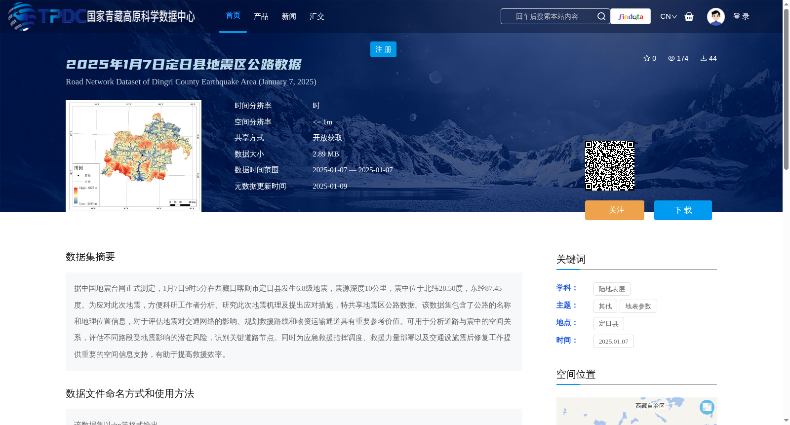
据中国地震台网正式测定,1月7日9时5分在西藏日喀则市定日县发生6.8级地震,震源深度10公里,震中位于北纬28.50度,东经87.45度。为应对此次地震,方便科研工作者分析、研究此次地震机理及提出应对措施,特共享地震区公路数据。该数据集包含了公路的名称和地理位置信息,对于评估地震对交通网络的影响、规划救援路线和物资运输通道具有重要参考价值。可用于分析道路与震中的空间关系,评估不同路段受地震影响的潜在风险,识别关键道路节点。同时为应急救援指挥调度、救援力量部署以及交通设施震后修复工作提供重要的空间信息支持,有助于提高救援效率。
Officially determined by the China Earthquake Networks Center (CENC), a magnitude 6.8 earthquake struck Dingri County, Xigazê City, Tibet Autonomous Region at 09:05 on January 7, with a focal depth of 10 km and the epicenter located at 28.50°N, 87.45°E. To respond to this earthquake and facilitate researchers in analyzing and studying the seismic mechanism and formulating response measures, the road network data in the earthquake-affected area is hereby shared. This dataset contains the names and geographic location information of roads, which is of great reference value for assessing the impact of the earthquake on the transportation network, planning rescue routes and material transport corridors. It can be used to analyze the spatial relationship between roads and the epicenter, evaluate the potential seismic risk of different road sections, and identify critical road nodes. Meanwhile, it provides important spatial information support for emergency rescue command and dispatch, deployment of rescue forces, and post-earthquake repair of transportation facilities, helping to improve rescue efficiency.
提供机构:
高分辨率对地观测系统甘肃数据与应用中心
创建时间:
2025-01-09
搜集汇总
数据集介绍
背景与挑战
背景概述
该数据集是针对2025年1月7日西藏定日县6.8级地震而提供的公路网络数据,包含公路名称和地理位置信息,空间分辨率高(≤1米),以shp等格式共享。它主要用于评估地震对交通的影响、规划救援路线和物资运输,为地震机理研究、应急救援和交通修复提供重要空间支持。
以上内容由遇见数据集搜集并总结生成


