黑河流域地表过程综合观测网:阿柔超级站气象要素梯度观测系统(2022)
收藏国家青藏高原科学数据中心2023-07-27 更新2024-03-07 收录
下载链接:
https://data.tpdc.ac.cn/zh-hans/data/1f8ecb3d-1469-4568-babb-3a3d85156450
下载链接
链接失效反馈官方服务:
资源简介:
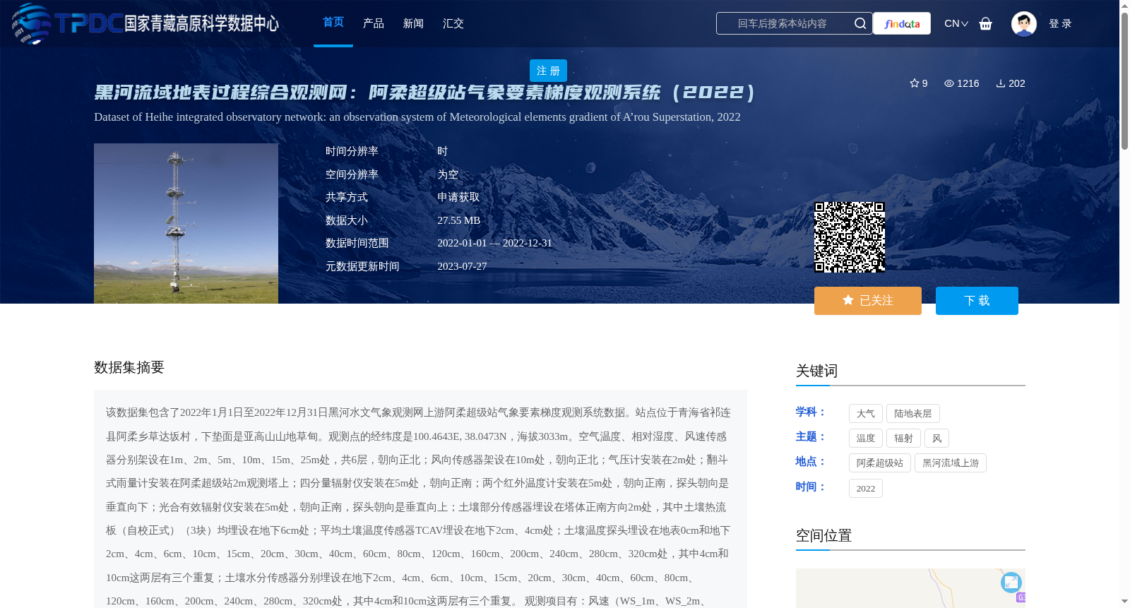
该数据集包含了2022年1月1日至2022年12月31日黑河水文气象观测网上游阿柔超级站气象要素梯度观测系统数据。站点位于青海省祁连县阿柔乡草达坂村,下垫面是亚高山山地草甸。观测点的经纬度是100.4643E, 38.0473N,海拔3033m。空气温度、相对湿度、风速传感器分别架设在1m、2m、5m、10m、15m、25m处,共6层,朝向正北;风向传感器架设在10m处,朝向正北;气压计安装在2m处;翻斗式雨量计安装在阿柔超级站2m观测塔上;四分量辐射仪安装在5m处,朝向正南;两个红外温度计安装在5m处,朝向正南,探头朝向是垂直向下;光合有效辐射仪安装在5m处,朝向正南,探头朝向是垂直向上;土壤部分传感器埋设在塔体正南方向2m处,其中土壤热流板(自校正式)(3块)均埋设在地下6cm处;平均土壤温度传感器TCAV埋设在地下2cm、4cm处;土壤温度探头埋设在地表0cm和地下2cm、4cm、6cm、10cm、15cm、20cm、30cm、40cm、60cm、80cm、120cm、160cm、200cm、240cm、280cm、320cm处,其中4cm和10cm这两层有三个重复;土壤水分传感器分别埋设在地下2cm、4cm、6cm、10cm、15cm、20cm、30cm、40cm、60cm、80cm、120cm、160cm、200cm、240cm、280cm、320cm处,其中4cm和10cm这两层有三个重复。
观测项目有:风速(WS_1m、WS_2m、WS_5m、WS_10m、WS_15m、WS_25m)(单位:米/秒)、风向(WD_10m)(单位:度)、空气温湿度(Ta_1m、Ta_2m、Ta_5m、Ta_10m、Ta_15m、Ta_25m和RH_1m、RH_2m、RH_5m、RH_10m、RH_15m、RH_25m)(单位:摄氏度、百分比)、气压(Press)(单位:百帕)、降水量(Rain)(单位:毫米)、四分量辐射(DR、UR、DLR_Cor、ULR_Cor、Rn)(单位:瓦/平方米)、地表辐射温度(IRT_1、IRT_2)(单位:摄氏度)、光合有效辐射(PAR)(单位:微摩尔/平方米秒)、平均土壤温度(TCAV)(单位:摄氏度)、土壤热通量(Gs_1、Gs_2、Gs_3)(单位:瓦/平方米)、土壤水分(Ms_2cm、Ms_4cm_1、Ms_4cm_2、Ms_4cm_3、Ms_6cm、Ms_10cm_1、Ms_10cm_2、Ms_10cm_3、Ms_15cm、Ms_20cm、Ms_30cm、Ms_40cm、Ms_60cm、Ms_80cm、Ms_120cm、Ms_160cm Ms_200cm、Ms_240cm、Ms_280cm、Ms_320cm)(单位:体积含水量,百分比)、土壤温度(Ts_0cm、Ts_2cm、Ts_4cm_1、Ts_4cm_2、Ts_4cm_3、Ts_6cm、Ts_10cm_1、Ts_10cm_2、Ts_10cm_3、Ts_15cm、Ts_20cm、Ts_30cm、Ts_40cm、Ts_60cm、Ts_80cm、Ts_120cm、Ts_160cm Ts_200cm、Ts_240cm、Ts_280cm、Ts_320cm)(单位:摄氏度)。
观测数据的处理与质量控制:(1)确保每天144个数据(每10min),若出现数据的缺失,则由-6999标示;(2)剔除有重复记录的时刻;(3)删除了明显超出物理意义或超出仪器量程的数据;(4)数据中以红字标示的部分为有疑问的数据;(5)日期和时间的格式统一,并且日期、时间在同一列。如,时间为:2022-6-10 10:30;(6)命名规则为:AWS+站点名称。
黑河综合观测网或站点信息请参考Liu et al. (2018),观测数据处理请参考Liu et al. (2011)。
This dataset contains data from the meteorological element gradient observation system of the Arou Super Station in the upper reaches of the Heihe River Hydrological and Meteorological Observation Network, covering the period from January 1, 2022 to December 31, 2022.
The station is located in Caodaban Village, Arou Township, Qilian County, Qinghai Province, with an underlying surface of subalpine mountain meadow. The coordinates of the observation site are 100.4643°E, 38.0473°N, and the elevation is 3033 m. Air temperature, relative humidity and wind speed sensors were installed at 6 heights (1 m, 2 m, 5 m, 10 m, 15 m, 25 m) facing true north. The wind direction sensor was installed at 10 m, facing true north. The barometer was installed at 2 m. The tipping-bucket rain gauge was installed on the 2 m observation tower of the Arou Super Station. The four-component radiometer was installed at 5 m, facing true south. Two infrared thermometers were installed at 5 m, facing true south with probes pointing vertically downward. The photosynthetically active radiation (PAR) sensor was installed at 5 m, facing true south with the probe pointing vertically upward.
Soil sensors were buried 2 m south of the tower: three self-calibrating soil heat flux plates were all buried at 6 cm below the ground; the average soil temperature sensor TCAV was buried at 2 cm and 4 cm below the ground; soil temperature probes were installed at 0 cm (surface) and 2 cm, 4 cm, 6 cm, 10 cm, 15 cm, 20 cm, 30 cm, 40 cm, 60 cm, 80 cm, 120 cm, 160 cm, 200 cm, 240 cm, 280 cm, 320 cm below the ground, with three replicates at both 4 cm and 10 cm depths; soil moisture sensors were buried at 2 cm, 4 cm, 6 cm, 10 cm, 15 cm, 20 cm, 30 cm, 40 cm, 60 cm, 80 cm, 120 cm, 160 cm, 200 cm, 240 cm, 280 cm, 320 cm below the ground, with three replicates at both 4 cm and 10 cm depths.
Observation items include:
1. Wind speed (WS_1m, WS_2m, WS_5m, WS_10m, WS_15m, WS_25m), unit: m/s;
2. Wind direction (WD_10m), unit: degree;
3. Air temperature and relative humidity (Ta_1m, Ta_2m, Ta_5m, Ta_10m, Ta_15m, Ta_25m and RH_1m, RH_2m, RH_5m, RH_10m, RH_15m, RH_25m), units: ℃ and % respectively;
4. Atmospheric pressure (Press), unit: hectopascal (hPa);
5. Precipitation (Rain), unit: millimeter (mm);
6. Four-component radiation (DR, UR, DLR_Cor, ULR_Cor, Rn), unit: W/m²;
7. Surface radiation temperature (IRT_1, IRT_2), unit: ℃;
8. Photosynthetically active radiation (PAR), unit: μmol·m⁻²·s⁻¹;
9. Average soil temperature (TCAV), unit: ℃;
10. Soil heat flux (Gs_1, Gs_2, Gs_3), unit: W/m²;
11. Soil moisture (Ms_2cm, Ms_4cm_1, Ms_4cm_2, Ms_4cm_3, Ms_6cm, Ms_10cm_1, Ms_10cm_2, Ms_10cm_3, Ms_15cm, Ms_20cm, Ms_30cm, Ms_40cm, Ms_60cm, Ms_80cm, Ms_120cm, Ms_160cm, Ms_200cm, Ms_240cm, Ms_280cm, Ms_320cm), unit: volumetric water content percentage (%);
12. Soil temperature (Ts_0cm, Ts_2cm, Ts_4cm_1, Ts_4cm_2, Ts_4cm_3, Ts_6cm, Ts_10cm_1, Ts_10cm_2, Ts_10cm_3, Ts_15cm, Ts_20cm, Ts_30cm, Ts_40cm, Ts_60cm, Ts_80cm, Ts_120cm, Ts_160cm, Ts_200cm, Ts_240cm, Ts_280cm, Ts_320cm), unit: ℃.
Data processing and quality control:
(1) Ensure 144 data records per day (one record every 10 minutes). Missing data will be marked with -6999;
(2) Remove duplicate records at the same time stamp;
(3) Delete data that obviously exceeds physical limits or instrument measuring ranges;
(4) Data marked in red indicate questionable values;
(5) Unify the date and time format, with date and time in the same column. For example, the time format is: 2022-6-10 10:30;
(6) The naming rule is: AWS+station name.
For information on the Heihe Comprehensive Observation Network or stations, please refer to Liu et al. (2018); for observation data processing procedures, please refer to Liu et al. (2011).
提供机构:
刘绍民,车涛,徐自为,张阳,谭俊磊,任志国,李新
创建时间:
2023-07-17
搜集汇总
数据集介绍
背景与挑战
背景概述
该数据集为2022年黑河流域阿柔超级站的气象要素梯度观测数据,包含多层次的气象和土壤参数,经过严格质量控制,适用于地表过程研究。
以上内容由遇见数据集搜集并总结生成


