延河流域25m分辨率年降水量数据集(2010-2021年)
收藏国家地球系统科学数据中心2024-11-13 更新2024-11-30 收录
下载链接:
https://www.geodata.cn/data/datadetails.html?dataguid=239225544374211&docId=2205
下载链接
链接失效反馈官方服务:
资源简介:
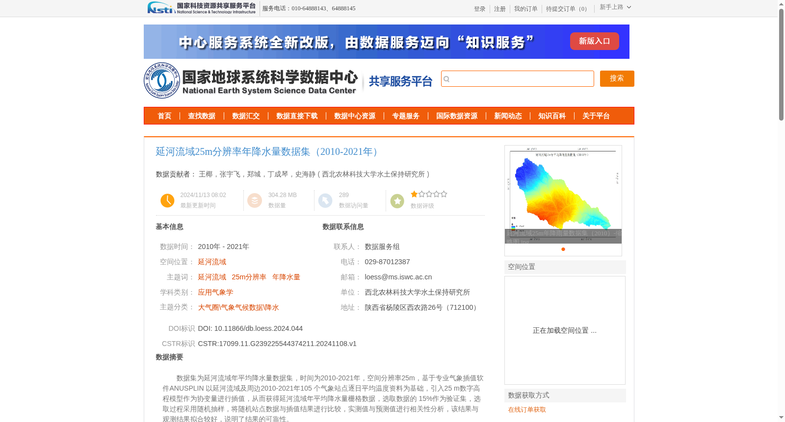
数据集为延河流域年平均降水量数据集,时间为2010-2021年,空间分辨率25m,基于专业气象插值软件ANUSPLIN 以延河流域及周边2010-2021年105 个气象站点逐日平均温度资料为基础,引入25 m数字高程模型作为协变量进行插值,从而获得延河流域年平均降水量栅格数据,选取数据的 15%作为验证集,选取过程采用随机抽样,将随机站点数据与插值结果进行比较,实测值与预测值进行相关性分析,该结果与观测结果拟合较好,说明了结果的可靠性。
This dataset is the annual average precipitation dataset for the Yanhe River Basin, covering the period from 2010 to 2021 with a spatial resolution of 25 meters. It was developed using the professional meteorological interpolation software ANUSPLIN, based on daily mean temperature data from 105 meteorological stations within and around the Yanhe River Basin during 2010–2021. A 25 m digital elevation model (DEM) was introduced as a covariate in the interpolation process to generate raster data of annual average precipitation for the Yanhe River Basin. 15% of the dataset was selected as the validation set via random sampling. Randomly sampled station data was compared with the interpolation results, and a correlation analysis was conducted between the measured values and predicted values. The results showed good agreement with the observed values, demonstrating the reliability of this dataset.
提供机构:
西北农林科技大学水土保持研究所
创建时间:
2024-11-08
搜集汇总
数据集介绍
背景与挑战
背景概述
该数据集提供了延河流域2010-2021年25米分辨率的年降水量栅格数据,基于气象站点和DEM插值生成,并通过验证集验证了数据的可靠性。
以上内容由遇见数据集搜集并总结生成


