青藏高原土地利用数据(1992、2005和2015)(V1.0)
收藏地球大数据科学工程2024-04-26 收录
下载链接:
https://data.casearth.cn/sdo/detail/5feae826819aec33049b7c3a
下载链接
链接失效反馈官方服务:
资源简介:
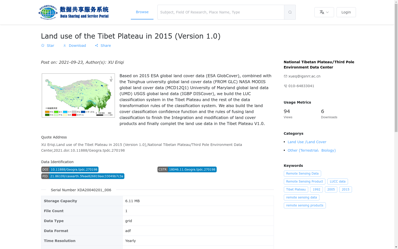
基于2015年欧空局ESA GlobCover全球陆地覆盖数据,结合中科院地理资源所土地利用数据NLCD-China、清华大学全球土地覆被FROM-GLC数据、美国NASA的MODIS全球土地覆被MCD12Q1数据、马里兰大学全球土地覆被UMD、美国USGS土地覆被数据IGBP DISCover,构建了青藏高原LUC分类系统以及其余数据分类系统的转换规则,构建土地覆被分类置信度函数和地类融合规则,进行土地覆被产品融合与修正,完成了青藏高原土地利用数据V1.0(1992,2005,2015,,300m×300m栅格,一级分类)
Based on the 2015 European Space Agency (ESA) GlobCover global land cover data, combined with land use data NLCD-China from the Institute of Geographic Sciences and Natural Resources Research of the Chinese Academy of Sciences, global land cover data FROM-GLC from Tsinghua University, MODIS global land cover product MCD12Q1 from NASA of the United States, global land cover product UMD from the University of Maryland, and land cover data IGBP DISCover from USGS of the United States, we established the Land Use/Cover (LUC) classification system for the Qinghai-Tibet Plateau and the classification conversion rules for the remaining datasets. We also developed land cover classification confidence functions and land category fusion rules to perform land cover product fusion and correction, and finally completed the Qinghai-Tibet Plateau Land Use Data V1.0, which covers the years 1992, 2005 and 2015, with a spatial resolution of 300m×300m grid and adopts first-level classification.
提供机构:
国家青藏高原科学数据中心
搜集汇总
数据集介绍
背景与挑战
背景概述
该数据集为2015年青藏高原土地利用数据(V1.0),整合了ESA GlobCover、FROM GLC、MCD12Q1等多个全球土地覆盖数据,空间分辨率为米级,地理范围覆盖东经73.0°至105.0°,北纬25.0°至40.0°的区域。
以上内容由遇见数据集搜集并总结生成


