Fine classification dataset of crops in the transboundary basin of the Heilongjiang River between Russia and China, 2015-2023
收藏DataCite Commons2025-04-27 更新2025-05-18 收录
下载链接:
https://www.scidb.cn/detail?dataSetId=c0e716d41548468c974767a46c6aa50d
下载链接
链接失效反馈官方服务:
资源简介:
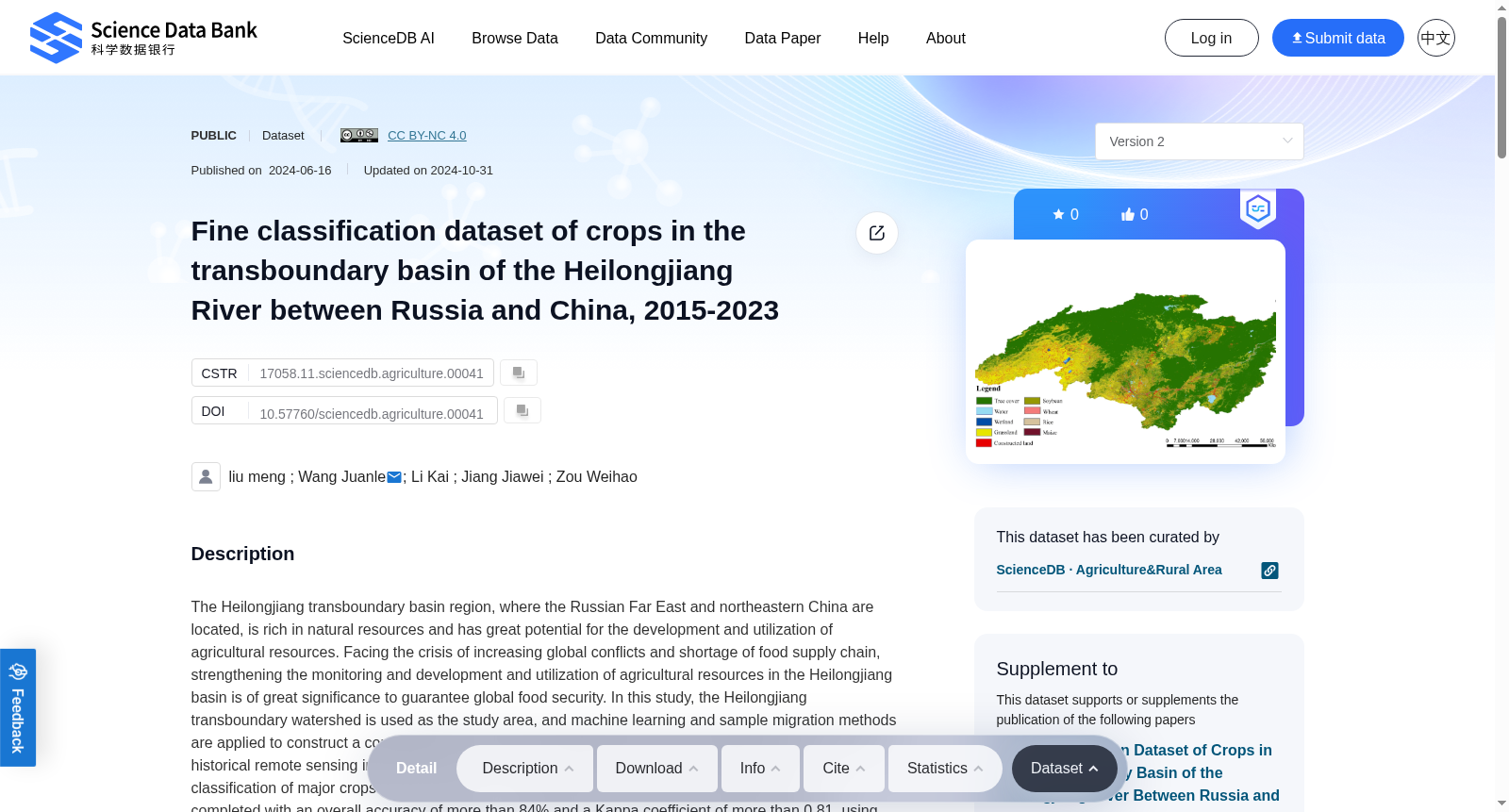
The Heilongjiang transboundary basin region, where the Russian Far East and northeastern China are located, is rich in natural resources and has great potential for the development and utilization of agricultural resources. Facing the crisis of increasing global conflicts and shortage of food supply chain, strengthening the monitoring and development and utilization of agricultural resources in the Heilongjiang basin is of great significance to guarantee global food security. In this study, the Heilongjiang transboundary watershed is used as the study area, and machine learning and sample migration methods are applied to construct a comprehensive set of fine classification system for agricultural crops. Based on historical remote sensing image data and the Google Earth Engine (GEE) cloud platform, the classification of major crops such as wheat, corn, soybean and rice in 2015, 2020 and 2023 was completed with an overall accuracy of more than 84% and a Kappa coefficient of more than 0.81, using Landsat images as the data source.
中俄远东与中国东北所在的黑龙江跨界流域地区,自然资源禀赋丰厚,农业资源开发利用潜力巨大。面对全球冲突频发、粮食供应链短缺的危机,加强黑龙江流域农业资源的监测与开发利用,对保障全球粮食安全具有重要意义。本研究以黑龙江跨界流域为研究区域,采用机器学习与样本迁移方法,构建了一套完备的农作物精细分类体系。本研究以Landsat影像为数据源,依托历史遥感影像数据与谷歌地球引擎(Google Earth Engine, GEE)云平台,完成了2015年、2020年及2023年小麦、玉米、大豆、水稻等主要农作物的分类工作,整体精度达84%以上,Kappa系数超过0.81。
提供机构:
Science Data Bank
创建时间:
2024-06-16
搜集汇总
数据集介绍
背景与挑战
背景概述
该数据集聚焦于2015-2023年中俄黑龙江跨境流域的农作物精细分类,利用机器学习和遥感技术(如Landsat和Sentinel-2影像)对小麦、玉米、大豆和水稻等主要作物进行分类,总体精度超过84%,旨在支持农业资源监测和全球粮食安全研究。数据集具有高精度和跨年份覆盖的特点,适用于地球科学和农业分析领域。
以上内容由遇见数据集搜集并总结生成


