【我遇到的问题】 • 现象:该数据集的下载链接已失效 【相关信息】 • 可考虑访问这个链接获取类似文件~https://www.selectdataset.com/dataset/3688356173feccbcf1f1e490ddc6bc72
yuvidhepe/us-accidents-updated
收藏Hugging Face2023-05-29 更新2024-03-04 收录
下载链接:
https://hf-mirror.com/datasets/yuvidhepe/us-accidents-updated
下载链接
链接失效反馈官方服务:
资源简介:
---
license:
- cc-by-nc-sa-4.0
kaggle_id: sobhanmoosavi/us-accidents
dataset_info:
features:
- name: ID
dtype: string
- name: Source
dtype: string
- name: Severity
dtype: int64
- name: Start_Time
dtype: string
- name: End_Time
dtype: string
- name: Start_Lat
dtype: float64
- name: Start_Lng
dtype: float64
- name: End_Lat
dtype: float64
- name: End_Lng
dtype: float64
- name: Distance(mi)
dtype: float64
- name: Description
dtype: string
- name: Street
dtype: string
- name: City
dtype: string
- name: County
dtype: string
- name: State
dtype: string
- name: Zipcode
dtype: string
- name: Country
dtype: string
- name: Timezone
dtype: string
- name: Airport_Code
dtype: string
- name: Weather_Timestamp
dtype: string
- name: Temperature(F)
dtype: float64
- name: Wind_Chill(F)
dtype: float64
- name: Humidity(%)
dtype: float64
- name: Pressure(in)
dtype: float64
- name: Visibility(mi)
dtype: float64
- name: Wind_Direction
dtype: string
- name: Wind_Speed(mph)
dtype: float64
- name: Precipitation(in)
dtype: float64
- name: Weather_Condition
dtype: string
- name: Amenity
dtype: bool
- name: Bump
dtype: bool
- name: Crossing
dtype: bool
- name: Give_Way
dtype: bool
- name: Junction
dtype: bool
- name: No_Exit
dtype: bool
- name: Railway
dtype: bool
- name: Roundabout
dtype: bool
- name: Station
dtype: bool
- name: Stop
dtype: bool
- name: Traffic_Calming
dtype: bool
- name: Traffic_Signal
dtype: bool
- name: Turning_Loop
dtype: bool
- name: Sunrise_Sunset
dtype: string
- name: Civil_Twilight
dtype: string
- name: Nautical_Twilight
dtype: string
- name: Astronomical_Twilight
dtype: string
splits:
- name: train
num_bytes: 3147354997
num_examples: 7728394
download_size: 1088140045
dataset_size: 3147354997
---
# Dataset Card for US Accidents (2016 - 2023)
## Table of Contents
- [Table of Contents](#table-of-contents)
- [Dataset Description](#dataset-description)
- [Dataset Summary](#dataset-summary)
- [Supported Tasks and Leaderboards](#supported-tasks-and-leaderboards)
- [Languages](#languages)
- [Dataset Structure](#dataset-structure)
- [Data Instances](#data-instances)
- [Data Fields](#data-fields)
- [Data Splits](#data-splits)
- [Dataset Creation](#dataset-creation)
- [Curation Rationale](#curation-rationale)
- [Source Data](#source-data)
- [Annotations](#annotations)
- [Personal and Sensitive Information](#personal-and-sensitive-information)
- [Considerations for Using the Data](#considerations-for-using-the-data)
- [Social Impact of Dataset](#social-impact-of-dataset)
- [Discussion of Biases](#discussion-of-biases)
- [Other Known Limitations](#other-known-limitations)
- [Additional Information](#additional-information)
- [Dataset Curators](#dataset-curators)
- [Licensing Information](#licensing-information)
- [Citation Information](#citation-information)
- [Contributions](#contributions)
## Dataset Description
- **Homepage:** https://kaggle.com/datasets/sobhanmoosavi/us-accidents
- **Repository:**
- **Paper:**
- **Leaderboard:**
- **Point of Contact:**
### Dataset Summary
### Description
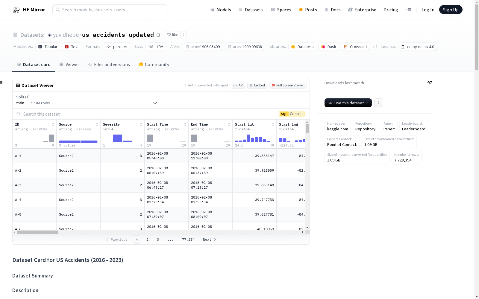
This is a countrywide car accident dataset, which covers __49 states of the USA__. The accident data are collected from __February 2016 to Mar 2023__, using multiple APIs that provide streaming traffic incident (or event) data. These APIs broadcast traffic data captured by a variety of entities, such as the US and state departments of transportation, law enforcement agencies, traffic cameras, and traffic sensors within the road-networks. Currently, there are about __7.7 million__ accident records in this dataset. Check [here](https://smoosavi.org/datasets/us_accidents) to learn more about this dataset.
### Acknowledgements
Please cite the following papers if you use this dataset:
- Moosavi, Sobhan, Mohammad Hossein Samavatian, Srinivasan Parthasarathy, and Rajiv Ramnath. “[A Countrywide Traffic Accident Dataset](https://arxiv.org/abs/1906.05409).”, 2019.
- Moosavi, Sobhan, Mohammad Hossein Samavatian, Srinivasan Parthasarathy, Radu Teodorescu, and Rajiv Ramnath. ["Accident Risk Prediction based on Heterogeneous Sparse Data: New Dataset and Insights."](https://arxiv.org/abs/1909.09638) In proceedings of the 27th ACM SIGSPATIAL International Conference on Advances in Geographic Information Systems, ACM, 2019.
### Content
This dataset has been collected in real-time, using multiple Traffic APIs. Currently, it contains accident data that are collected from February 2016 to Dec 2021 for the Contiguous United States. Check [here](https://smoosavi.org/datasets/us_accidents) to learn more about this dataset.
### Inspiration
US-Accidents can be used for numerous applications such as real-time car accident prediction, studying car accidents hotspot locations, casualty analysis and extracting cause and effect rules to predict car accidents, and studying the impact of precipitation or other environmental stimuli on accident occurrence. The most recent release of the dataset can also be useful to study the impact of COVID-19 on traffic behavior and accidents.
### Usage Policy and Legal Disclaimer
This dataset is being distributed only for __Research__ purposes, under Creative Commons Attribution-Noncommercial-ShareAlike license (CC BY-NC-SA 4.0). By clicking on download button(s) below, you are agreeing to use this data only for non-commercial, research, or academic applications. You may need to cite the above papers if you use this dataset.
### Inquiries or need help?
For any inquiries, contact me at moosavi.3@osu.edu
### Supported Tasks and Leaderboards
[More Information Needed]
### Languages
[More Information Needed]
## Dataset Structure
### Data Instances
[More Information Needed]
### Data Fields
[More Information Needed]
### Data Splits
[More Information Needed]
## Dataset Creation
### Curation Rationale
[More Information Needed]
### Source Data
#### Initial Data Collection and Normalization
[More Information Needed]
#### Who are the source language producers?
[More Information Needed]
### Annotations
#### Annotation process
[More Information Needed]
#### Who are the annotators?
[More Information Needed]
### Personal and Sensitive Information
[More Information Needed]
## Considerations for Using the Data
### Social Impact of Dataset
[More Information Needed]
### Discussion of Biases
[More Information Needed]
### Other Known Limitations
[More Information Needed]
## Additional Information
### Dataset Curators
This dataset was shared by [@sobhanmoosavi](https://kaggle.com/sobhanmoosavi)
### Licensing Information
The license for this dataset is cc-by-nc-sa-4.0
### Citation Information
```bibtex
[More Information Needed]
```
### Contributions
[More Information Needed]
许可证:
- CC BY-NC-SA 4.0(Creative Commons Attribution-NonCommercial-ShareAlike 4.0 International)
Kaggle数据集ID:sobhanmoosavi/us-accidents
数据集信息:
特征:
- 名称:ID,数据类型:字符串
- 名称:Source,数据类型:字符串
- 名称:Severity(事故严重程度),数据类型:int64
- 名称:Start_Time(事故开始时间),数据类型:字符串
- 名称:End_Time(事故结束时间),数据类型:字符串
- 名称:Start_Lat(起始纬度),数据类型:float64
- 名称:Start_Lng(起始经度),数据类型:float64
- 名称:End_Lat(结束纬度),数据类型:float64
- 名称:End_Lng(结束经度),数据类型:float64
- 名称:Distance(mi)(事故距离,单位:英里),数据类型:float64
- 名称:Description(事故描述),数据类型:字符串
- 名称:Street(街道),数据类型:字符串
- 名称:City(城市),数据类型:字符串
- 名称:County(县),数据类型:字符串
- 名称:State(州),数据类型:字符串
- 名称:Zipcode(邮政编码),数据类型:字符串
- 名称:Country(国家),数据类型:字符串
- 名称:Timezone(时区),数据类型:字符串
- 名称:Airport_Code(机场代码),数据类型:字符串
- 名称:Weather_Timestamp(天气时间戳),数据类型:字符串
- 名称:Temperature(F)(气温,单位:华氏度),数据类型:float64
- 名称:Wind_Chill(F)(风寒温度,单位:华氏度),数据类型:float64
- 名称:Humidity(%)(湿度,单位:百分比),数据类型:float64
- 名称:Pressure(in)(气压,单位:英寸汞柱),数据类型:float64
- 名称:Visibility(mi)(能见度,单位:英里),数据类型:float64
- 名称:Wind_Direction(风向),数据类型:字符串
- 名称:Wind_Speed(mph)(风速,单位:英里每小时),数据类型:float64
- 名称:Precipitation(in)(降水量,单位:英寸),数据类型:float64
- 名称:Weather_Condition(天气状况),数据类型:字符串
- 名称:Amenity(周边公共设施),数据类型:布尔值
- 名称:Bump(路面凸起),数据类型:布尔值
- 名称:Crossing(人行横道),数据类型:布尔值
- 名称:Give_Way(让行标志),数据类型:布尔值
- 名称:Junction(交叉路口),数据类型:布尔值
- 名称:No_Exit(无出口道路),数据类型:布尔值
- 名称:Railway(铁路道口),数据类型:布尔值
- 名称:Roundabout(环岛),数据类型:布尔值
- 名称:Station(公共服务站),数据类型:布尔值
- 名称:Stop(停车标志),数据类型:布尔值
- 名称:Traffic_Calming(交通镇静设施,如减速带),数据类型:布尔值
- 名称:Traffic_Signal(交通信号灯),数据类型:布尔值
- 名称:Turning_Loop(掉头车道),数据类型:布尔值
- 名称:Sunrise_Sunset(日出日落时段),数据类型:字符串
- 名称:Civil_Twilight(民用暮光时段),数据类型:字符串
- 名称:Nautical_Twilight(航海暮光时段),数据类型:字符串
- 名称:Astronomical_Twilight(天文暮光时段),数据类型:字符串
数据划分:
- 名称:训练集(train),字节数:3147354997,样本数:7728394
下载大小:1088140045
数据集总大小:3147354997
# 美国交通事故数据集(2016-2023)数据集卡片
## 目录
- [目录](#table-of-contents)
- [数据集说明](#dataset-description)
- [数据集概述](#dataset-summary)
- [支持任务与排行榜](#supported-tasks-and-leaderboards)
- [语言](#languages)
- [数据集结构](#dataset-structure)
- [数据实例](#data-instances)
- [数据字段](#data-fields)
- [数据划分](#data-splits)
- [数据集构建](#dataset-creation)
- [数据集构建初衷](#curation-rationale)
- [源数据](#source-data)
- [标注信息](#annotations)
- [个人与敏感信息](#personal-and-sensitive-information)
- [数据集使用注意事项](#considerations-for-using-the-data)
- [数据集社会影响](#social-impact-of-dataset)
- [偏差讨论](#discussion-of-biases)
- [其他已知局限性](#other-known-limitations)
- [附加信息](#additional-information)
- [数据集维护者](#dataset-curators)
- [许可信息](#licensing-information)
- [引用信息](#citation-information)
- [贡献说明](#contributions)
## 数据集说明
- **数据集主页**:https://kaggle.com/datasets/sobhanmoosavi/us-accidents
- **代码仓库**:
- **相关论文**:
- **排行榜**:
- **联系人**:
### 数据集概述
#### 数据集描述
本数据集为全美范围的交通事故数据集,覆盖美国本土49个州。数据集采集时段为2016年2月至2023年3月,通过多个提供流式交通事件数据的API获取。这些API会广播由多类主体采集的交通数据,包括美国及各州交通运输部门、执法机构、道路网络内的交通摄像头与交通传感器等。当前本数据集共包含约770万条事故记录。可访问[此处](https://smoosavi.org/datasets/us_accidents)了解该数据集的更多详情。
#### 致谢
若使用本数据集,请引用以下论文:
- Moosavi, Sobhan, Mohammad Hossein Samavatian, Srinivasan Parthasarathy, 和 Rajiv Ramnath. 《全美交通事故数据集》,2019年。
- Moosavi, Sobhan, Mohammad Hossein Samavatian, Srinivasan Parthasarathy, Radu Teodorescu, 和 Rajiv Ramnath. 《基于异构稀疏数据的事故风险预测:新数据集与研究结论》,收录于第27届ACM SIGSPATIAL地理信息系统进展国际会议论文集,ACM出版社,2019年。
#### 数据集内容
本数据集通过多个交通API实时采集。当前版本包含2016年2月至2021年12月期间美国本土的事故数据,可访问[此处](https://smoosavi.org/datasets/us_accidents)了解更多详情。
#### 应用场景
美国交通事故数据集可应用于诸多场景,例如实时交通事故预测、交通事故热点区域研究、伤亡情况分析、提取事故因果规则以预测交通事故,以及探究降水或其他环境因素对事故发生的影响。本数据集的最新版本还可用于研究新冠疫情对交通行为与交通事故的影响。
#### 使用政策与法律声明
本数据集仅以研究用途为目的分发,采用知识共享署名-非商业性使用-相同方式共享4.0(CC BY-NC-SA 4.0)许可协议。点击下方下载按钮即表示您同意仅将本数据集用于非商业性研究或学术用途。若使用本数据集,您需引用上述论文。
#### 咨询与协助
如有任何咨询或需要协助,请发送邮件至 moosavi.3@osu.edu。
### 支持任务与排行榜
【需补充更多信息】
### 语言
【需补充更多信息】
## 数据集结构
### 数据实例
【需补充更多信息】
### 数据字段
【需补充更多信息】
### 数据划分
【需补充更多信息】
## 数据集构建
### 数据集构建初衷
【需补充更多信息】
### 源数据
#### 初始数据采集与标准化
【需补充更多信息】
#### 源语言生产者是谁?
【需补充更多信息】
### 标注信息
#### 标注流程
【需补充更多信息】
#### 标注者是谁?
【需补充更多信息】
### 个人与敏感信息
【需补充更多信息】
## 数据集使用注意事项
### 数据集社会影响
【需补充更多信息】
### 偏差讨论
【需补充更多信息】
### 其他已知局限性
【需补充更多信息】
## 附加信息
### 数据集维护者
本数据集由[@sobhanmoosavi](https://kaggle.com/sobhanmoosavi)分享。
### 许可信息
本数据集采用CC BY-NC-SA 4.0许可协议。
### 引用信息
bibtex
【需补充更多信息】
### 贡献说明
【需补充更多信息】
提供机构:
yuvidhepe
原始信息汇总
数据集概述
数据集名称
- 名称: US Accidents (2016 - 2023)
数据集内容
- 描述: 这是一个覆盖美国49个州的汽车事故数据集,数据收集自2016年2月至2023年3月,通过多个提供实时交通事件数据的API获取。
- 数据量: 包含约770万条事故记录。
数据集特征
- 特征列表:
- ID (字符串)
- Source (字符串)
- Severity (整数)
- Start_Time (字符串)
- End_Time (字符串)
- Start_Lat (浮点数)
- Start_Lng (浮点数)
- End_Lat (浮点数)
- End_Lng (浮点数)
- Distance(mi) (浮点数)
- Description (字符串)
- Street (字符串)
- City (字符串)
- County (字符串)
- State (字符串)
- Zipcode (字符串)
- Country (字符串)
- Timezone (字符串)
- Airport_Code (字符串)
- Weather_Timestamp (字符串)
- Temperature(F) (浮点数)
- Wind_Chill(F) (浮点数)
- Humidity(%) (浮点数)
- Pressure(in) (浮点数)
- Visibility(mi) (浮点数)
- Wind_Direction (字符串)
- Wind_Speed(mph) (浮点数)
- Precipitation(in) (浮点数)
- Weather_Condition (字符串)
- Amenity (布尔值)
- Bump (布尔值)
- Crossing (布尔值)
- Give_Way (布尔值)
- Junction (布尔值)
- No_Exit (布尔值)
- Railway (布尔值)
- Roundabout (布尔值)
- Station (布尔值)
- Stop (布尔值)
- Traffic_Calming (布尔值)
- Traffic_Signal (布尔值)
- Turning_Loop (布尔值)
- Sunrise_Sunset (字符串)
- Civil_Twilight (字符串)
- Nautical_Twilight (字符串)
- Astronomical_Twilight (字符串)
数据集大小
- 下载大小: 1088140045字节
- 数据集大小: 3147354997字节
数据集分割
- 训练集:
- 大小: 3147354997字节
- 记录数: 7728394条
许可证
- 许可证: cc-by-nc-sa-4.0
数据集用途
- 用途: 仅供研究使用,适用于实时汽车事故预测、事故热点位置研究、伤亡分析、事故原因与效果规则提取,以及研究降水或其他环境因素对事故发生的影响。
联系信息
- 联系邮箱: moosavi.3@osu.edu
搜集汇总
数据集介绍
构建方式
该数据集通过整合多个实时交通事件API,涵盖了美国49个州的交通事故数据,时间跨度从2016年2月至2023年3月。数据来源包括美国及各州交通部门、执法机构、交通摄像头及道路网络中的交通传感器。数据集的构建旨在提供一个全面且实时的交通事故数据库,以支持交通管理和安全研究。
使用方法
用户可以通过访问数据集的Kaggle页面进行下载和使用。数据集适用于多种应用场景,如实时交通事故预测、事故热点分析、伤亡分析及环境因素对事故发生的影响研究。使用时需遵守CC BY-NC-SA 4.0许可协议,确保仅用于非商业、研究或学术目的,并需引用相关文献。
背景与挑战
背景概述
在交通管理和公共安全领域,交通事故数据的收集与分析对于预防事故、优化交通管理策略具有重要意义。'US Accidents (2016 - 2023)'数据集由Sobhan Moosavi等研究人员创建,涵盖了美国49个州的交通事故数据,时间跨度从2016年2月至2023年3月。该数据集通过多个实时交通事件API收集,包括美国和各州交通部门、执法机构、交通摄像头和道路网络中的交通传感器提供的数据。这一数据集的创建旨在为交通事故预测、热点分析、原因与结果规则提取等研究提供支持,同时也为研究COVID-19对交通行为和事故的影响提供了宝贵数据。
当前挑战
尽管'US Accidents (2016 - 2023)'数据集为交通事故研究提供了丰富的信息,但其构建过程中仍面临诸多挑战。首先,数据来源多样,包括不同机构和传感器,数据质量和一致性难以保证。其次,数据量庞大,处理和存储这些数据需要高效的计算资源和技术支持。此外,数据中可能包含的偏见和敏感信息,如地理位置和时间戳,需要在分析时进行谨慎处理,以避免潜在的社会影响和隐私问题。最后,数据集的实时更新要求高,确保数据的时效性和准确性是一个持续的挑战。
常用场景
经典使用场景
在交通管理和安全领域,'yuvidhepe/us-accidents-updated'数据集被广泛用于分析和预测交通事故的发生。通过整合多源实时交通数据,该数据集能够帮助研究人员识别事故高发区域,并探索事故发生与天气、时间、地理位置等因素的关联性。此外,该数据集还可用于开发和验证交通事故预测模型,从而为交通管理部门提供决策支持,提升道路安全水平。
解决学术问题
该数据集解决了交通科学领域中关于交通事故发生机制和影响因素的学术研究问题。通过提供大规模、多维度的交通事故数据,研究人员能够深入探讨事故发生的时空分布规律、事故严重程度与环境因素的关系,以及不同交通管理措施对事故发生率的影响。这些研究成果不仅丰富了交通科学的理论体系,还为实际交通管理提供了科学依据。
实际应用
在实际应用中,'yuvidhepe/us-accidents-updated'数据集被用于开发智能交通系统(ITS),以实时监控和预测交通事故。交通管理部门可以利用这些数据优化交通信号控制、规划紧急救援路线,并制定针对性的交通管理策略。此外,保险公司和汽车制造商也可利用该数据集评估驾驶风险,设计更安全的车辆和驾驶辅助系统,从而减少交通事故的发生。
数据集最近研究
最新研究方向
近年来,基于'yuvidhepe/us-accidents-updated'数据集的研究主要集中在交通事故的预测与分析领域。研究者们利用该数据集中的丰富信息,如地理位置、天气条件和交通状况等,开发了多种预测模型,旨在提高交通事故的预警精度。此外,该数据集还被用于研究交通事故与环境因素之间的关系,特别是在极端天气条件下的交通事故模式。这些研究不仅有助于提升交通安全管理水平,还为政策制定者提供了科学依据,以优化交通基础设施和应急响应策略。
以上内容由遇见数据集搜集并总结生成


