广东海岸带地热资源分布图(1:150万)
收藏南海海洋数据中心2024-03-01 收录
下载链接:
https://data.scsio.ac.cn/metaData-detail/1503943961444012032
下载链接
链接失效反馈官方服务:
资源简介:
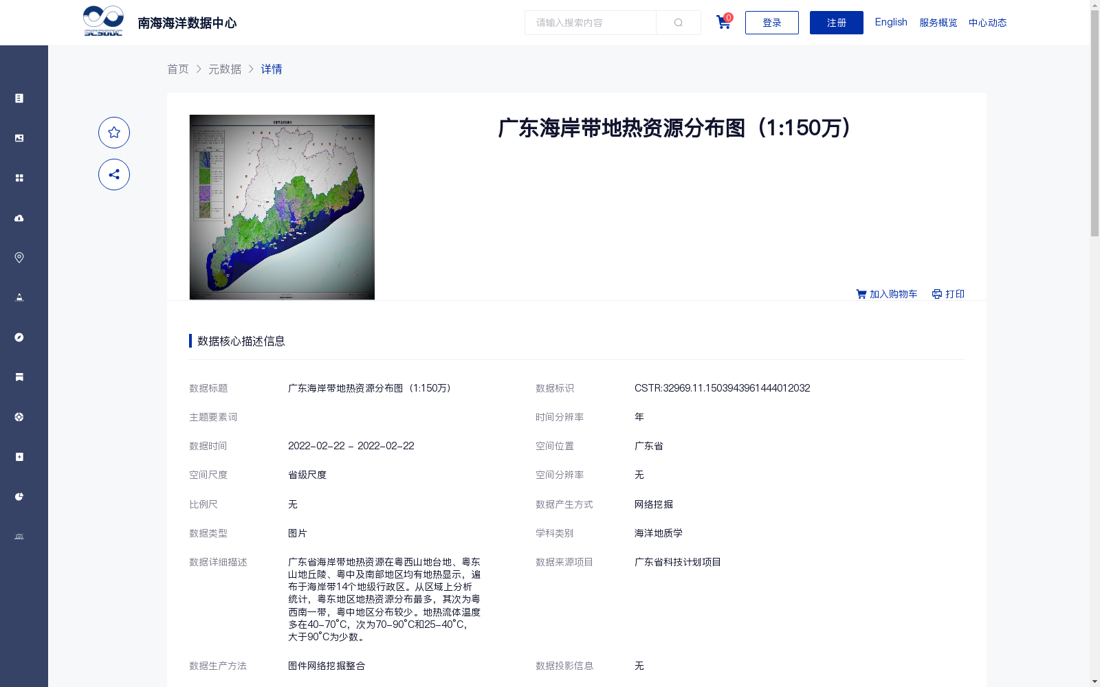
广东省海岸带地热资源在粤西山地台地、粤东山地丘陵、粤中及南部地区均有地热显示,遍布于海岸带14个地级行政区。从区域上分析统计,粤东地区地热资源分布最多,其次为粤西南一带,粤中地区分布较少。地热流体温度多在40-70°C,次为70-90°C和25-40°C,大于90°C为少数。
Geothermal resources in the coastal zone of Guangdong Province present geothermal manifestations in the mountainous platform areas of western Guangdong, mountainous and hilly areas of eastern Guangdong, as well as central and southern Guangdong, and are distributed across 14 prefecture-level administrative regions within the coastal zone. Regional statistical analysis shows that geothermal resources are most abundantly distributed in eastern Guangdong, followed by southwestern Guangdong, while central Guangdong has relatively fewer geothermal resources. The temperatures of geothermal fluids mostly range from 40°C to 70°C, followed by 70°C to 90°C and 25°C to 40°C, with only a small number of cases where the temperature exceeds 90°C.
提供机构:
广州海洋地质调查局
搜集汇总
数据集介绍
背景与挑战
背景概述
该数据集是2022年发布的广东省海岸带地热资源分布图,比例尺为1:150万,以图片形式呈现,属于海洋地质学领域。数据集详细描述了地热资源在广东省海岸带14个地级行政区的分布情况,其中粤东地区分布最多,粤西南次之,粤中较少,地热流体温度主要集中在40-70°C。数据来源于广东省科技计划项目,通过图件网络挖掘整合生产,质量可靠,适用于相关研究和应用。
以上内容由遇见数据集搜集并总结生成


