1998-2017年青藏高原及周边地区气温和降水格点数据
收藏地球大数据科学工程2024-03-04 收录
下载链接:
https://data.casearth.cn/sdo/detail/5feae826819aec33049b7c35
下载链接
链接失效反馈官方服务:
资源简介:
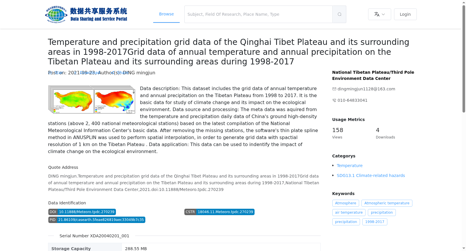
数据内容:本数据集包括1998-2017年青藏高原逐年的气温和降水格点数据,是进行气候变化及其对生态环境影响的基础性数据。数据来源及加工:源数据来自基于国家气象信息中心基础资料专项最新整编的中国地面高密度台站(2400多个国家级气象观测站)的气温和降水日值资料,对缺测站点进行预处理之后,利用ANUSPLIN软件的薄盘样条法 (TPS,Thin Plate Spline)进行空间插值,生成青藏高原及200km缓冲区空间分辨率1km的年值格点数据。数据应用:该数据可用于气候变化对生态环境影响的研究中。
Data Content: This dataset contains annual air temperature and precipitation grid data over the Qinghai-Tibet Plateau from 1998 to 2017, which serves as fundamental data for studies on climate change and its impacts on the ecological environment. Data Sources and Processing: The raw data is derived from daily air temperature and precipitation records from China's high-density surface meteorological stations (more than 2,400 national-level observation stations), which were recently compiled under the Basic Data Special Project of the National Meteorological Information Center. After preprocessing the stations with missing observations, spatial interpolation was performed using the Thin Plate Spline (TPS) method in the ANUSPLIN software, generating annual grid data with a spatial resolution of 1 km for the Qinghai-Tibet Plateau and its 200 km buffer zone. Data Applications: This data can be utilized in research on the impacts of climate change on the ecological environment.
提供机构:
国家青藏高原科学数据中心
搜集汇总
数据集介绍
背景与挑战
背景概述
该数据集包含1998-2017年青藏高原及周边地区的年温度和年降水网格数据,空间分辨率为1公里,来源于中国地面高密度站点的日数据,经过空间插值处理生成,适用于气候变化及其对生态环境影响的研究。
以上内容由遇见数据集搜集并总结生成


