
A dataset of hydroclimate variations during the past 1000 years for Eastern China
收藏DataCite Commons2025-02-02 更新2025-04-16 收录
下载链接:
https://www.scidb.cn/en/detail?dataSetId=49dc77dd86fb41d5b77d3a8cb07727ac
下载链接
链接失效反馈官方服务:
资源简介:
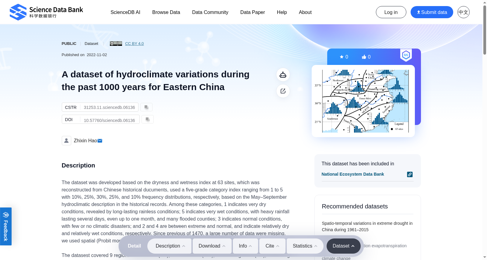
The dataset was developed based on the dryness and wetness index at 63 sites, which was reconstructed from Chinese historical ducuments, used a five-grade category index ranging from 1 to 5 with 10%, 25%, 30%, 25%, and 10% frequency distributions, respectively, based on the May–September hydroclimatic description in the historical records. Among these categories, 1 indicates very dry conditions, revealed by long-lasting rainless conditions; 5 indicates very wet conditions, with heavy rainfall lasting several days, even up to one month, and many flooded counties; 3 indicates normal conditions, with few or no climatic disasters; and 2 and 4 are between extreme and normal, and indicate relatively dry and relatively wet conditions, respectively. Since previous of 1470, a large number of data were missing, we used spatial (Probit model) and temproal (Markov chain) interpolation methods.The datasest covered 9 regions as the north (NC), the northwest (NW), Guanzhong Plain (GP), Shandong Island (SI), Henan–Hubei (HH), the middle-lower reaches of the Yangtze River (MLRYR), the southwest (SW), the southeast (SE), and the south (SC), based on their geographic location. Spatially, the dataset covered the scope of 22-41°N, 102-122°E.The data file includes 10 colomns: Year, and 9 regions.
本数据集基于63个站点的干湿指数构建,该指数由中国历史文献重建得到,采用1至5的五级分类指标,各级频率分布依次为10%、25%、30%、25%、10%,分类依据为历史记录中5-9月的水文气候描述。其中,1代表极端干旱状态,由长期无雨天气所致;5代表极端湿润状态,表现为持续数日乃至长达一个月的强降雨,且多县发生洪涝;3代表正常气候状态,极少或无气象灾害;2和4则介于极端与正常状态之间,分别对应相对干旱与相对湿润的气候条件。由于1470年之前存在大量数据缺失,我们采用空间插值方法(概率单位模型,Probit model)与时间插值方法(马尔可夫链,Markov chain)进行数据补全。本数据集依据地理位置划分为9个区域:北方地区(NC)、西北地区(NW)、关中平原(GP)、山东岛(SI)、豫鄂地区(HH)、长江中下游地区(MLRYR)、西南地区(SW)、东南地区(SE)以及华南地区(SC)。空间覆盖范围为北纬22°至41°、东经102°至122°。数据文件共包含10列,分别为年份列与上述9个区域的对应数据列。
提供机构:
Science Data Bank创建时间:
2022-11-02
搜集汇总
数据集介绍
背景与挑战
背景概述
该数据集提供了中国东部过去1000年(基于历史文献重建)的水文气候变异数据,使用1-5级干湿指数分类,覆盖9个地理区域和北纬22-41度、东经102-122度的空间范围。数据集通过Probit模型和Markov链插值方法处理缺失数据,文件包含年份和各区域数据列,适用于地球科学研究,采用开放许可(CC BY 4.0)且数据量较小(209.00 KB)。
以上内容由遇见数据集搜集并总结生成

暂无相关数据集


