舰长礁地形图
收藏南海海洋数据中心2024-03-01 收录
下载链接:
https://data.scsio.ac.cn/metaData-detail/1427911882814402560
下载链接
链接失效反馈官方服务:
资源简介:
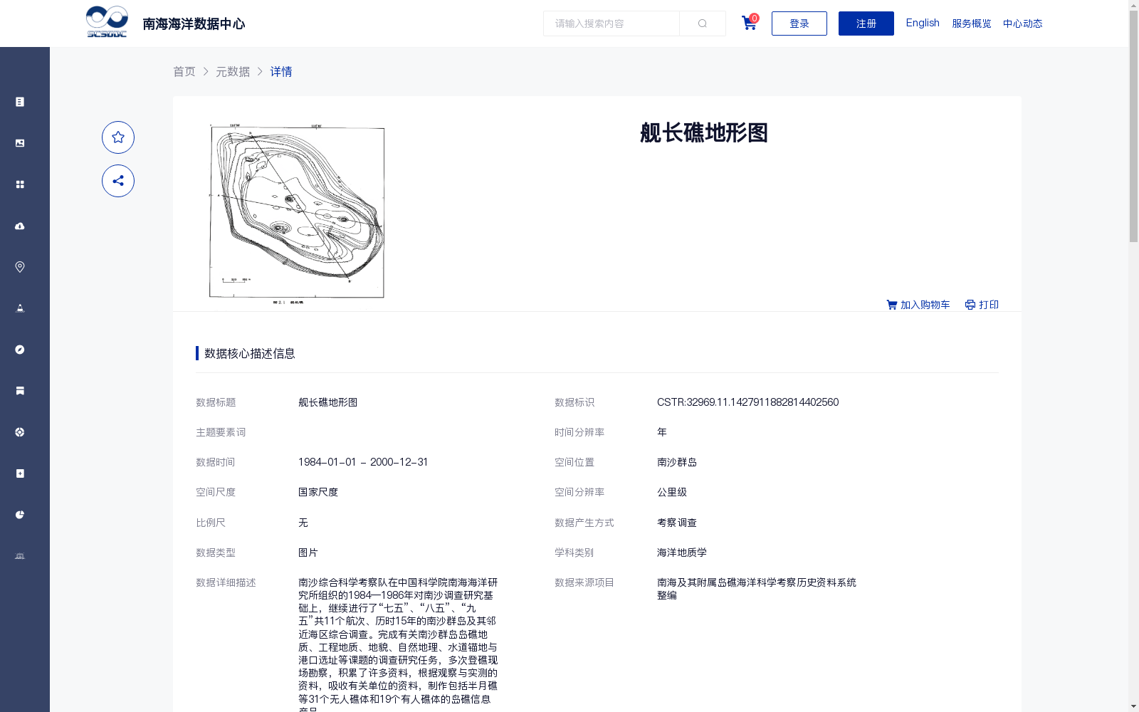
南沙综合科学考察队在中国科学院南海海洋研究所组织的1984—1986年对南沙调查研究基础上,继续进行了“七五”、“八五”、“九五”共11个航次、历时15年的南沙群岛及其邻近海区综合调查。完成有关南沙群岛岛礁地质、工程地质、地貌、自然地理、水道锚地与港口选址等课题的调查研究任务,多次登礁现场勘察,积累了许多资料,根据观察与实测的资料,吸收有关单位的资料,制作包括半月礁等31个无人礁体和19个有人礁体的岛礁信息产品。
Based on the Nansha investigation and research organized by the South China Sea Institute of Oceanology, Chinese Academy of Sciences from 1984 to 1986, the Nansha Comprehensive Scientific Expedition Team continued to conduct comprehensive surveys of the Nansha Islands and their adjacent sea areas. The surveys spanned 15 years and included a total of 11 cruises across the 7th, 8th, and 9th Five-Year Plan periods. The team fulfilled investigation and research tasks covering topics such as reef geology, engineering geology, geomorphology, physical geography, waterway anchorage and port site selection for the Nansha Islands. It conducted multiple on-site reconnaissance missions by landing on various reefs, and accumulated a substantial amount of data. Leveraging observed and measured data as well as materials obtained from relevant institutions, the team developed reef information products encompassing 31 uninhabited reefs (including Ban Yue Reef / Half Moon Reef) and 19 inhabited reefs.
提供机构:
中国科学院南海海洋研究所
搜集汇总
数据集介绍
背景与挑战
背景概述
该数据集是南沙综合科学考察队历时15年对南沙群岛及其邻近海区进行综合调查的结果,包含31个无人礁体和19个有人礁体的岛礁信息,数据质量可靠。数据集以图片形式呈现,适用于海洋地质学研究。
以上内容由遇见数据集搜集并总结生成


