鄂尔多斯盆地植被要素历史演变数据集(1984-2024)
收藏国家青藏高原科学数据中心2026-04-26 更新2025-11-08 收录
下载链接:
https://data.tpdc.ac.cn/zh-hans/data/e58a6951-d969-4b67-bb2c-4f4c3c0a25de
下载链接
链接失效反馈官方服务:
资源简介:
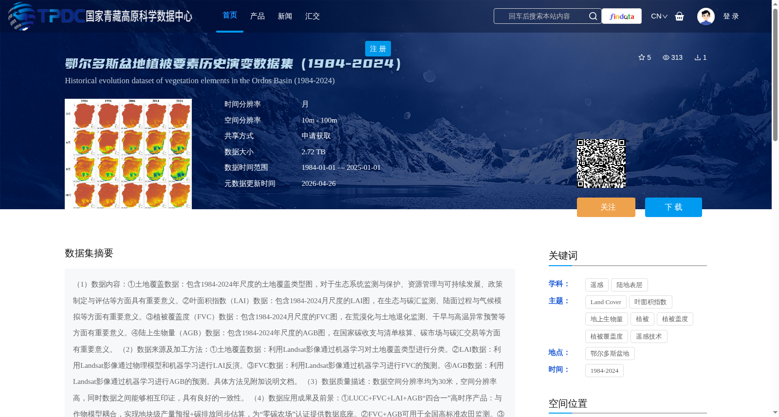
(1)数据内容:①土地覆盖数据:包含1984-2024年尺度的土地覆盖类型图,对于生态系统监测与保护、资源管理与可持续发展、政策制定与评估等方面具有重要意义。②叶面积指数(LAI)数据:包含1984-2024月尺度的LAI图,在生态与碳汇监测、陆面过程与气候模拟等方面有重要意义。③植被覆盖度(FVC)数据:包含1984-2024月尺度的FVC图,在荒漠化与土地退化监测、干旱与高温异常预警等方面有重要意义。④陆上生物量(AGB)数据:包含1984-2024年尺度的AGB图,在国家碳收支与清单核算、碳市场与碳汇交易等方面有重要意义。
(2)数据来源及加工方法:①土地覆盖数据:利用Landsat影像通过机器学习对土地覆盖类型进行分类。②LAI数据:利用Landsat影像通过物理模型和机器学习进行LAI反演。③FVC数据:利用Landsat影像通过机器学习进行FVC的预测。④AGB数据:利用Landsat影像通过机器学习进行AGB的预测。具体方法见附加说明文档。
(3)数据质量描述:数据空间分辨率均为30米,空间分辨率高,同时数据之间能够相互印证,具有良好的一致性。
(4)数据应用成果及前景:①LUCC+FVC+LAI+AGB“四合一”高时序产品:与作物模型耦合,实现地块级产量预报+碳排放同步估算,为“零碳农场”认证提供数据底座。②FVC+AGB可用于全国高标准农田监测。③将FVC异常与气象干旱指数耦合,可开发“遥感植被干旱指数保险”。
(1) Data Content:
① Land Cover Data: Includes annual-scale land cover type maps spanning 1984 to 2024, which is of great significance for ecosystem monitoring and protection, resource management and sustainable development, policy formulation and evaluation, etc.
② Leaf Area Index (LAI) Data: Includes monthly-scale LAI maps from 1984 to 2024, which plays an important role in ecological and carbon sink monitoring, land surface process and climate simulation, etc.
③ Fractional Vegetation Cover (FVC) Data: Includes monthly-scale FVC maps from 1984 to 2024, which is crucial for desertification and land degradation monitoring, drought and high-temperature anomaly early warning, etc.
④ Aboveground Biomass (AGB) Data: Includes annual-scale AGB maps from 1984 to 2024, which is significant for national carbon budget and inventory accounting, carbon market and carbon sink trading, etc.
(2) Data Sources and Processing Methods:
① Land Cover Data: Classify land cover types using Landsat imagery via machine learning.
② LAI Data: Retrieve LAI using Landsat imagery through physical models and machine learning.
③ FVC Data: Predict FVC using Landsat imagery via machine learning.
④ AGB Data: Predict AGB using Landsat imagery via machine learning. For specific processing methods, please refer to the attached supplementary documentation.
(3) Data Quality Description: All datasets have a spatial resolution of 30 meters, featuring high spatial resolution. Meanwhile, the datasets can mutually validate each other and exhibit good consistency.
(4) Data Application Achievements and Prospects:
① "Four-in-One" high-temporal-resolution product combining LUCC (Land Use and Land Cover Change), FVC, LAI and AGB: Coupled with crop models, it enables plot-level crop yield forecasting and synchronized estimation of carbon emissions, providing a solid data foundation for "Net-Zero Farm" certification.
② Combination of FVC and AGB can be applied to national high-standard farmland monitoring.
③ By coupling FVC anomalies with meteorological drought indices, "Remote Sensing Vegetation Drought Index Insurance" can be developed.
提供机构:
王志慧
创建时间:
2025-10-09
搜集汇总
数据集介绍
背景与挑战
背景概述
该数据集提供了1984-2024年鄂尔多斯盆地植被要素的历史演变数据,包括土地覆盖、叶面积指数、植被覆盖度和陆上生物量四类关键指标,均基于Landsat影像通过机器学习方法生成,具有30米的高空间分辨率。数据时间跨度长、要素全面,适用于生态系统监测、碳汇评估、农田管理和干旱预警等多种应用场景。
以上内容由遇见数据集搜集并总结生成


