“一带一路”沿线地区沿海港口与机场分布图(2018)
收藏国家青藏高原科学数据中心2021-04-20 更新2024-03-06 收录
下载链接:
https://data.tpdc.ac.cn/zh-hans/data/42f7f978-795f-48b8-968b-37655ad55d24
下载链接
链接失效反馈官方服务:
资源简介:
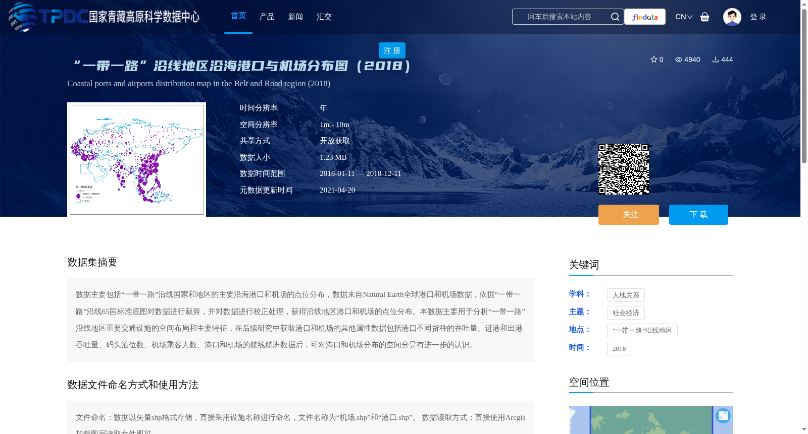
数据主要包括“一带一路”沿线国家和地区的主要沿海港口和机场的点位分布,数据来自Natural Earth全球港口和机场数据,依据“一带一路”沿线65国标准底图对数据进行裁剪,并对数据进行校正处理,获得沿线地区港口和机场的点位分布。本数据主要用于分析“一带一路”沿线地区重要交通设施的空间布局和主要特征,在后续研究中获取港口和机场的其他属性数据包括港口不同货种的吞吐量、进港和出港吞吐量、码头泊位数、机场乘客人数、港口和机场的航线航班数据后,可对港口和机场分布的空间分异有进一步的认识。
This dataset primarily covers the spatial point distributions of major coastal ports and airports in countries and regions along the Belt and Road Initiative (BRI). The original data is sourced from the global port and airport datasets provided by Natural Earth. We first clipped the original data using the standard base map of the 65 countries along the BRI, then conducted correction processing, and finally obtained the spatial point distributions of ports and airports in the BRI-related regions. This dataset is mainly used to analyze the spatial layout and main characteristics of important transportation facilities in the BRI regions. If additional attribute data of ports and airports (including throughput of different cargo types, inbound and outbound throughput, number of terminal berths, passenger throughput of airports, and route and flight data of both ports and airports) is collected in follow-up studies, further insights into the spatial differentiation of port and airport distributions can be obtained.
提供机构:
王成金
创建时间:
2020-02-28
搜集汇总
数据集介绍
背景与挑战
背景概述
该数据集提供了2018年'一带一路'沿线国家和地区主要沿海港口与机场的空间分布信息,数据格式为可直接GIS分析的矢量shp文件,适用于交通设施布局研究。数据经过专业裁剪和校正处理,具有1m-10m的高空间分辨率。
以上内容由遇见数据集搜集并总结生成


