喜马拉雅山区1:250万地质图(2006)
收藏国家青藏高原科学数据中心2023-03-13 更新2024-03-06 收录
下载链接:
https://data.tpdc.ac.cn/zh-hans/data/f103ea18-19f5-4621-9624-88d0d2354991
下载链接
链接失效反馈官方服务:
资源简介:
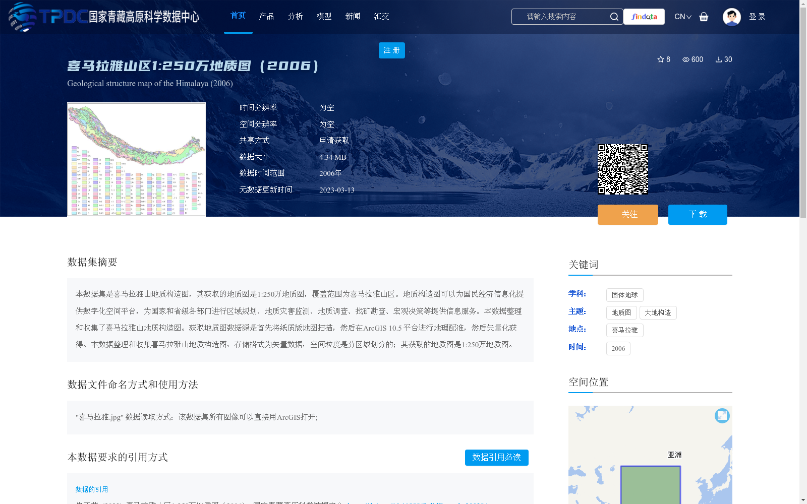
本数据集是喜马拉雅山地质构造图,其获取的地质图是1:250万地质图,覆盖范围为喜马拉雅山区。地质构造图可以为国民经济信息化提供数字化空间平台,为国家和省级各部门进行区域规划、地质灾害监测、地质调查、找矿勘查、宏观决策等提供信息服务。本数据整理和收集了喜马拉雅山地质构造图。获取地质图数据源是首先将纸质版地图扫描,然后在ArcGIS 10.5 平台进行地理配准,然后矢量化获得。本数据整理和收集喜马拉雅山地质构造图,存储格式为矢量数据,空间粒度是分区域划分的;其获取的地质图是1:250万地质图。
This dataset is a geological tectonic map of the Himalayas. The acquired geological map is a 1:2,500,000-scale geological map covering the Himalayan region. This geological tectonic map can provide a digital spatial platform for the informatization of the national economy, and offer information services for national and provincial departments to conduct regional planning, geological disaster monitoring, geological survey, mineral exploration, macro decision-making and other relevant work. This dataset compiles and collects the geological tectonic map of the Himalayas. The data source of the geological map was obtained by first scanning the paper map, then performing geographic registration on the ArcGIS 10.5 platform, and finally completing vectorization. The dataset stores the collected Himalayan geological tectonic map in vector data format, with spatial granularity divided by regions, and the core data is the 1:2,500,000-scale geological map mentioned above.
提供机构:
朱亚茹
创建时间:
2023-02-22
搜集汇总
数据集介绍
背景与挑战
背景概述
本数据集是喜马拉雅山区1:250万比例尺的地质构造图,数据来源于2006年,通过纸质地图扫描、地理配准和矢量化处理生成矢量格式。该数据集覆盖喜马拉雅山区,空间粒度分区域划分,主要用于支持区域规划、地质灾害监测、地质调查和找矿勘查等应用,为国民经济信息化提供数字化空间平台。
以上内容由遇见数据集搜集并总结生成


