10m分辨率中国滩涂空间分布数据集(2020年)
收藏国家地球系统科学数据中心2021-11-04 更新2024-03-04 收录
下载链接:
https://www.geodata.cn/data/datadetails.html?dataguid=192951013633169&docId=10610
下载链接
链接失效反馈官方服务:
资源简介:
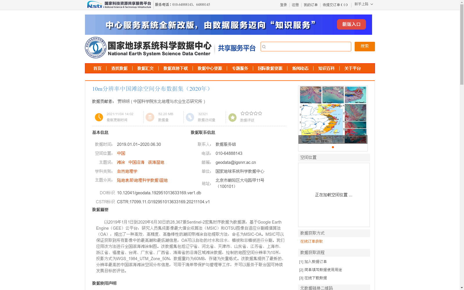
以2019年1月1日到2020年6月30日的28,367景Sentinel-2密集时序数据为数据源,基于Google Earth Engine(GEE)云平台,研究人员集成影像最大值合成算法(MSIC)和OTSU图像自适应分割阈值算法(OA),提出了一种高效、高精度、高鲁棒性的潮间带滩涂自动提取方法,命名为MSIC-OA。MSIC可以保证获取到所有影像中的最高潮和最低潮信息,OA可以自动的对水和非水、植被和非植被进行分割。我们应用该方法进行全国滨海滩涂制图。该数据集包括辽宁省、河北省、天津市、山东省、江苏省、上海市、浙江省、福建省、台湾、广东省、广西省、海南省的沿海区域滩涂数据,绘制的地图空间分辨率为10米,投影方式为WGS_1984_UTM_Zone_50N,数据量约为60MB,存储为矢量格式。该数据集提供了最新的、分辨率最高的中国滨海滩涂空间分布信息,可用于海岸带保护与管理等工作,并可以服务于联合国可持续发展目标的评估。
This study utilized 28,367 dense time-series Sentinel-2 images acquired between January 1, 2019 and June 30, 2020 as the data source, and was implemented on the Google Earth Engine (GEE) cloud platform. Researchers integrated the Maximum Synthetic Image Composite algorithm (MSIC) and the OTSU adaptive image segmentation threshold algorithm (OA), and proposed an efficient, high-precision, and highly robust automatic extraction method for intertidal mudflats, designated as MSIC-OA. Specifically, MSIC can capture both high-tide and low-tide information across all input images, while OA enables automatic segmentation between water and non-water, as well as vegetation and non-vegetation. We employed this method to generate national coastal mudflat maps. This dataset covers coastal mudflat data of the coastal regions of Liaoning Province, Hebei Province, Tianjin Municipality, Shandong Province, Jiangsu Province, Shanghai Municipality, Zhejiang Province, Fujian Province, Taiwan, China, Guangdong Province, Guangxi Zhuang Autonomous Region, and Hainan Province. The mapped spatial resolution is 10 meters, with the projection set to WGS_1984_UTM_Zone_50N. The total data volume is approximately 60 MB, and the data is stored in vector format. This dataset provides the most up-to-date and highest-resolution spatial distribution information of China's coastal mudflats, which can be applied to coastal zone conservation and management efforts, and supports the assessment of the United Nations Sustainable Development Goals.
提供机构:
中国科学院东北地理与农业生态研究所
创建时间:
2021-11-04
搜集汇总
数据集介绍
背景与挑战
背景概述
该数据集提供了2020年中国沿海滩涂的高分辨率空间分布信息,基于Sentinel-2时序数据和Google Earth Engine平台,采用MSIC-OA自动提取方法生成,空间分辨率为10米,覆盖辽宁至海南等省份。数据精度高,总体分类精度达95%,适用于海岸带保护、管理和可持续发展评估等应用。
以上内容由遇见数据集搜集并总结生成


