喜马拉雅山区30mDEM数据(2017)
收藏国家青藏高原科学数据中心2023-01-09 更新2024-03-01 收录
下载链接:
https://data.tpdc.ac.cn/zh-hans/data/53c811a6-42aa-4d83-858e-c4f1223c6f5b
下载链接
链接失效反馈官方服务:
资源简介:
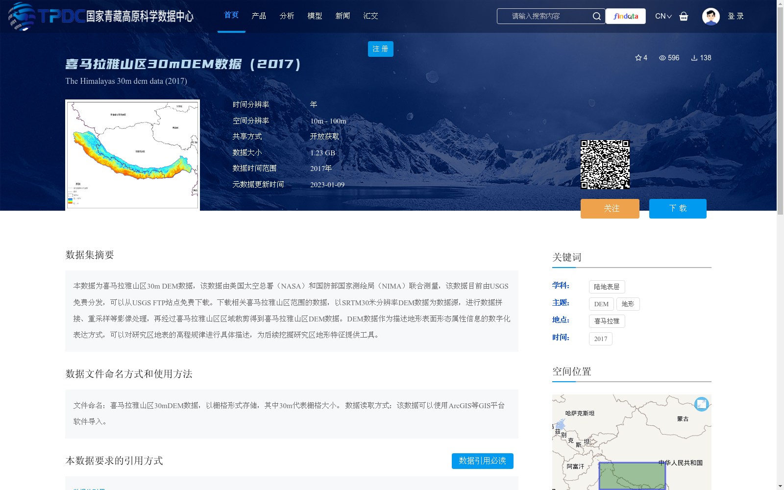
本数据为喜马拉雅山区30m DEM数据,该数据由美国太空总署(NASA)和国防部国家测绘局(NIMA)联合测量,该数据目前由USGS免费分发,可以从USGS FTP站点免费下载。下载相关喜马拉雅山区范围的数据,以SRTM30米分辨率DEM数据为数据源,进行数据拼接、重采样等影像处理,再经过喜马拉雅山区区域裁剪得到喜马拉雅山区DEM数据。DEM数据作为描述地形表面形态属性信息的数字化表达方式,可以对研究区地表的高程规律进行具体描述,为后续挖掘研究区地形特征提供工具。
This dataset is 30m resolution DEM (Digital Elevation Model) data for the Himalayas region. It was jointly surveyed by the National Aeronautics and Space Administration (NASA) and the National Imagery and Mapping Agency (NIMA) of the United States, and is currently freely distributed by the United States Geological Survey (USGS), which can be downloaded for free from the USGS FTP server. Relevant data covering the Himalayas region was downloaded, using SRTM 30m resolution DEM data as the source dataset, and underwent image processing operations including data mosaicking and resampling, followed by regional clipping for the Himalayas to generate the final targeted DEM dataset. As a digital representation describing the attribute information of topographic surface morphology, DEM data can specifically depict the elevation patterns of the land surface in the study area, providing a reliable tool for subsequent extraction of topographic features of the research region.
提供机构:
王中根
创建时间:
2022-12-21
搜集汇总
数据集介绍
背景与挑战
背景概述
该数据集是喜马拉雅山区2017年的30米分辨率数字高程模型数据,由NASA和NIMA联合测量、USGS免费分发,并通过国家青藏高原科学数据中心开放共享。数据大小为1.23 GB,主要用于描述地形表面形态,支持喜马拉雅山区的高程规律分析和地形特征挖掘研究。
以上内容由遇见数据集搜集并总结生成


