青藏高原逐小时高分辨率全天候大气水汽总量多源遥感融合数据集(2016-2022)
收藏国家青藏高原科学数据中心2025-01-13 更新2025-01-18 收录
下载链接:
https://data.tpdc.ac.cn/zh-hans/data/4bb3c256-3cdb-4373-9924-f7ac16ddc717
下载链接
链接失效反馈官方服务:
资源简介:
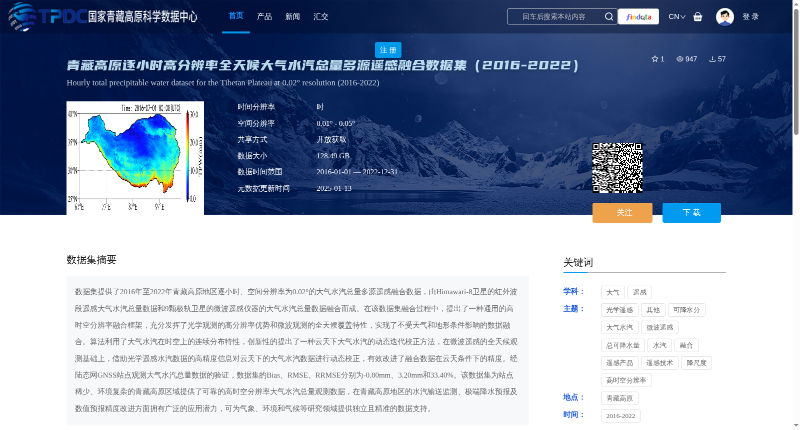
数据集提供了2016年至2022年青藏高原地区逐小时、空间分辨率为0.02°的大气水汽总量多源遥感融合数据,由Himawari-8卫星的红外波段遥感大气水汽总量数据和9颗极轨卫星的微波遥感仪器的大气水汽总量数据融合而成。在该数据集融合过程中,提出了一种通用的高时空分辨率融合框架,充分发挥了光学观测的高分辨率优势和微波观测的全天候覆盖特性,实现了不受天气和地形条件影响的数据融合。算法利用了大气水汽在时空上的连续分布特性,创新性的提出了一种云天下大气水汽的动态迭代校正方法,在微波遥感的全天候观测基础上,借助光学遥感水汽数据的高精度信息对云天下的大气水汽数据进行动态校正,有效改进了融合数据在云天条件下的精度。经陆态网GNSS站点观测大气水汽总量数据的验证,数据集的Bias、RMSE、RRMSE分别为-0.80mm、3.20mm和33.40%。该数据集为站点稀少、环境复杂的青藏高原区域提供了可靠的高时空分辨率大气水汽总量观测数据,在青藏高原地区的水汽输送监测、极端降水预报及数值预报精度改进方面拥有广泛的应用潜力,可为气象、环境和气候等研究领域提供独立且精准的数据支持。
This dataset provides multi-source remote sensing fused total atmospheric water vapor (TWA) data with hourly temporal resolution and 0.02° spatial resolution over the Qinghai-Tibet Plateau from 2016 to 2022. It is generated by fusing the infrared-band remote sensing TWA data from the Himawari-8 satellite and TWA data collected by microwave remote sensing instruments aboard 9 polar-orbiting satellites. During the dataset fusion process, a general high spatiotemporal resolution fusion framework was proposed, which fully leverages the high-resolution advantage of optical observations and the all-weather coverage characteristic of microwave observations, enabling data fusion unaffected by weather and terrain conditions. The algorithm utilizes the continuous spatiotemporal distribution property of atmospheric water vapor, and innovatively proposes a dynamic iterative correction method for TWA under cloudy skies. Based on the all-weather observation data from microwave remote sensing, this method uses the high-precision information of optical remote sensing TWA data to dynamically correct the TWA data under cloudy skies, effectively improving the accuracy of the fused data under cloudy conditions. Verified against the TWA data observed by GNSS stations of the Crustal Movement Observation Network of China (CMONOC), the Bias, RMSE and RRMSE of this dataset are -0.80 mm, 3.20 mm and 33.40% respectively. This dataset offers reliable high spatiotemporal resolution TWA observation data for the Qinghai-Tibet Plateau, which has scarce meteorological stations and complex environmental conditions. It has broad application prospects in water vapor transport monitoring, extreme precipitation forecasting and numerical forecast accuracy improvement over the Qinghai-Tibet Plateau, and can provide independent and precise data support for research fields including meteorology, environmental science and climatology.
提供机构:
姬大彬,孙启翔,王永前,施建成
创建时间:
2024-10-28
搜集汇总
数据集介绍
背景与挑战
背景概述
该数据集是2016-2022年青藏高原地区逐小时、高分辨率(0.02°)的大气水汽总量多源遥感融合数据,结合了红外和微波遥感技术,具有全天候覆盖和高精度的特点,适用于气象、环境和气候研究。
以上内容由遇见数据集搜集并总结生成


