2020 年全球 30m 耕地空间分布产品 (GCL30_2020)
收藏地球大数据科学工程2024-03-04 收录
下载链接:
https://data.casearth.cn/sdo/detail/62ff4caa819aec75a535cbe6
下载链接
链接失效反馈官方服务:
资源简介:
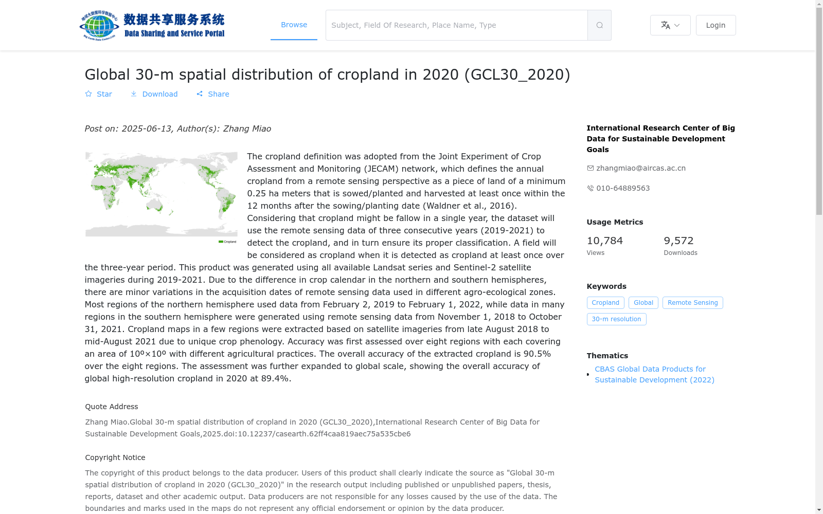
基于地球观测组织全球农业监测旗舰计划(GEOGLAM)全球农作物评估与监测联合实验计划(JECAM)对耕地的定义,从遥感角度上将耕地定义为在播种/ 种植日期后的12 个月内至少收获一次,且面积至少为0.25 公顷(最小宽度为30m)的土地。由于单年度耕地可能存在休耕现象,数据产品利用连续三年(2019-2021年)的遥感数据探测耕地种植状况,三年中至少有一次耕作行为的土地被认为是耕地。本产品的研制主要采用2019-2021年间中高分辨率遥感数据。由于南北半球不同纬度农作物生育期差异,使得全球不同农业生态区耕地空间分布研究所需遥感数据在时段选择上存在不同,北半球大部分地区采用 2019 年 2 月 2 日 -2022 年 2 月 1 日期间的数据;南半球大部分地区采用2018 年 11 月 1 日 -2021 年 10 月 31 日期间的遥感数据;部分地区由于物候期特殊,采用2018年8月下旬至 2021年8月中旬的数据。产品精度方面,在全球8个10°×10°的典型区域对耕地产品研制算法进行验证,平均总体精度为90.5%;进一步利用在全球不同农业生态区通过众源方式获取的耕地验证样本对全球数据产品进行精度验证,总体精度为89.4%。
Based on the cropland definition established by the Joint Experiment for Crop Assessment and Monitoring (JECAM) under the Group on Earth Observations (GEO) Global Agricultural Monitoring Flagship Initiative (GEOGLAM), cropland is defined from a remote sensing perspective as land that has been harvested at least once within 12 months following the sowing or planting date, with a minimum area of 0.25 hectares and a minimum width of 30 meters. Given that single-year cropland may undergo fallow periods, this data product employs three consecutive years (2019–2021) of remote sensing data to detect cropland cultivation conditions; land that has experienced at least one cultivation activity over the three-year period is classified as cropland. This product was primarily developed using medium- and high-resolution remote sensing data collected between 2019 and 2021. Due to the disparities in crop phenological periods across different latitudes between the Northern and Southern Hemispheres, the selection of remote sensing data time windows varies for studies on the spatial distribution of cropland in global agro-ecological zones. For most regions in the Northern Hemisphere, data spanning from February 2, 2019 to February 1, 2022 are utilized; for most regions in the Southern Hemisphere, remote sensing data from November 1, 2018 to October 31, 2021 are adopted. For some regions with unique phenological characteristics, data from late August 2018 to mid-August 2021 are used. Regarding product accuracy, the cropland mapping algorithm was validated in 8 typical global 10°×10° regions, achieving an average overall accuracy of 90.5%. Further validation of the global cropland data product was conducted using crowdsourced cropland validation samples acquired across diverse global agro-ecological zones, yielding an overall accuracy of 89.4%.
提供机构:
可持续发展大数据国际研究中心
搜集汇总
数据集介绍
背景与挑战
背景概述
该数据集是2020年全球30米空间分辨率的耕地分布产品,基于JECAM标准定义耕地,并使用2019-2021年连续三年的Landsat和Sentinel-2遥感影像生成,以应对年度休耕情况,确保分类准确性。数据覆盖全球范围,以GeoTIFF格式分瓦片提供,总体精度评估约为89.4%,适用于高分辨率耕地监测和分析。
以上内容由遇见数据集搜集并总结生成


