面向SDG11.2.1指标的顾及实际可达与真实服务人口的城市公共交通设施均等性分析数据产品
收藏地球大数据科学工程2024-06-22 收录
下载链接:
https://data.casearth.cn/sdo/detail/66716ab4819aec0d5564be58
下载链接
链接失效反馈官方服务:
资源简介:
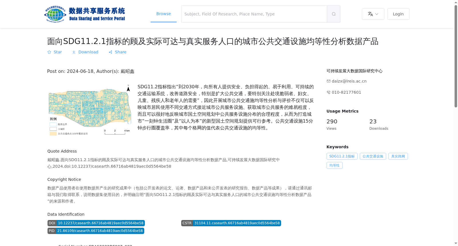
SDG11.2指标指出“到2030年,向所有人提供安全、负担得起的、易于利用、可持续的交通运输系统,改善道路安全,特别是扩大公共交通,要特别关注处境脆弱者、妇女、儿童、残疾人和老年人的需要”,因此开展城市公共交通施均等性分析与评价不仅可以反映城市居民使用不同交通方式接近城市公共服务设施、获取城市公共服务的难易程度,而且可以很好地反映城市国土空间规划中公共服务设施分布的合理程度,从而为打造城市“一刻钟生活圈”及“以人为本”的新型国土空间规划提供可行参考。公共交通设施15分钟步行圈覆盖率,其中每个格网的值代表公共交通设施的均等性。
Indicator SDG 11.2 stipulates that "by 2030, provide safe, affordable, accessible and sustainable transport systems for all, improve road safety, particularly by expanding public transport, and give special attention to the needs of vulnerable populations, women, children, persons with disabilities and the elderly". Therefore, conducting equity analysis and evaluation of urban public transport facilities can not only reflect the difficulty for urban residents to access urban public service facilities and obtain urban public services via different transportation modes, but also effectively reflect the rationality of the distribution of public service facilities in urban territorial spatial planning, thus providing feasible references for developing urban "15-minute living circles" and people-oriented new territorial spatial planning. This dataset measures the coverage rate of 15-minute walking circles surrounding public transport facilities, where the value of each grid cell represents the equity level of public transport facilities.
提供机构:
可持续发展大数据国际研究中心
搜集汇总
数据集介绍
背景与挑战
背景概述
该数据集是针对联合国可持续发展目标SDG11.2.1指标的城市公共交通设施均等性分析数据产品,专注于评估西安市公共交通设施15分钟步行圈覆盖率,以反映实际可达性和服务人口分布。数据采用GeoTiff栅格格式,包含16个文件,总容量6.75 MB,旨在支持城市国土空间规划和‘一刻钟生活圈’建设,为公共交通均等性提供量化分析依据。
以上内容由遇见数据集搜集并总结生成


