重点区域20国300米分辨率土壤侵蚀强度数据集(2015)
收藏国家青藏高原科学数据中心2021-10-11 更新2024-03-06 收录
下载链接:
https://data.tpdc.ac.cn/zh-hans/data/44bbcc76-fdce-4197-9d7b-dc3528537f97
下载链接
链接失效反馈官方服务:
资源简介:
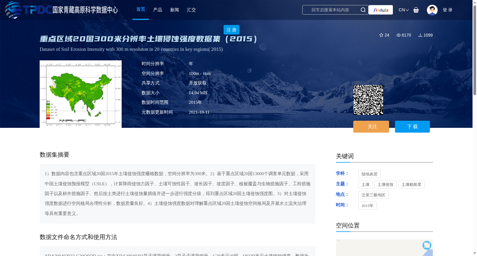
1)数据内容包含重点区域20国2015年土壤侵蚀强度栅格数据,空间分辨率为300米。2)基于重点区域20国13000个调查单元数据,采用中国土壤侵蚀预报模型(CSLE),计算降雨侵蚀力因子、土壤可蚀性因子、坡长因子、坡度因子、植被覆盖与生物措施因子、工程措施因子以及耕作措施因子。然后按土类进行土壤侵蚀量插值并进一步进行强度分级,得到重点区域20国土壤侵蚀强度图。3)对土壤侵蚀强度数据进行空间格局合理性分析,数据质量良好。4)土壤侵蚀强度数据对理解重点区域20国土壤侵蚀空间格局及开展水土流失治理等具有重要意义。
1) The dataset includes grid data of soil erosion intensity for 20 countries in the key regions in 2015, with a spatial resolution of 300 meters.
2) Based on the data from 13,000 survey units in the 20 key regional countries, the Chinese Soil Loss Equation (CSLE) was adopted to calculate the rainfall erosivity factor, soil erodibility factor, slope length factor, slope steepness factor, vegetation cover and biological measure factor, engineering measure factor, and tillage measure factor. Subsequently, soil erosion amount was interpolated based on soil types and further classified by erosion intensity, thus obtaining the soil erosion intensity map for the 20 countries in the key regions.
3) Rationality analysis of the spatial pattern was conducted on the soil erosion intensity data, and the data quality is good.
4) The soil erosion intensity data is of great significance for understanding the spatial pattern of soil erosion in the 20 key regional countries and carrying out soil and water loss control and other related works.
提供机构:
章文波
创建时间:
2021-10-03
搜集汇总
数据集介绍
背景与挑战
背景概述
该数据集包含2015年重点区域20国的300米分辨率土壤侵蚀强度数据,采用中国土壤侵蚀预报模型(CSLE)计算多个因子并插值生成,数据质量良好,适用于土壤侵蚀空间格局分析和水土流失治理研究。
以上内容由遇见数据集搜集并总结生成


