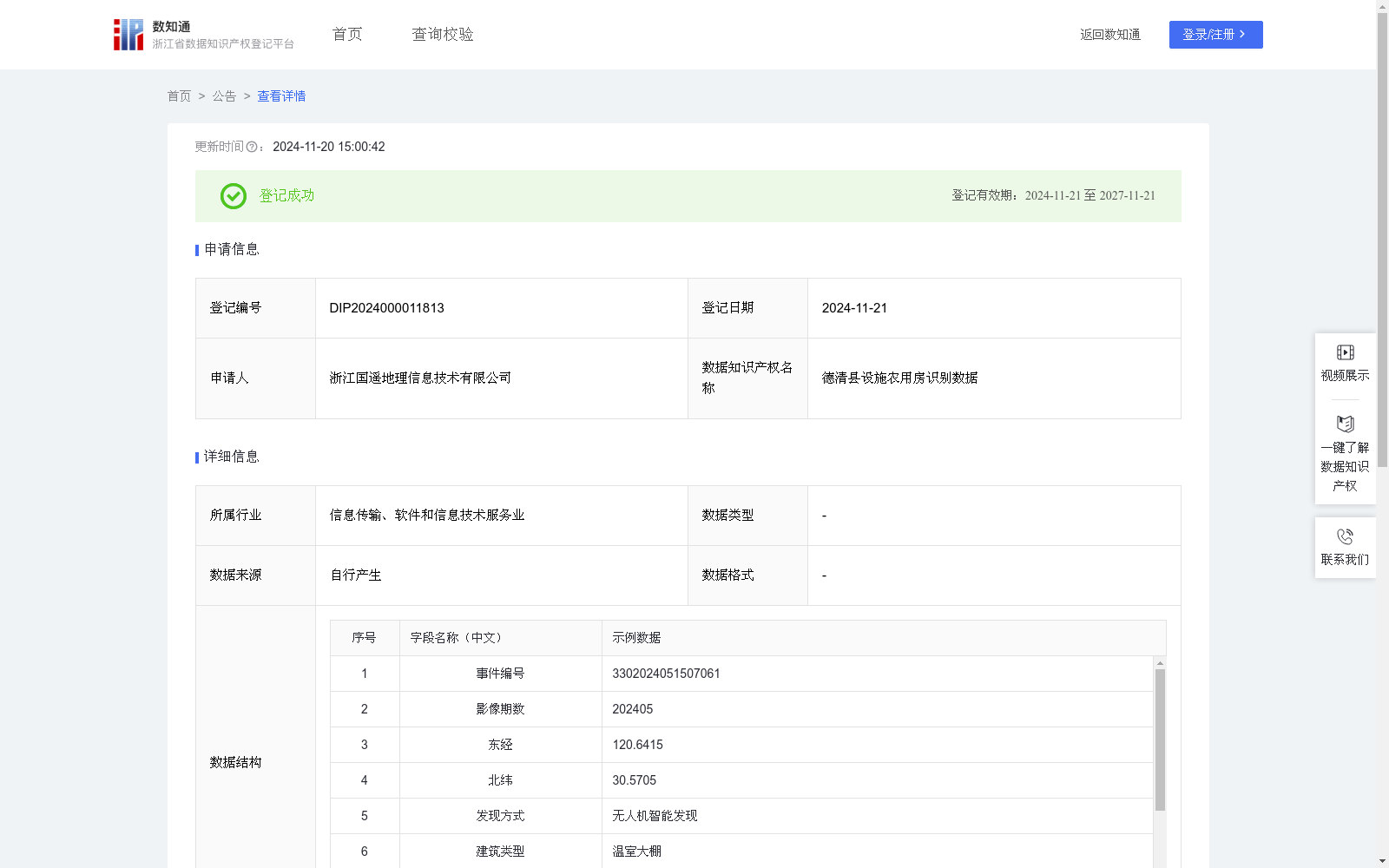
德清县设施农用房识别数据
收藏浙江省数据知识产权登记平台2024-11-20 更新2024-11-21 收录
下载链接:
https://www.zjip.org.cn/home/announce/trends/86986
下载链接
链接失效反馈官方服务:
资源简介:
主要用于实现对设施农用房的快速精准识别,包括新增建设、变更位置等情况的监测。通过遥感技术,有效解决了基层人员在广阔农田中巡查困难、安全隐患多等问题。该系统能够自动提取设施农用房的遥感影像,为农房监管人员提供坐标、建筑类型、面积等信息,便于及时掌握农房建设动态。融合基层人员实际操作经验,该识别数据有助于优化资源配置,提高农业设施管理效率。基于无人机航拍采集德清县域遥感影像数据,首先将两期影像如示例数据所示2023年10月与2024年5月进行对比得到所有发生变化的区域,在此基础上建立遥感影像设施农用房识别深度学习网络。将单元神经网络应用于完整的遥感影像,将图像分割成规则的单元格,每个单元神经网络负责预测K个单元格。预测每个区域的概率,所有单元格上具有最大概率的类被选择并分配给特定的网格单元,生成由预测概率加权的边界框,之后进行NMS运算,识别下一个最高类别概率的边界框,循环往复,直到剩下所有不同的边界框。算法输出所需的向量,并对各类地物进行分类,接着筛选出类别为设施农用房的区域。
对于识别正确的地块,进一步计算其区域中心坐标(x,y),并采用CGCS2000坐标系进行定位,默认采用东经、北纬格式。此外,还通过先进算法分析影像中的特征区域,自动识别并提取建筑类型、占地面积、周边环境等关键信息,以及匹配现有平台数据,汇总匹配各审批文件以此监测设施农用房的合法性。系统自动记录问题点位的坐标,并将其与相应的村镇级行政区划进行匹配。最终,这些特征区域的影像、坐标及其他相关信息将被自动上传至德清农业农村数字化遥感监测治理平台。
This dataset is primarily intended for rapid and accurate identification of facility agricultural buildings, including monitoring of newly constructed structures and location changes. Leveraging remote sensing technology, it effectively addresses the challenges of difficult patrols and numerous potential safety hazards faced by grassroots personnel when conducting inspections across expansive farmlands.
The system can automatically extract remote sensing imagery of facility agricultural buildings, providing agricultural housing supervisors with key information such as coordinates, building types, and floor area, enabling timely oversight of agricultural housing construction dynamics. By integrating the actual operational experience of grassroots personnel, this recognition dataset assists in optimizing resource allocation and enhancing the efficiency of agricultural facility management.
Based on remote sensing image data of Deqing County collected via UAV aerial photography, two phases of imagery (October 2023 and May 2024, as demonstrated in the sample data) are first compared to identify all changed regions. On this basis, a deep learning network for facility agricultural building recognition from remote sensing imagery is developed.
The grid-based neural network is applied to the complete remote sensing image: the image is split into regular grid cells, with each grid unit neural network responsible for predicting K cells. Probabilities for each region are predicted, and the class with the highest probability across all cells is selected and assigned to a specific grid cell. Bounding boxes weighted by the prediction probabilities are generated, followed by a Non-Maximum Suppression (NMS) operation. The bounding box with the next highest class probability is then identified, and this process repeats until all distinct bounding boxes remain. The algorithm outputs the required vectors, classifies various ground features, and subsequently filters out regions categorized as facility agricultural buildings.
For correctly identified plots, their regional center coordinates (x, y) are further calculated, and positioning is performed using the China Geodetic Coordinate System 2000 (CGCS2000), with the default format being east longitude and north latitude. Additionally, advanced algorithms are utilized to analyze characteristic regions within the imagery, automatically identifying and extracting critical information including building types, floor area, and surrounding environment. It also matches existing platform data and aggregates matching approval documents to monitor the legality of facility agricultural buildings.
The system automatically records the coordinates of problematic locations and matches them with corresponding village and town-level administrative divisions. Finally, the imagery, coordinates, and other relevant information of these characteristic regions are automatically uploaded to the Deqing Agricultural and Rural Digital Remote Sensing Monitoring and Governance Platform.
提供机构:
浙江国遥地理信息技术有限公司
创建时间:
2024-10-17
搜集汇总
数据集介绍
特点
德清县设施农用房识别数据包含517条记录,通过无人机航拍和深度学习技术实现农用房的快速识别与监测,提供建筑类型、面积、坐标等关键信息,应用于农业设施管理。
以上内容由遇见数据集搜集并总结生成


