黑河流域研究区边界
收藏资源简介:
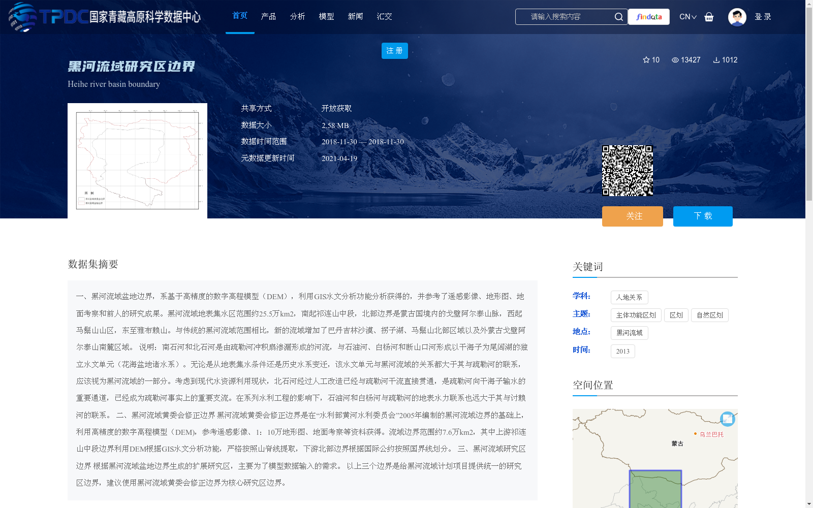
一、黑河流域盆地边界,系基于高精度的数字高程模型(DEM),利用GIS水文分析功能分析获得的,并参考了遥感影像、地形图、地面考察和前人的研究成果。黑河流域地表集水区范围约25.5万km2,南起祁连山中段,北部边界是蒙古国境内的戈壁阿尔泰山脉,西起马鬃山山区,东至雅布赖山。与传统的黑河流域范围相比,新的流域增加了巴丹吉林沙漠、拐子湖、马鬃山北部区域以及外蒙古戈壁阿尔泰山南麓区域。 说明:南石河和北石河是由疏勒河冲积扇渗漏形成的河流,与石油河、白杨河和断山口河形成以干海子为尾闾湖的独立水文单元(花海盆地诸水系)。无论是从地表集水条件还是历史水系变迁,该水文单元与黑河流域的关系都大于其与疏勒河的联系,应该视为黑河流域的一部分。考虑到现代水资源利用现状,北石河经过人工改造已经与疏勒河干流直接贯通,是疏勒河向干海子输水的重要通道,已经成为疏勒河事实上的重要支流。在系列水利工程的影响下,石油河和白杨河与疏勒河的地表水力联系也远大于其与讨赖河的联系。 二、黑河流域黄委会修正边界 黑河流域黄委会修正边界是在“水利部黄河水利委员会”2005年编制的黑河流域边界的基础上,利用高精度的数字高程模型(DEM),参考遥感影像、1:10万地形图、地面考察等资料获得。流域边界范围约7.6万km2,其中上游祁连山中段边界利用DEM根据GIS水文分析功能,严格按照山脊线提取,下游北部边界根据国际公约按照国界线划分。 三、黑河流域研究区边界 根据黑河流域盆地边界生成的扩展研究区,主要为了模型数据输入的需求。 以上三个边界是给黑河流域计划项目提供统一的研究区边界,建议使用黑河流域黄委会修正边界为核心研究区边界。
1. Basin boundary of the Heihe River Basin: Derived via hydrological analysis using GIS based on high-precision Digital Elevation Models (DEMs), and referenced with remote sensing imagery, topographic maps, field surveys, and previous research findings. The surface catchment area of the Heihe River Basin is approximately 255,000 km², extending from the middle section of the Qilian Mountains in the south, with the northern boundary being the Gobi Altai Mountains within Mongolia, the western boundary starting from the Mazhongshan Mountain area, and the eastern boundary reaching the Yabrai Mountains. Compared with the traditional scope of the Heihe River Basin, the newly delineated basin adds the Badain Jaran Desert, Guaizi Lake, the northern area of Mazhongshan Mountain, and the southern foothills of the Gobi Altai Mountains in Outer Mongolia. Note: The South Shihe River and North Shihe River are rivers formed by seepage from the alluvial fan of the Shule River. Together with the Shiyou River, Baiyang River and Duanshankou River, they form an independent hydrological unit (the water systems of the Huahai Basin) with Ganhaizi as its terminal lake. Both in terms of surface catchment conditions and historical water system changes, this hydrological unit has a closer connection with the Heihe River Basin than with the Shule River, and should therefore be considered part of the Heihe River Basin. Considering the current status of modern water resource utilization, the North Shihe River has been artificially connected directly to the main stream of the Shule River, serving as an important channel for the Shule River to transport water to Ganhaizi, and has effectively become an important tributary of the Shule River. Under the influence of a series of water conservancy projects, the surface hydraulic connections between the Shiyou River, Baiyang River and the Shule River are also much stronger than their connections with the Taolai River. 2. Revised Boundary of the Heihe River Basin by the Yellow River Conservancy Commission (YRCC) The revised boundary of the Heihe River Basin by the YRCC was developed based on the Heihe River Basin boundary compiled by the Ministry of Water Resources' Yellow River Conservancy Commission in 2005, using high-precision Digital Elevation Models (DEMs) and referencing remote sensing imagery, 1:100,000 scale topographic maps, field surveys and other materials. The boundary covers an area of approximately 76,000 km². For the middle section of the upstream Qilian Mountains, the boundary was strictly extracted based on ridge lines via GIS hydrological analysis using DEMs, while the northern downstream boundary was delineated according to international conventions and national boundaries. 3. Research Area Boundary of the Heihe River Basin The extended research area generated based on the basin boundary of the Heihe River Basin is mainly intended to meet the data input requirements of models. These three boundaries are intended to provide a unified research area boundary for the Heihe River Basin planning project, and it is recommended to use the YRCC-revised boundary of the Heihe River Basin as the core research area boundary.