潮汕地区遥感影像数据集(1992年)
收藏国家地球系统科学数据中心2017-07-22 更新2024-03-04 收录
下载链接:
https://www.geodata.cn/data/datadetails.html?dataguid=278577641767371&docId=27023
下载链接
链接失效反馈官方服务:
资源简介:
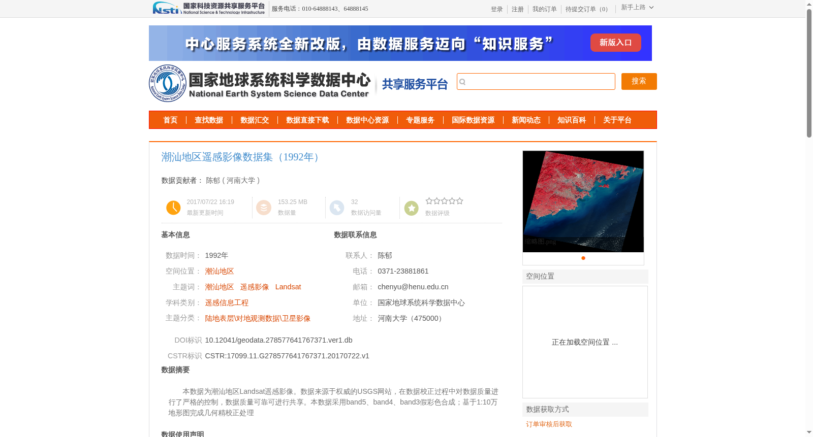
本数据为潮汕地区Landsat遥感影像。数据来源于权威的USGS网站,在数据校正过程中对数据质量进行了严格的控制,数据质量可靠可进行共享。本数据采用band5、band4、band3假彩色合成;基于1:10万地形图完成几何精校正处理
This dataset consists of Landsat remote sensing imagery of the Chaoshan region. The data is sourced from the official USGS website. Strict quality control was conducted throughout the data correction process, rendering the data reliable and available for public sharing. False-color composite was generated using Bands 5, 4, and 3, and fine geometric correction was completed based on 1:100,000 scale topographic maps.
提供机构:
河南大学
创建时间:
2017-07-22
搜集汇总
数据集介绍
背景与挑战
背景概述
该数据集为1992年潮汕地区的Landsat遥感影像,数据来源于USGS网站,经过几何精校正处理,质量可靠,适用于科学研究。数据采用band5、band4、band3假彩色合成,空间投影为UTM投影。
以上内容由遇见数据集搜集并总结生成


