WildBe
收藏Hugging Face2024-06-18 更新2024-12-12 收录
下载链接:
https://huggingface.co/datasets/FBK-TeV/WildBe
下载链接
链接失效反馈官方服务:
资源简介:
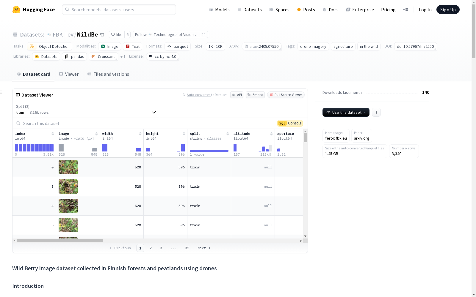
WildBe数据集是首个使用无人机在芬兰森林和泥炭地拍摄的野生浆果图像数据集。该数据集包含3,516张图像,总计18,468个标注的边界框,涵盖多种浆果类型,如越橘、云莓、越橘和乌饭树莓。数据集用于对象检测任务,特别关注在复杂环境和光照变化下的图像。
The WildBe dataset is the first wild berry image dataset captured by drones in Finnish forests and peatlands. It contains 3,516 images and a total of 18,468 annotated bounding boxes, covering various berry types including lingonberry, cloudberry, lingonberry, and bog bilberry. This dataset is designed for object detection tasks, with a special focus on images taken in complex environments and under changing lighting conditions.
创建时间:
2024-06-07
原始信息汇总
WildBe 数据集概述
数据集描述
- 许可证: cc-by-nc-4.0
- 任务类别: object-detection
- 数据集名称: WildBe
- 数据规模: 1K<n<10K
- 标签: drone imagery, agriculture, in the wild
数据字段
- index: 唯一标识符,数据类型为 int64。
- image: 图像,数据类型为 image。
- width: 图像宽度,数据类型为 int64。
- height: 图像高度,数据类型为 int64。
- split: 数据分割(如 train, validation, test),数据类型为 string。
- altitude: 拍摄高度,数据类型为 float64。
- aperture: 相机光圈设置,数据类型为 float64。
- area: 地理区域代码,数据类型为 float64。
- date: 拍摄日期,数据类型为 string。
- device: 拍摄设备,数据类型为 string。
- exposure: 相机曝光时间,数据类型为 float64。
- focal: 相机镜头焦距,数据类型为 float64。
- iso: 相机 ISO 设置,数据类型为 float64。
- latitude_deg: 拍摄地点的纬度度数,数据类型为 float64。
- latitude_dir: 纬度方向,数据类型为 string。
- longitude_deg: 拍摄地点的经度度数,数据类型为 float64。
- longitude_dir: 经度方向,数据类型为 string。
- source_image_id: 源图像的唯一标识符,数据类型为 string。
- time: 拍摄时间,数据类型为 string。
- labels: 标签信息,数据类型为 string。
数据字段详细说明
- index: 每个示例的唯一整数标识符。
- image: PIL 图像。
- split: 数据分割标识,如 train, validation, test。
- labels: 包含以下字段的字典列表:
- class: 类别标识符,整数。
- label: 类别名称,字符串。
- x: 边界框中心的归一化 x 坐标,浮点数。
- y: 边界框中心的归一化 y 坐标,浮点数。
- width: 边界框的归一化宽度,浮点数。
- height: 边界框的归一化高度,浮点数。
- altitude: 图像拍摄时的海拔高度(如果可用),浮点数。
- aperture: 相机光圈设置(如果可用),浮点数。
- area: 图像拍摄的地理区域代码(如果可用),浮点数。
- date: 图像拍摄日期(如果可用),字符串。
- device: 拍摄图像的设备(如果可用),字符串。
- exposure: 相机曝光时间(如果可用),浮点数。
- focal: 相机镜头焦距(如果可用),浮点数。
- height: 图像像素高度,整数。
- width: 图像像素宽度,整数。
- iso: 相机 ISO 设置(如果可用),浮点数。
- latitude_deg: 图像拍摄地点的纬度度数(如果可用),浮点数。
- latitude_dir: 纬度方向(如果可用),字符串。
- longitude_deg: 图像拍摄地点的经度度数(如果可用),浮点数。
- longitude_dir: 经度方向(如果可用),字符串。
- source_image_id: 源图像的唯一标识符(如果可用),字符串。
- time: 图像拍摄时间(如果可用),字符串。
搜集汇总
数据集介绍
构建方式
WildBe数据集是通过无人机在芬兰森林和泥炭地中采集的野生浆果图像构建而成。该数据集涵盖了多种浆果品种,包括越橘、云莓、越橘和乌鸦莓等,拍摄环境复杂且光照条件多变。数据采集过程中,无人机配备了先进的成像技术,确保了图像的高质量和多样性。每张图像均附有详细的元数据,如拍摄高度、光圈设置、地理位置等,为后续的深度学习模型训练提供了丰富的上下文信息。
特点
WildBe数据集的特点在于其独特的采集环境和丰富的浆果种类。数据集中的图像在复杂的光照条件和杂乱的背景下拍摄,涵盖了多种野生浆果的视觉特征。此外,数据集提供了详细的元数据,包括拍摄设备参数、地理位置和时间信息,这些信息为研究者在不同场景下的模型训练和验证提供了极大的便利。数据集的多样性和高质量使其成为农业和无人机图像分析领域的重要资源。
使用方法
使用WildBe数据集时,研究者可以通过Hugging Face平台加载数据集,并利用提供的Python代码进行图像可视化和分析。数据集中的每张图像都附有标签信息,包括浆果的类别和边界框坐标,便于目标检测任务的训练和评估。通过加载数据集,研究者可以轻松访问图像和元数据,并结合自定义的深度学习模型进行训练和测试。数据集的分割(训练、验证、测试)也为模型的性能评估提供了标准化的基准。
背景与挑战
背景概述
WildBe数据集由芬兰森林和泥炭地中无人机采集的野生浆果图像构成,旨在推动农业领域的智能化发展。该数据集由FBK等多家研究机构于2024年发布,首次涵盖了越橘、云莓、越桔和岩高兰等多种浆果类别,并在复杂光照和杂乱环境中采集数据。其研究背景源于芬兰传统的浆果采摘活动,结合无人机技术与先进成像方法,为优化采摘效率和实现可持续农业提供了重要支持。WildBe的发布不仅填补了相关领域数据集的空白,还为计算机视觉在农业中的应用开辟了新方向。
当前挑战
WildBe数据集在解决农业领域中的浆果检测问题时面临多重挑战。首先,浆果在自然环境中分布稀疏且形态多样,尤其是在复杂光照和植被遮挡条件下,目标检测的准确性受到极大限制。其次,数据采集过程中,无人机飞行高度、光照变化以及植被密度等因素导致图像质量参差不齐,增加了数据标注和模型训练的难度。此外,构建数据集时需处理大量高分辨率图像,计算资源和存储需求较高,同时对标注精度要求严格,以确保模型的泛化能力。这些挑战共同构成了WildBe数据集在应用和推广中的主要障碍。
常用场景
经典使用场景
WildBe数据集在农业和无人机图像分析领域具有广泛的应用前景。其经典使用场景包括通过无人机采集的野生浆果图像,用于训练和评估目标检测模型。这些模型能够在复杂的光照和环境中识别不同种类的浆果,如越橘、云莓、越桔和乌鸦莓,从而为自动化浆果采摘提供技术支持。
实际应用
在实际应用中,WildBe数据集为农业自动化提供了重要支持。通过训练基于该数据集的模型,无人机能够在野外环境中高效识别和定位浆果,从而优化采摘流程,减少人工成本,并提高采摘效率。此外,该数据集还可用于生态监测和生物多样性研究,帮助科学家更好地理解野生浆果的分布和生长规律。
衍生相关工作
WildBe数据集的发布催生了一系列相关研究工作。例如,基于该数据集的目标检测算法优化研究,以及结合深度学习和无人机技术的自动化农业系统开发。此外,该数据集还被用于研究无人机图像处理中的光照和背景干扰问题,推动了计算机视觉技术在农业领域的创新应用。
以上内容由遇见数据集搜集并总结生成


