黑龙江省兴凯湖国家级自然保护区调整前后范围与功能区划图
收藏国家林业和草原科学数据中心2017-01-28 更新2024-03-06 收录
下载链接:
https://www.forestdata.cn/dataDetail.html?id=CSTR:17575.11.0120020909132.000029.V1
下载链接
链接失效反馈官方服务:
资源简介:
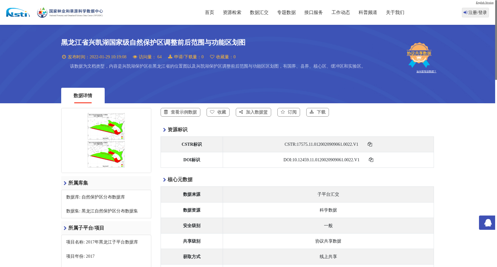
该数据为文档类型,内容是兴凯湖保护区在黑龙江省的位置图以及兴凯湖保护区调整前后范围与功能区区划图,有国界、县界、核心区、缓冲区和实验区。
This is a document-type dataset containing the location map of the Xingkai Lake Nature Reserve in Heilongjiang Province, as well as the zoning maps of the reserve's scope and functional zones before and after adjustment. The maps include national boundaries, county boundaries, core zones, buffer zones and experimental zones.
提供机构:
国家林业和草原科学数据中心
创建时间:
2017-01-28
搜集汇总
数据集介绍
背景与挑战
背景概述
该数据集提供了黑龙江省兴凯湖国家级自然保护区调整前后的范围与功能区划图,以文档形式呈现,内容包括保护区位置、国界、县界以及核心区、缓冲区、实验区的划分。数据集发布于2022年,数据时间为2018年,属于植物学学科,用于支持自然保护区管理和研究。
以上内容由遇见数据集搜集并总结生成


