ERA-Interim 全球地面气温再分析数据集(1979-2016)
收藏国家青藏高原科学数据中心2021-04-19 更新2024-03-07 收录
下载链接:
https://data.tpdc.ac.cn/zh-hans/data/bd429368-b5f6-430b-a4bc-20cc489e832a
下载链接
链接失效反馈官方服务:
资源简介:
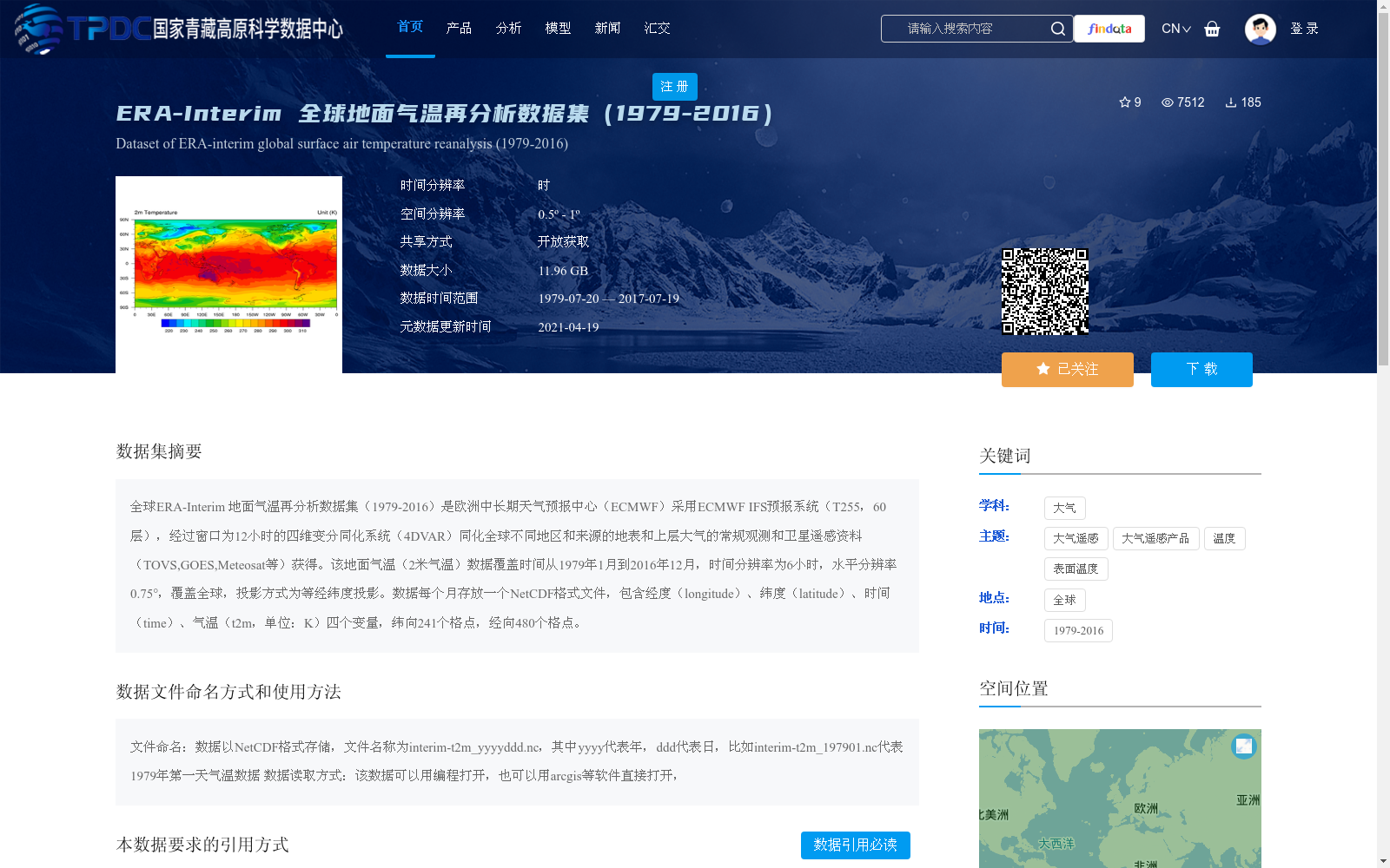
全球ERA-Interim 地面气温再分析数据集(1979-2016)是欧洲中长期天气预报中心(ECMWF)采用ECMWF IFS预报系统(T255,60层),经过窗口为12小时的四维变分同化系统(4DVAR)同化全球不同地区和来源的地表和上层大气的常规观测和卫星遥感资料(TOVS,GOES,Meteosat等)获得。该地面气温(2米气温)数据覆盖时间从1979年1月到2016年12月,时间分辨率为6小时,水平分辨率0.75°,覆盖全球,投影方式为等经纬度投影。数据每个月存放一个NetCDF格式文件,包含经度(longitude)、纬度(latitude)、时间(time)、气温(t2m,单位:K)四个变量,纬向241个格点,经向480个格点。
Global ERA-Interim Surface Air Temperature Reanalysis Dataset (1979–2016) was produced by the European Centre for Medium-Range Weather Forecasts (ECMWF) utilizing the ECMWF Integrated Forecast System (IFS, T255, 60 vertical levels). This dataset assimilated conventional in-situ observations and satellite remote sensing data (including TOVS, GOES, Meteosat, etc.) from various regions and sources across the globe for both surface and upper atmospheric layers via a 12-hour four-dimensional variational assimilation (4DVAR) system. The 2-meter surface air temperature data covers the period from January 1979 to December 2016, with a temporal resolution of 6 hours, a horizontal resolution of 0.75°, and full global coverage, adopting the equirectangular projection. Each month’s data is stored as a single NetCDF-format file, which contains four core variables: longitude, latitude, time, and air temperature (t2m, unit: K). The dataset has 241 zonal grid points and 480 meridional grid points.
提供机构:
李斐
创建时间:
2018-08-25
搜集汇总
数据集介绍
背景与挑战
背景概述
该数据集是欧洲中长期天气预报中心(ECMWF)生产的全球地面气温再分析数据,覆盖1979年至2016年,时间分辨率为6小时,空间分辨率为0.75°,以NetCDF格式提供全球范围的2米气温观测。它通过四维变分同化系统整合了地面和卫星观测资料,适用于气候研究和环境分析,需遵循特定的引用规范。
以上内容由遇见数据集搜集并总结生成


