2025年江西省标准化土壤水分指数(SSMI)月度数据集
收藏国家生态科学数据中心2025-12-27 收录
下载链接:
http://www.nesdc.org.cn/sdo/detail?id=691c89157e28174acd7e6be0
下载链接
链接失效反馈官方服务:
资源简介:
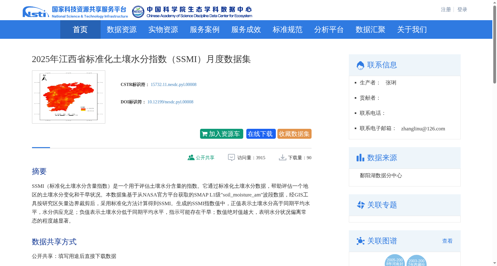
SSMI(标准化土壤水分含量指数)是一个用于评估土壤水分含量的指数。它通过标准化土壤水分数据,帮助评估一个地区的土壤水分变化和干旱状况。本数据集基于从NASA官方平台获取的SMAP L1级"soil_moisture_am"波段数据,经GIS工具按研究区矢量边界裁剪后,采用标准化方法计算得到SSMI。生成的SSMI指数值中,正值表示土壤水分高于同期平均水平,水分供应充足;负值表示土壤水分低于同期平均水平,指示可能存在干旱;数值绝对值越大,表明水分状况偏离常态的程度越显著。
SSMI (Standardized Soil Moisture Content Index) is an index dedicated to evaluating soil moisture conditions. It standardizes soil moisture datasets to enable rigorous assessment of regional soil moisture fluctuations and drought conditions. This dataset is generated from SMAP L1-level "soil_moisture_am" band data obtained through the official NASA platform. Following cropping to the vector boundary of the study area using GIS software, the dataset undergoes a standardization process to derive the SSMI. For the resulting SSMI values, positive scores indicate soil moisture levels exceeding the corresponding-period average, meaning adequate water availability; negative scores reflect soil moisture below the corresponding-period average, signaling potential drought occurrence; the larger the absolute value of the index, the more significant the deviation of soil moisture status from the normal baseline.
创建时间:
2025-11-01
搜集汇总
数据集介绍
背景与挑战
背景概述
该数据集为2025年江西省标准化土壤水分指数(SSMI)月度数据,基于NASA SMAP遥感数据经GIS处理和标准化计算生成,用于监测土壤水分变化和干旱状况。数据覆盖2025年5月至10月,空间范围为江西省全境,以栅格图像形式提供,支持地球科学和生态学领域的研究与应用。
以上内容由遇见数据集搜集并总结生成


