
Landsat Image Mosaic Of Antarctica (LIMA)
收藏Mendeley Data2024-01-31 更新2024-06-27 收录
下载链接:
https://www.usgs.gov/centers/eros/science/usgs-eros-archive-landsat-legacy-landsat-image-mosaic-antarctica-lima
下载链接
链接失效反馈官方服务:
资源简介:
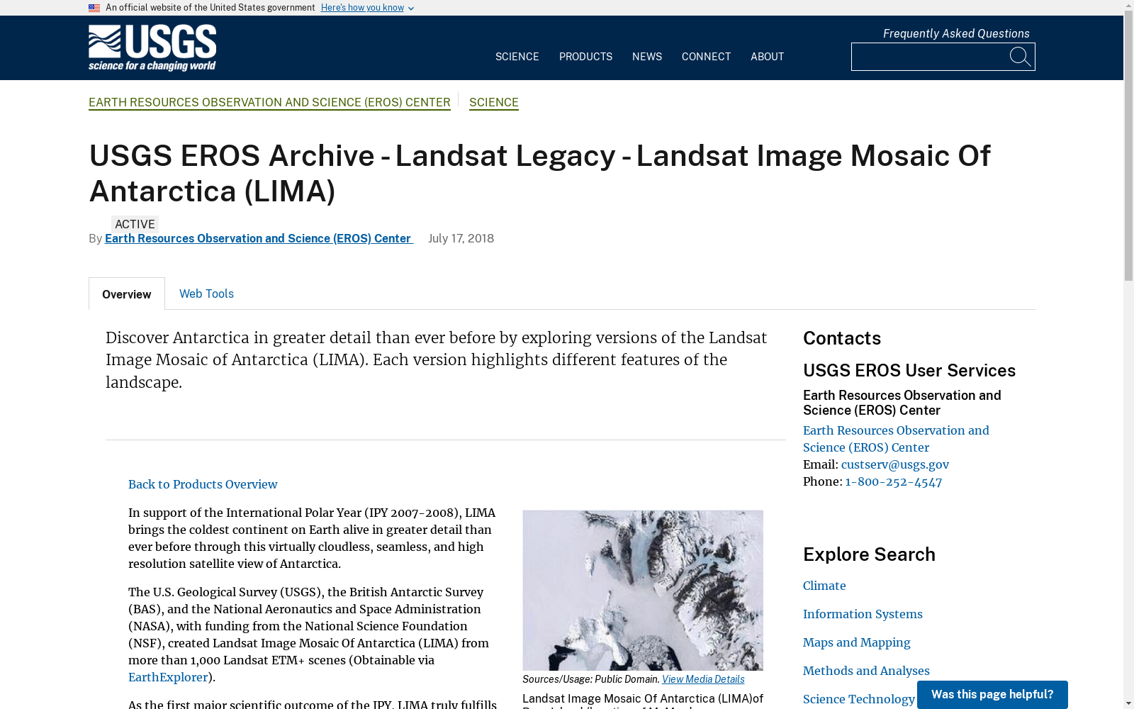
In support of the International Polar Year (IPY 2007-2008), LIMA brings the coldest continent on Earth alive in greater detail than ever before through this virtually cloudless, seamless, and high resolution satellite view of Antarctica. The U.S. Geological Survey (USGS), the British Antarctic Survey (BAS), and the National Aeronautics and Space Administration (NASA), with funding from the National Science Foundation (NSF), created LIMA from more than 1,000 Landsat ETM+ scenes. As the first major scientific outcome of the IPY, LIMA truly fulfills the IPY goals. LIMA is an international effort, supports current scientific polar research, encourages new projects, and helps the general public visualize Antarctica and changes happening to this southernmost environment. Researchers and the general public can download LIMA and all of the component Landsat scenes at no charge. Pan to view the continent and zoom in to see the stunning details of this NaturalColor, Pan-Sharpened LIMA (bands 3, 2, 1). LIMA covers the entire continent except from the South Pole at 90 degrees south to 82.5 degrees south latitude, where Landsat has no coverage because of its nearpolar orbit. To provide a continental view, the image above has LIMA 3, 2, 1 overlaying the MODIS Mosaic of Antarctica (MOA). The opening view includes McMurdo Station, the largest research base in Antarctica. Located at the tip of Hut Point Peninsula on Ross Island, McMurdo has been continually operated by the United States of America since 1956. Ross Island is roughly 72 km (45 mi) across. The flat, white areas are the Ross Ice Shelf and other sea ice off the coast of Antarctica. Also visible are the Erebus Glacier Toungde, Koettlitz and Ferrar Glaciers, and the Royal Society Range.
为支持国际极地年(International Polar Year, IPY 2007-2008),LIMA数据集通过这张几乎无云、无缝且高分辨率的南极洲卫星全景图,以前所未有的细节展现了这座地球上最寒冷的大陆。美国地质调查局(U.S. Geological Survey, USGS)、英国南极调查局(British Antarctic Survey, BAS)以及美国国家航空航天局(National Aeronautics and Space Administration, NASA)在美国国家科学基金会(National Science Foundation, NSF)的资助下,依托超过1000景Landsat ETM+影像拼接生成了LIMA数据集。作为国际极地年的首个重大科研成果,LIMA切实达成了国际极地年的各项目标。LIMA是一项国际性合作项目,可为当前极地科学研究提供支撑,助力催生全新科研课题,并帮助普通公众直观了解南极洲及其所处这一最南端环境发生的变化。科研人员与普通公众均可免费下载LIMA数据集及其所有原始Landsat分景影像。您可通过平移浏览查看整个大陆,放大后即可观赏这张采用3、2、1波段合成的天然色全色锐化LIMA影像的精美细节。LIMA覆盖了南极洲除南纬90°(南极点)至南纬82.5°之外的全部区域,由于Landsat卫星的近极轨道设计,该纬度区间无Landsat影像覆盖。为呈现完整的大陆视角,本页上方影像将采用3、2、1波段合成的LIMA数据叠加在南极洲MODIS镶嵌图(MODIS Mosaic of Antarctica, MOA)之上。开篇视图包含南极洲规模最大的科研基地——麦克默多站(McMurdo Station)。该站坐落于罗斯岛赫特角半岛的顶端,自1956年起便由美国持续运营。罗斯岛的直径约为72千米(45英里)。画面中平坦的白色区域为罗斯冰架及南极洲近海的其他海冰。此外还可见埃里伯斯冰川舌(Erebus Glacier Tongue)、科特利茨冰川(Koettlitz Glacier)、费拉尔冰川(Ferrar Glacier)以及皇家学会山脉(Royal Society Range)。
创建时间:
2024-01-31
搜集汇总
数据集介绍
背景与挑战
背景概述
Landsat Image Mosaic Of Antarctica (LIMA)数据集是一个高分辨率、无缝且几乎无云的南极洲卫星图像集合,由超过1000张Landsat ETM+场景组成。该数据集由USGS、BAS和NASA合作创建,旨在支持国际极年活动,并为科学研究和公众教育提供资源。
以上内容由遇见数据集搜集并总结生成



