基于卫星遥感数据的全球陆面蒸散发逐日近实时估算数据集(2001-2024)
收藏国家青藏高原科学数据中心2024-05-27 更新2024-03-06 收录
下载链接:
https://data.tpdc.ac.cn/zh-hans/data/236e33bf-e66b-4682-bbc1-274de1dcbcd3
下载链接
链接失效反馈官方服务:
资源简介:
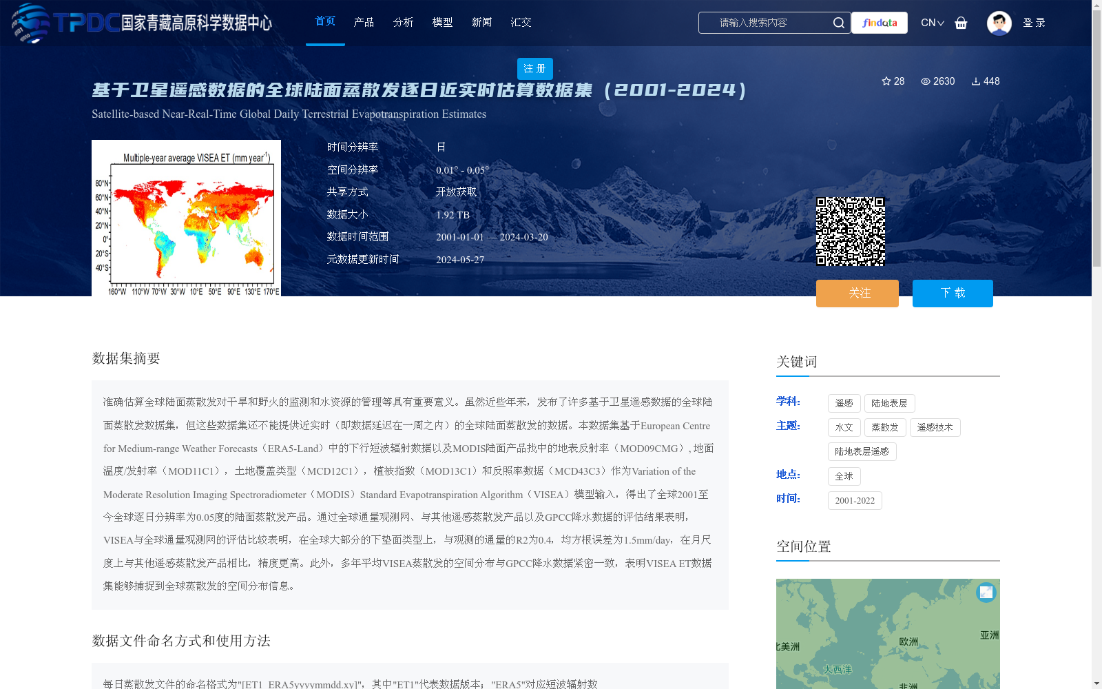
准确估算全球陆面蒸散发对干旱和野火的监测和水资源的管理等具有重要意义。虽然近些年来,发布了许多基于卫星遥感数据的全球陆面蒸散发数据集,但这些数据集还不能提供近实时(即数据延迟在一周之内)的全球陆面蒸散发的数据。本数据集基于European Centre for Medium-range Weather Forecasts(ERA5-Land)中的下行短波辐射数据以及MODIS陆面产品找中的地表反射率(MOD09CMG), 地面温度/发射率(MOD11C1),土地覆盖类型(MCD12C1),植被指数(MOD13C1)和反照率数据(MCD43C3)作为Variation of the Moderate Resolution Imaging Spectroradiometer(MODIS)Standard Evapotranspiration Algorithm(VISEA)模型输入,得出了全球2001至今全球逐日分辨率为0.05度的陆面蒸散发产品。通过全球通量观测网、与其他遥感蒸散发产品以及GPCC降水数据的评估结果表明,VISEA与全球通量观测网的评估比较表明,在全球大部分的下垫面类型上,与观测的通量的R2为0.4,均方根误差为1.5mm/day,在月尺度上与其他遥感蒸散发产品相比,精度更高。此外,多年平均VISEA蒸散发的空间分布与GPCC降水数据紧密一致,表明VISEA ET数据集能够捕捉到全球蒸散发的空间分布信息。
Accurate estimation of global land surface evapotranspiration (ET) is of great significance for drought and wildfire monitoring, water resource management, and other related fields. Although numerous global land surface ET datasets based on satellite remote sensing data have been released in recent years, most of them cannot provide near-real-time global land surface ET data (i.e., with a data latency of less than one week). This dataset uses downward shortwave radiation data from the European Centre for Medium-Range Weather Forecasts (ERA5-Land), along with surface reflectance (MOD09CMG), land surface temperature/emissivity (MOD11C1), land cover type (MCD12C1), vegetation index (MOD13C1), and albedo data (MCD43C3) from MODIS land products as inputs to the Variation of the Moderate Resolution Imaging Spectroradiometer (MODIS) Standard Evapotranspiration Algorithm (VISEA) model, to produce a global daily land surface ET product with a spatial resolution of 0.05° from 2001 to the present. Evaluations using the global flux observation network, other remote sensing ET products, and GPCC precipitation data show that: when compared with in-situ flux measurements from the global flux observation network, VISEA achieves a coefficient of determination (R²) of 0.4 and a root mean square error (RMSE) of 1.5 mm/day across most global underlying surface types; additionally, it outperforms other remote sensing ET products at the monthly scale in terms of accuracy. Furthermore, the spatial distribution of multi-year average VISEA ET is highly consistent with GPCC precipitation data, demonstrating that the VISEA ET dataset can capture the spatial distribution patterns of global evapotranspiration.
提供机构:
黄磊
创建时间:
2023-09-25
搜集汇总
数据集介绍
背景与挑战
背景概述
该数据集提供了全球2001年至2024年逐日分辨率为0.05度的陆面蒸散发产品,基于卫星遥感数据和VISEA模型生成,具有高精度和近实时更新的特点。数据覆盖全球范围,适用于干旱和野火监测、水资源管理等领域。
以上内容由遇见数据集搜集并总结生成


