黄土高原1km降水数据集(2000-2020年)
收藏国家地球系统科学数据中心2024-10-25 更新2024-10-26 收录
下载链接:
https://www.geodata.cn/data/datadetails.html?dataguid=52014202479247&docId=2295
下载链接
链接失效反馈官方服务:
资源简介:
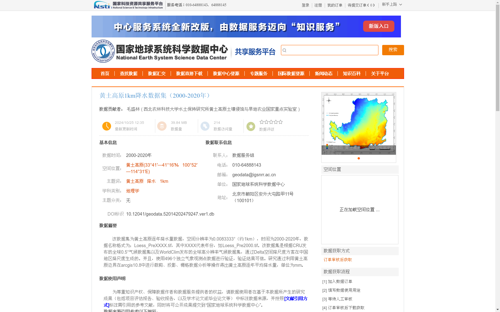
该数据集为黄土高原逐年降水量数据,空间分辨率为0.0083333°(约1km),时间为2000-2020年,数据名称格式为:Loess_PreXXXX.tif,其中XXXX代表年份,如Loess_Pre2000.tif。该数据集是根据CRU发布的全球0.5°气候数据集以及WorldClim发布的全球高分辨率气候数据集,通过Delta空间降尺度方案在中国地区降尺度生成的。并且,使用496个独立气象观测点数据进行验证,验证结果可信。研究通过利用黄土高原边界在arcgis10.8中进行裁剪、投影、栅格数据分析等操作得出黄土高原逐年平均降水量,单位为mm。
This dataset contains annual precipitation data for the Loess Plateau, with a spatial resolution of 0.0083333° (approximately 1 km) and covers the period from 2000 to 2020. The data files follow the naming convention: Loess_PreXXXX.tif, where XXXX represents the four-digit year, e.g., Loess_Pre2000.tif. This dataset was generated via the Delta spatial downscaling method for the Chinese region, based on the global 0.5° climate dataset released by CRU and the global high-resolution climate dataset released by WorldClim. Moreover, it was validated using data from 496 independent meteorological observation stations, and the validation results demonstrate its reliability. To derive the annual average precipitation (unit: mm) for the Loess Plateau, this study conducted operations including cropping, projection, and raster data analysis using the Loess Plateau boundary in ArcGIS 10.8.
提供机构:
西北农林科技大学水土保持研究所黄土高原土壤侵蚀与旱地农业国家重点实验室
创建时间:
2024-10-25
搜集汇总
数据集介绍
背景与挑战
背景概述
该数据集提供了黄土高原地区2000年至2020年的逐年降水量数据,空间分辨率约为1公里,数据格式为GeoTIFF。它基于全球气候数据集通过降尺度方法生成,并经过独立气象观测点验证,具有较高的可靠性,适用于地理学和气候相关研究。
以上内容由遇见数据集搜集并总结生成


