中亚大湖区数据库-地下水-埋深(2021)
收藏国家青藏高原科学数据中心2022-08-20 更新2024-03-01 收录
下载链接:
https://data.tpdc.ac.cn/zh-hans/data/8e99f771-97e4-4317-b20b-8ca187777361
下载链接
链接失效反馈官方服务:
资源简介:
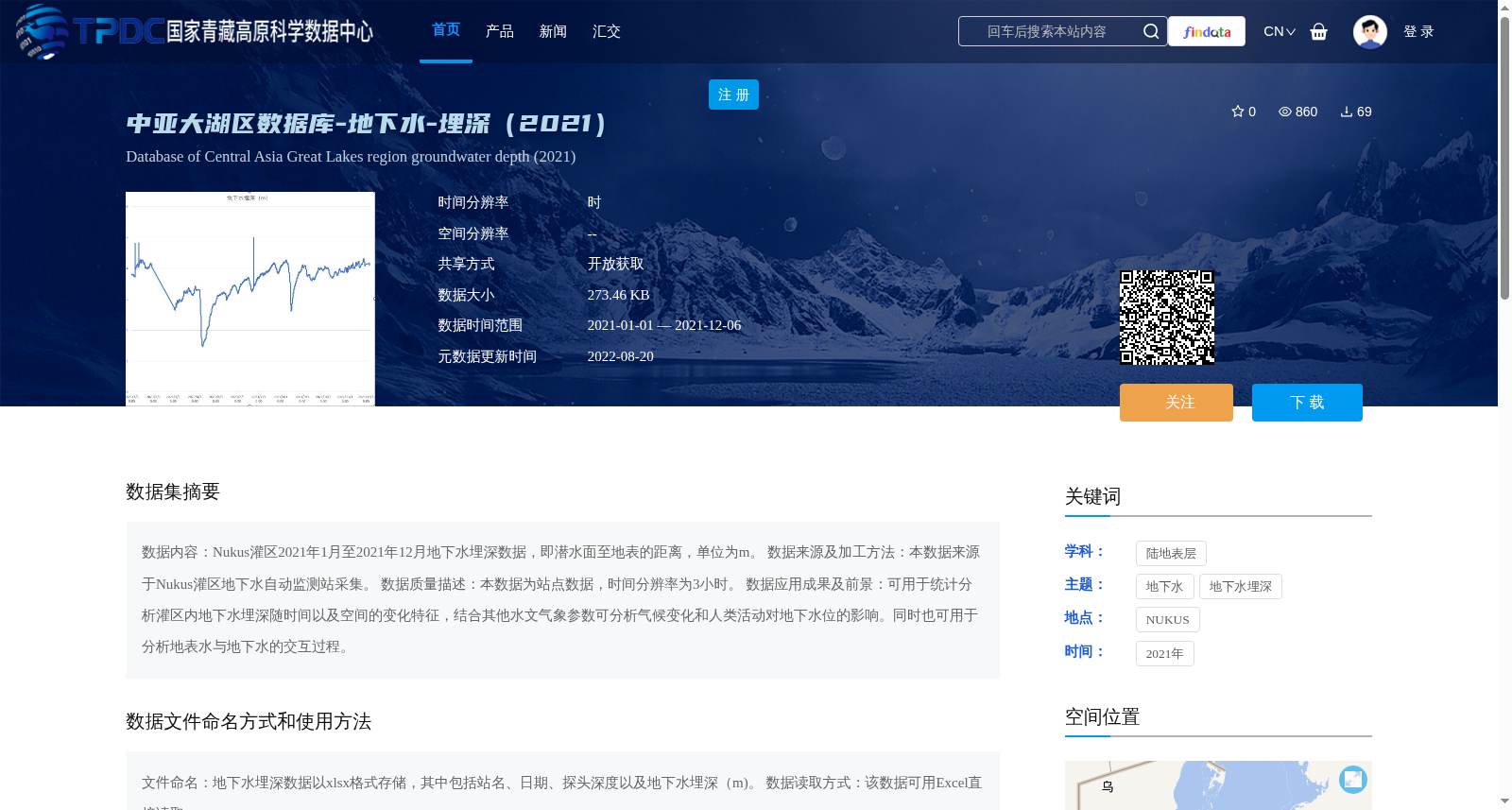
数据内容:Nukus灌区2021年1月至2021年12月地下水埋深数据,即潜水面至地表的距离,单位为m。
数据来源及加工方法:本数据来源于Nukus灌区地下水自动监测站采集。
数据质量描述:本数据为站点数据,时间分辨率为3小时。
数据应用成果及前景:可用于统计分析灌区内地下水埋深随时间以及空间的变化特征,结合其他水文气象参数可分析气候变化和人类活动对地下水位的影响。同时也可用于分析地表水与地下水的交互过程。
Data Content: Groundwater depth data (defined as the distance from the water table to the ground surface) in the Nukus Irrigation District from January 2021 to December 2021, with the unit of meters (m).
Data Source and Processing Method: This dataset was collected from the automatic groundwater monitoring stations in the Nukus Irrigation District.
Data Quality Description: This is in-situ station-based data with a temporal resolution of 3 hours.
Applications and Prospects: This dataset can be used to statistically analyze the temporal and spatial variation characteristics of groundwater depth within the irrigation district. Combined with other hydro-meteorological parameters, it can be employed to evaluate the impacts of climate change and human activities on groundwater levels. Additionally, it can also be utilized to analyze the interaction processes between surface water and groundwater.
提供机构:
刘铁
创建时间:
2022-06-14
搜集汇总
数据集介绍
背景与挑战
背景概述
该数据集提供了2021年Nukus灌区的地下水埋深数据,时间分辨率为3小时,以xlsx格式存储,可用于分析地下水埋深的时空变化、研究气候变化和人类活动对地下水位的影响,以及地表水与地下水交互过程。数据来源于自动监测站,覆盖2021年全年,适用于水文和环境研究。
以上内容由遇见数据集搜集并总结生成


