中国氮、硫临界负荷数据集(2015)
收藏国家青藏高原科学数据中心2023-05-06 更新2024-03-01 收录
下载链接:
https://data.tpdc.ac.cn/zh-hans/data/fddf192f-21d7-45f2-ac27-55978d539b59
下载链接
链接失效反馈官方服务:
资源简介:
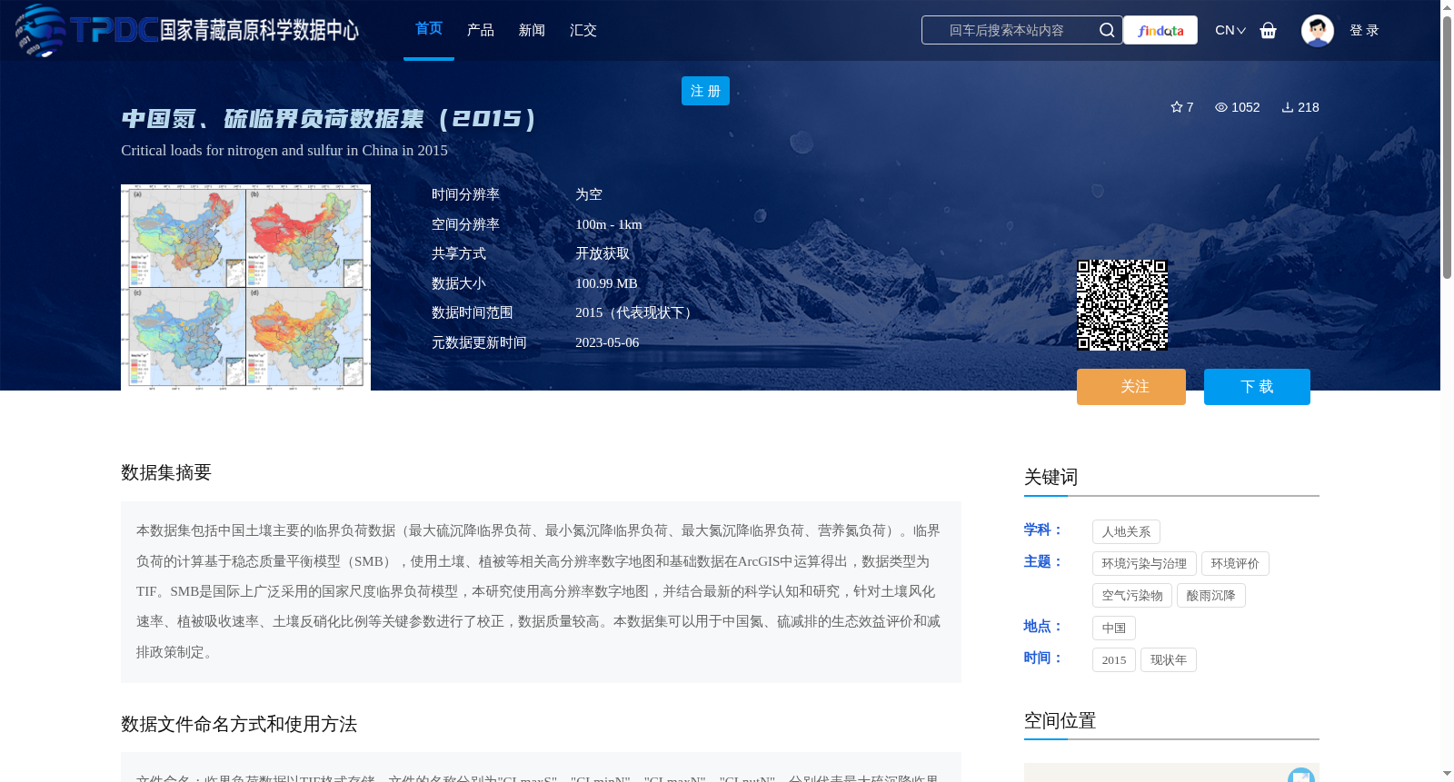
本数据集包括中国土壤主要的临界负荷数据(最大硫沉降临界负荷、最小氮沉降临界负荷、最大氮沉降临界负荷、营养氮负荷)。临界负荷的计算基于稳态质量平衡模型(SMB),使用土壤、植被等相关高分辨率数字地图和基础数据在ArcGIS中运算得出,数据类型为TIF。SMB是国际上广泛采用的国家尺度临界负荷模型,本研究使用高分辨率数字地图,并结合最新的科学认知和研究,针对土壤风化速率、植被吸收速率、土壤反硝化比例等关键参数进行了校正,数据质量较高。本数据集可以用于中国氮、硫减排的生态效益评价和减排政策制定。
This dataset contains the main critical load data for soils in China, including maximum sulfur deposition critical load, minimum nitrogen deposition critical load, maximum nitrogen deposition critical load, and nutrient nitrogen load. The critical loads were calculated based on the Steady-State Mass Balance model (SMB), which was implemented in ArcGIS using high-resolution digital maps of soil, vegetation and other relevant base data, with the output data stored in TIF format. The SMB model is a national-scale critical load model widely adopted internationally. In this study, high-resolution digital maps were utilized, combined with the latest scientific understandings and research advances, to calibrate key parameters including soil weathering rate, vegetation uptake rate and soil denitrification ratio, yielding a high-quality dataset. This dataset can be applied to ecological benefit assessment and emission reduction policy formulation for nitrogen and sulfur emission reductions in China.
提供机构:
葛晓冬,段雷
创建时间:
2022-12-30
搜集汇总
数据集介绍
背景与挑战
背景概述
该数据集包含2015年中国土壤的氮、硫临界负荷数据,采用高分辨率数字地图和稳态质量平衡模型计算,适用于生态效益评价和减排政策制定。
以上内容由遇见数据集搜集并总结生成


